| Gebietsname
|
Bild/Commons
|
BfN-ID
|
WDPA-ID
|
EEA-ID
|
seit
|
Lage
|
Kreis/Stadt
|
Fläche ha
|
Bemerkungen
|
| Abbaustellen zwischen Rain und Gempfing
|
|
7331-301
|
555521900
|
DE7331301
|
2000
|
⊙
|
Landkreis Donau-Ries
|
000002,3
|
|
| Aggenstein
|
|
8429-304
|
555522273
|
DE8429304
|
2000
|
⊙
|
Landkreis Ostallgäu
|
000129,87
|
|
| Ahorntal
|
|
6134-371
|
555521377
|
DE6134371
|
2004
|
⊙
|
Landkreis Bayreuth
|
000311,39
|
|
| Aitnach
|
|
6943-371
|
555521768
|
DE6943371
|
2004
|
⊙
|
Landkreis Regen
|
000048,75
|
|
| Albtrauf im Landkreis Lichtenfels
|

|
5932-371
|
555521247
|
DE5932371
|
2004
|
⊙
|
Landkreis Lichtenfels
|
001852,51
|
|
| Albtrauf von der Friesener Warte zur Langen Meile
|
|
6132-371
|
555521375
|
DE6132371
|
2004
|
⊙
|
Landkreis Bamberg
Landkreis Forchheim
|
001880,45
|
|
| Albtrauf von Dörnwasserlos bis Zeegendorf
|

|
6032-371
|
555521318
|
DE6032371
|
2004
|
⊙
|
Landkreis Bamberg
|
003030,52
|
|
| Albtraufhänge zwischen Görau und Thurnau
|

|
5934-371
|
555521252
|
DE5934371
|
2004
|
⊙
|
Landkreis Kulmbach
Landkreis Lichtenfels
|
000303,95
|
|
| Allacher Forst und Angerlohe
|

|
7734-302
|
555522017
|
DE7734302
|
2000
|
⊙
|
München
|
000221,46
|
|
| Allgäuer Hochalpen
|

|
8528-301
|
555522288
|
DE8528301
|
2000
|
⊙
|
Landkreis Oberallgäu
|
021222,9
|
|
| Allgäuer Molassetobel
|

|
8326-371
|
555522224
|
DE8326371
|
2004
|
⊙
|
Landkreis Lindau
Landkreis Oberallgäu
|
000944,98
|
|
| Alpenrandquellseen
|

|
8429-302
|
555522271
|
DE8429302
|
2000
|
⊙
|
Landkreis Ostallgäu
|
000229,27
|
|
| Alsteraue von der Landesgrenze bis zur Mündung
|
|
5830-301
|
555521167
|
DE5830301
|
2000
|
⊙
|
Landkreis Coburg
Landkreis Haßberge
|
000116,97
|
|
| Altbachgebiet südwestlich Triftern
|
|
7643-371
|
555521994
|
DE7643371
|
2004
|
⊙
|
Landkreis Rottal-Inn
|
000117,76
|
|
| Alte Günz bei Tafertshofen
|
|
7727-301
|
555522010
|
DE7727301
|
2000
|
⊙
|
Landkreis Unterallgäu
|
000019,92
|
|
| Altenburg
|
|
5629-303
|
555521018
|
DE5629303
|
2000
|
⊙
|
Landkreis Rhön-Grabfeld
|
000305,53
|
|
| Altwässer an der Regnitzmündung bei Bamberg und bei Viereth
|

|
6031-371
|
555521316
|
DE6031371
|
2004
|
⊙
|
Bamberg
Landkreis Bamberg
|
000152,47
|
|
| Alz vom Chiemsee bis Altenmarkt
|

|
8041-302
|
555522113
|
DE8041302
|
2000
|
⊙
|
Landkreis Traunstein
|
000443,12
|
|
| Ammer vom Alpenrand b. zum NSG 'Vogelfreistätte Ammersee-Südufer'
|
|
8331-302
|
555522238
|
DE8331302
|
1998
|
⊙
|
Landkreis Garmisch-Partenkirchen
Landkreis Weilheim-Schongau
|
002331,7
|
|
| Ammergebirge
|
|
8431-371
|
555522278
|
DE8431371
|
2004
|
⊙
|
Landkreis Garmisch-Partenkirchen
Landkreis Ostallgäu
|
027588,85
|
|
| Ammersee-Südufer und Raistinger Wiesen
|
|
8032-371
|
555522098
|
DE8032371
|
2004
|
⊙
|
Landkreis Landsberg am Lech
Landkreis Weilheim-Schongau
|
000888,43
|
|
| Ammerseeufer und Leitenwälder
|

|
7932-372
|
555522069
|
DE7932372
|
2004
|
⊙
|
Landkreis Landsberg am Lech
Landkreis Starnberg
|
000952,07
|
|
| Ammertaler Wiesmahdhänge
|
|
8332-304
|
555522242
|
DE8332304
|
2000
|
⊙
|
Landkreis Garmisch-Partenkirchen
|
000449,43
|
|
| Ampermoos
|
|
7832-371
|
555522041
|
DE7832371
|
2004
|
⊙
|
Landkreis Fürstenfeldbruck
Landkreis Landsberg am Lech
Landkreis Starnberg
|
000551,43
|
|
| Ampertal
|
|
7635-301
|
555521989
|
DE7635301
|
2000
|
⊙
|
Landkreis Dachau
Landkreis Fürstenfeldbruck
Landkreis Freising
|
002155,58
|
|
| Amphibienhabitate um Neuburg
|
|
7233-371
|
555521857
|
DE7233371
|
2004
|
⊙
|
Landkreis Neuburg-Schrobenhausen
|
000026,92
|
|
| Amphibien-Lebensräume um Etsdorf
|
|
6538-371
|
555521598
|
DE6538371
|
2004
|
⊙
|
Landkreis Amberg-Sulzbach
Landkreis Schwandorf
|
000033,99
|
|
| Amphibienvorkommen am Pfahl bei Ried am Pfahl
|
|
6841-372
|
555521733
|
DE6841372
|
2004
|
⊙
|
Landkreis Cham
|
000036,75
|
|
| Angelberger Forst
|
|
7829-301
|
555522039
|
DE7829301
|
2000
|
⊙
|
Landkreis Unterallgäu
|
000646,92
|
|
| Anstieg der Frankenhöhe östlich der A 7
|
|
6528-371
|
555521587
|
DE6528371
|
2004
|
⊙
|
Landkreis Ansbach
Landkreis Neustadt a. d. Aisch-Bad Windsheim
|
003443,56
|
|
| Arracher Moor
|
|
6844-301
|
555521739
|
DE6844301
|
2004
|
⊙
|
Landkreis Cham
|
000019,19
|
|
| Attel
|

|
7938-371
|
555522075
|
DE7938371
|
2004
|
⊙
|
Landkreis Ebersberg
Landkreis Rosenheim
|
000274,04
|
|
| Attenloher Filzen und Mariensteiner Moore
|

|
8235-371
|
555522189
|
DE8235371
|
2004
|
⊙
|
Landkreis Miesbach
Landkreis Bad Tölz-Wolfratshausen
|
000646,82
|
|
| Attlesee
|
|
8329-304
|
555522232
|
DE8329304
|
2000
|
⊙
|
Landkreis Ostallgäu
|
000068,62
|
|
| Auer Weidmoos mit Kalten und Kaltenaue
|

|
8138-371
|
555522146
|
DE8138371
|
2004
|
⊙
|
Rosenheim
Landkreis Rosenheim
|
000452,85
|
|
| Auerberg, Mühlberg
|
|
8432-302
|
555522280
|
DE8432302
|
2000
|
⊙
|
Landkreis Garmisch-Partenkirchen
|
000296,71
|
|
| Aufgelassene Sandgrube östlich Riding
|
|
7638-301
|
555521993
|
DE7638301
|
2000
|
⊙
|
Landkreis Erding
|
000002,25
|
|
| Aurach zwischen Emskirchen und Herzogenaurach
|
|
6430-371
|
555521541
|
DE6430371
|
2004
|
⊙
|
Landkreis Erlangen-Höchstadt
Landkreis Neustadt a. d. Aisch-Bad Windsheim
|
000197,29
|
|
| Bachmuschelbäche südlich Thalmassing
|
|
7138-371
|
555521829
|
DE7138371
|
2004
|
⊙
|
Landkreis Regensburg
Landkreis Kelheim
|
000047,33
|
|
| Bachmuschelbestände bei Lauben
|
|
7927-371
|
555522065
|
DE7927371
|
2004
|
⊙
|
Landkreis Unterallgäu
|
000021,91
|
|
| Bachsystem der Streu mit Nebengewässern
|
|
5527-371
|
555520900
|
DE5527371
|
2004
|
⊙
|
Landkreis Rhön-Grabfeld
|
001267,88
|
|
| Bachtäler der Hersbrucker Alb
|
|
6534-371
|
555521594
|
DE6534371
|
2004
|
⊙
|
Landkreis Nürnberger Land
|
000682,91
|
|
| Bachtäler im Falkensteiner Vorwald
|

|
6939-302
|
555521763
|
DE6939302
|
2000
|
⊙
|
Landkreis Regensburg
Landkreis Cham
Landkreis Straubing-Bogen
|
001382,86
|
|
| Bahratal
|
|
5528-371
|
555520903
|
DE5528371
|
2004
|
⊙
|
Landkreis Rhön-Grabfeld
|
000070,6
|
|
| Bärnseemoor
|
|
8240-302
|
555522196
|
DE8240302
|
2000
|
⊙
|
Landkreis Rosenheim
|
000094,72
|
|
| Basaltkuppen im Raum Kemnath
|

|
6137-302
|
555521381
|
DE6137302
|
2000
|
⊙
|
Landkreis Neustadt an der Waldnaab
Landkreis Tirschenreuth
|
000080,7
|
|
| Basaltkuppen in der Nördlichen Oberpfalz
|
|
6039-301
|
555521329
|
DE6039301
|
2000
|
⊙
|
Landkreis Tirschenreuth
|
000224,7
|
|
| Baunachtal zwischen Reckendorf und Baunach
|
|
5931-373
|
555521245
|
DE5931373
|
2004
|
⊙
|
Landkreis Bamberg
|
000093,99
|
|
| Bayerische Hohe Rhön
|

|
5526-371
|
555520898
|
DE5526371
|
2006
|
⊙
|
Landkreis Bad Kissingen
Landkreis Rhön-Grabfeld
|
019292,47
|
|
| Bayerische Schwarzach und Biberbach
|
|
6541-371
|
555521601
|
DE6541371
|
2004
|
⊙
|
Landkreis Cham
Landkreis Schwandorf
|
000529,62
|
|
| Bayerisches Bodenseeufer
|
|
8423-301
|
555522259
|
DE8423301
|
2000
|
⊙
|
Landkreis Lindau
|
000220,94
|
|
| Bayerwaldbäche um Schöllnach und Eging am See
|
|
7245-301
|
555521869
|
DE7245301
|
2000
|
⊙
|
Landkreis Deggendorf
Landkreis Freyung-Grafenau
Landkreis Passau
|
000409,44
|
|
| Bechstein-Fledermausvorkommen um Bad Wörishofen
|

|
7929-301
|
555522066
|
DE7929301
|
2000
|
⊙
|
Landkreis Unterallgäu
|
000136,6
|
|
| Benninger Ried
|

|
8027-301
|
555522090
|
DE8027301
|
1998
|
⊙
|
Memmingen
Landkreis Unterallgäu
|
000096,29
|
|
| Berg- und Moorwiesen bei Kornbach
|
|
5936-302
|
555521256
|
DE5936302
|
2000
|
⊙
|
Landkreis Bayreuth
|
000035,66
|
|
| Bergsturzgebiet 'Im Gsott'
|
|
8332-303
|
555522241
|
DE8332303
|
2000
|
⊙
|
Landkreis Garmisch-Partenkirchen
|
000091,52
|
|
| Bergwiesen im südlichen Fichtelgebirge
|
|
6037-371
|
555521327
|
DE6037371
|
2004
|
⊙
|
Landkreis Bayreuth
Landkreis Wunsiedel i. Fichtelgebirge
|
000378,59
|
|
| Bergwiesen und Magerrasen am Dreisessel
|
|
7248-301
|
555521873
|
DE7248301
|
2000
|
⊙
|
Landkreis Freyung-Grafenau
|
000044,2
|
|
| Bergwiesen und -weiden im Vorderen Bayerischen Wald
|
|
7043-301
|
555521797
|
DE7043301
|
2000
|
⊙
|
Landkreis Deggendorf
Landkreis Regen
|
000017,04
|
|
| Bergwiesengebiet Altglashütte
|
|
6240-301
|
555521428
|
DE6240301
|
2000
|
⊙
|
Landkreis Tirschenreuth
|
000072,76
|
|
| Bernecker Felshänge
|
|
5936-301
|
555521255
|
DE5936301
|
2000
|
⊙
|
Landkreis Bayreuth
|
000126,17
|
|
| Bibert und Haselbach
|

|
6630-301
|
555521643
|
DE6630301
|
2000
|
⊙
|
Landkreis Ansbach
Landkreis Fürth
|
000241,68
|
|
| Binnendünen und Albtrauf bei Neumarkt
|
|
6734-371
|
555521692
|
DE6734371
|
2004
|
⊙
|
Landkreis Neumarkt in der Oberpfalz
|
000735,89
|
|
| Birkenbruchwald Oed und Erlenwälder bei Arnbruck und Hötzelsried
|
|
6843-302
|
555521737
|
DE6843302
|
2004
|
⊙
|
Landkreis Regen
|
000059,76
|
|
| Bischofsreuter Waldhufen
|
|
7148-301
|
555521837
|
DE7148301
|
2000
|
⊙
|
Landkreis Freyung-Grafenau
|
000950,29
|
|
| Blockschuttwälder am Pleysteiner Sulzberg
|
|
6340-301
|
555521483
|
DE6340301
|
2000
|
⊙
|
Landkreis Neustadt an der Waldnaab
|
000110,94
|
|
| Blumenau bei Bad Berneck
|
|
5935-303
|
555521254
|
DE5935303
|
2000
|
⊙
|
Landkreis Bayreuth
Landkreis Kulmbach
|
000075,54
|
|
| Borstgrasrasen und Bergwiesen Obergrainet-Gschwendet
|
|
7248-371
|
555521875
|
DE7248371
|
2004
|
⊙
|
Landkreis Freyung-Grafenau
|
000141,3
|
|
| Brandmoos und Hauerin
|

|
6941-302
|
555521767
|
DE6941302
|
1998
|
⊙
|
Landkreis Straubing-Bogen
|
000090,25
|
|
| Bruchschollenkuppen im Landkreis Coburg
|
|
5732-371
|
555521093
|
DE5732371
|
2004
|
⊙
|
Landkreis Coburg
|
000104,98
|
|
| Bruderwald mit Naturwaldreservat Wolfsruhe
|

|
6131-302
|
555521372
|
DE6131302
|
2000
|
⊙
|
Bamberg
|
000464,82
|
|
| Buchberg bei Reicholdsgrün
|
|
5837-302
|
555521179
|
DE5837302
|
2000
|
⊙
|
Landkreis Wunsiedel i. Fichtelgebirge
|
000023,58
|
|
| Buchen- und Mischwälder um Deusmauer
|

|
6735-371
|
555521694
|
DE6735371
|
2004
|
⊙
|
Landkreis Neumarkt in der Oberpfalz
|
000255,04
|
|
| Buchenberg
|
|
6233-303
|
555521421
|
DE6233303
|
2000
|
⊙
|
Landkreis Forchheim
|
000210,4
|
|
| Buchenwald östlich Krumbach
|

|
7728-302
|
555522012
|
DE7728302
|
2000
|
⊙
|
Landkreis Günzburg
|
000184,64
|
|
| Buchenwald östlich Perlhütte
|
|
6642-371
|
555521657
|
DE6642371
|
2004
|
⊙
|
Landkreis Cham
|
000175,66
|
|
| Buchenwälder auf der Albhochfläche
|

|
7132-373
|
555521821
|
DE7132373
|
2004
|
⊙
|
Landkreis Eichstätt
|
000277,99
|
|
| Buchenwälder bei Althütte
|
|
6642-302
|
555521656
|
DE6642302
|
2000
|
⊙
|
Landkreis Cham
|
000217,19
|
|
| Buchenwälder bei Sitzambuch
|
|
6438-301
|
555521550
|
DE6438301
|
2000
|
⊙
|
Landkreis Amberg-Sulzbach
|
000142,19
|
|
| Buchenwälder und Wiesentäler des Nordsteigerwalds
|

|
6029-371
|
555521310
|
DE6029371
|
2004
|
⊙
|
Landkreis Bamberg
Landkreis Schweinfurt
Landkreis Haßberge
|
015893,36
|
|
| Bucher Graben
|
|
7438-371
|
555521933
|
DE7438371
|
2004
|
⊙
|
Landkreis Landshut
|
000046,8
|
|
| Buchstein
|

|
6035-302
|
555521322
|
DE6035302
|
2000
|
⊙
|
Bayreuth
|
000013,19
|
|
| Büg bei Eggolsheim
|
|
6232-371
|
555521420
|
DE6232371
|
2004
|
⊙
|
Landkreis Forchheim
|
000097,15
|
|
| Bundorfer Wald und Quellbäche der Baunach
|
|
5728-371
|
555521081
|
DE5728371
|
2004
|
⊙
|
Landkreis Rhön-Grabfeld
Landkreis Haßberge
|
001558,15
|
|
| Burgstallwald bei Gunzenhausen
|
|
6830-372
|
555521721
|
DE6830372
|
2004
|
⊙
|
Landkreis Weißenburg-Gunzenhausen
|
000118,27
|
|
| Chamb, Regentalaue und Regen zwischen Roding und Donaumündung
|

|
6741-371
|
555521700
|
DE6741371
|
2004
|
⊙
|
Landkreis Regensburg
Regensburg
Landkreis Cham
Landkreis Schwandorf
|
003268,09
|
|
| Charlottenhofer Weihergebiet, Hirtlohweiher und Langwiedteiche
|

|
6639-372
|
555537819
|
DE6639372
|
2001
|
⊙
|
Landkreis Schwandorf
|
000927,09
|
|
| Chiemsee
|

|
8140-372
|
555522150
|
DE8140372
|
2004
|
⊙
|
Landkreis Rosenheim
Landkreis Traunstein
|
008141,32
|
|
| Daschendorfer Forst
|
|
5931-371
|
555521243
|
DE5931371
|
2004
|
⊙
|
Landkreis Bamberg
|
000824,21
|
|
| Dattenhauser Ried
|
|
7328-303
|
555521891
|
DE7328303
|
2000
|
⊙
|
Landkreis Dillingen a. d. Donau
|
000299,55
|
|
| Deggendorfer Vorwald
|

|
7043-371
|
555521798
|
DE7043371
|
2004
|
⊙
|
Landkreis Deggendorf
Landkreis Regen
Landkreis Straubing-Bogen
|
001508,82
|
|
| Dinkelscherbener Moor
|

|
7629-372
|
555521984
|
DE7629372
|
2004
|
⊙
|
Landkreis Augsburg
|
000049,98
|
|
| Dolomitkuppenalb
|
|
6335-306
|
555521477
|
DE6335306
|
2000
|
⊙
|
Landkreis Nürnberger Land
|
002177,45
|
|
| Donau mit Jura-Hängen zwischen Leitheim und Neuburg
|

|
7232-301
|
555521856
|
DE7232301
|
1998
|
⊙
|
Landkreis Neuburg-Schrobenhausen
Landkreis Donau-Ries
|
003278,45
|
|
| Donau und Altwässer zwischen Regensburg und Straubing
|

|
7040-371
|
555521795
|
DE7040371
|
2004
|
⊙
|
Landkreis Regensburg
Landkreis Straubing-Bogen
Straubing
|
002262,5
|
|
| Donau von Kachlet bis Jochenstein mit Inn- und Ilzmündung
|
|
7447-371
|
555521941
|
DE7447371
|
2004
|
⊙
|
Passau
Landkreis Passau
|
000510,76
|
|
| Donauauen Blindheim-Donaumünster
|

|
7329-301
|
555521895
|
DE7329301
|
1998
|
⊙
|
Landkreis Dillingen a. d. Donau
Landkreis Donau-Ries
|
001231,67
|
|
| Donauauen mit Gerolfinger Eichenwald
|

|
7233-372
|
555521858
|
DE7233372
|
2004
|
⊙
|
Ingolstadt
Landkreis Neuburg-Schrobenhausen
|
002902,99
|
|
| Donauauen zwischen Ingolstadt und Weltenburg
|
|
7136-304
|
555521826
|
DE7136304
|
2000
|
⊙
|
Landkreis Eichstätt
Ingolstadt
Landkreis Pfaffenhofen a. d. Ilm
Landkreis Kelheim
|
002725,45
|
|
| Donauauen zwischen Straubing und Vilshofen
|

|
7142-301
|
555521831
|
DE7142301
|
2001
|
⊙
|
Landkreis Deggendorf
Landkreis Passau
Landkreis Straubing-Bogen
Straubing
|
004720,93
|
|
| Donau-Auen zwischen Thalfingen und Höchstädt
|

|
7428-301
|
555521928
|
DE7428301
|
1998
|
⊙
|
Landkreis Dillingen a. d. Donau
Landkreis Günzburg
Landkreis Neu-Ulm
|
005808,55
|
|
| Donauleiten von Passau bis Jochenstein
|

|
7446-301
|
555521939
|
DE7446301
|
1998
|
⊙
|
Passau
Landkreis Passau
|
000534,59
|
|
| Donaumoosbäche, Zucheringer Wörth und Brucker Forst
|

|
7233-373
|
555521859
|
DE7233373
|
2004
|
⊙
|
Ingolstadt
Landkreis Neuburg-Schrobenhausen
Landkreis Pfaffenhofen a. d. Ilm
Landkreis Aichach-Friedberg
|
000936,78
|
|
| Donauwörther Forst mit Standortübungsplatz und Harburger Karab
|

|
7230-371
|
555521855
|
DE7230371
|
2004
|
⊙
|
Landkreis Donau-Ries
|
002390,56
|
|
| Drei Seen im oberen Breitenbachtal bei Breitenbuch
|
|
6320-371
|
555521455
|
DE6320371
|
2004
|
⊙
|
Landkreis Miltenberg
|
000039,12
|
|
| Dürrfelder und Sulzheimer Wald
|

|
6028-371
|
555521309
|
DE6028371
|
2004
|
⊙
|
Landkreis Schweinfurt
|
000780,4
|
|
| Eberfinger Drumlinfeld mit Magnetsrieder Hardt u. Bernrieder Filz
|

|
8133-302
|
555522138
|
DE8133302
|
2000
|
⊙
|
Landkreis Weilheim-Schongau
|
001077,8
|
|
| Ebersberger und Großhaager Forst
|

|
7837-371
|
555522044
|
DE7837371
|
2004
|
⊙
|
Landkreis Ebersberg
Landkreis Mühldorf am Inn
|
003851,77
|
|
| Egau
|
|
7328-304
|
555521892
|
DE7328304
|
2000
|
⊙
|
Landkreis Dillingen a. d. Donau
|
000072,18
|
|
| Eger- und Röslautal
|
|
5838-302
|
555521181
|
DE5838302
|
2000
|
⊙
|
Landkreis Wunsiedel i. Fichtelgebirge
|
000922,2
|
|
| Eglofsteiner Weiher
|
|
6232-304
|
555521419
|
DE6232304
|
2000
|
⊙
|
Landkreis Forchheim
|
000016,19
|
|
| Ehemaliger Standortübungsplatz Ebern und Umgebung
|

|
5930-371
|
555521240
|
DE5930371
|
2004
|
⊙
|
Landkreis Haßberge
|
000256,27
|
|
| Ehemaliges Kiesgrubengelände nördlich Hellersberg
|
|
7346-371
|
555521908
|
DE7346371
|
2004
|
⊙
|
Passau
|
000013,6
|
|
| Ehrenbürg und Katzenköpfe
|

|
6233-372
|
555521423
|
DE6233372
|
2004
|
⊙
|
Landkreis Forchheim
|
000905,13
|
|
| Ehrlichbachaue bei Obernsees
|
|
6034-302
|
555521320
|
DE6034302
|
2000
|
⊙
|
Landkreis Bayreuth
|
000007,31
|
|
| Eichelgarten im Forstenrieder Park
|

|
7934-302
|
555522073
|
DE7934302
|
2000
|
⊙
|
Landkreis München
|
000019,66
|
|
| Eichenalleen und Wälder um Meiling und Weßling
|

|
7933-371
|
555522071
|
DE7933371
|
2004
|
⊙
|
Landkreis Starnberg
|
000320,33
|
|
| Eierberge bei Banz und Teile des Banzer Waldes
|

|
5831-372
|
555521169
|
DE5831372
|
2004
|
⊙
|
Landkreis Coburg
Landkreis Lichtenfels
|
000654,5
|
|
| Einertsberg, Schondraberg und angrenzende Wälder
|
|
5824-371
|
555521160
|
DE5824371
|
2004
|
⊙
|
Landkreis Bad Kissingen
Landkreis Main-Spessart
|
002393,24
|
|
| Elbsee
|

|
8229-301
|
555522178
|
DE8229301
|
2000
|
⊙
|
Landkreis Ostallgäu
|
000149,64
|
|
| Ellbach- und Kirchseemoor
|

|
8235-301
|
555522188
|
DE8235301
|
1998
|
⊙
|
Landkreis Miesbach
Landkreis Bad Tölz-Wolfratshausen
|
001134,75
|
|
| Endseer Berg
|
|
6527-371
|
555521585
|
DE6527371
|
2004
|
⊙
|
Landkreis Ansbach
|
000126,27
|
|
| Engenkopfmoor
|
|
8627-301
|
555522292
|
DE8627301
|
2000
|
⊙
|
Landkreis Oberallgäu
|
000094,24
|
|
| Eremitage in Bayreuth
|
|
6035-373
|
555521325
|
DE6035373
|
2004
|
⊙
|
Bayreuth
|
000041,55
|
|
| Erlau
|

|
7347-371
|
555521909
|
DE7347371
|
2004
|
⊙
|
Landkreis Freyung-Grafenau
Landkreis Passau
|
000571,46
|
|
| Erlenbach bei Syburg
|
|
6932-301
|
555521757
|
DE6932301
|
2000
|
⊙
|
Landkreis Weißenburg-Gunzenhausen
|
000057,69
|
|
| Estergebirge
|

|
8433-371
|
555522281
|
DE8433371
|
2006
|
⊙
|
Landkreis Garmisch-Partenkirchen
|
006075,43
|
|
| Ettinger Bach
|

|
8132-302
|
555522136
|
DE8132302
|
2000
|
⊙
|
Landkreis Weilheim-Schongau
|
000050,5
|
|
| Extensivwiesen in der Ramsau
|
|
8343-372
|
555522254
|
DE8343372
|
2004
|
⊙
|
Landkreis Berchtesgadener Land
|
000041,51
|
|
| Extensivwiesen östlich Deggendorf
|
|
7144-372
|
555521834
|
DE7144372
|
2004
|
⊙
|
Landkreis Deggendorf
|
000102,61
|
|
| Extensivwiesen um Glentleiten bei Großweil
|
|
8333-371
|
555522245
|
DE8333371
|
2004
|
⊙
|
Landkreis Garmisch-Partenkirchen
Landkreis Bad Tölz-Wolfratshausen
|
000132,27
|
|
| Extensivwiesen um Ruhpolding
|
|
8241-371
|
555522198
|
DE8241371
|
2004
|
⊙
|
Landkreis Traunstein
|
000105,61
|
|
| Extensivwiesen und Ameisenbläulinge in und um Aschaffenburg
|

|
6021-371
|
555521299
|
DE6021371
|
2004
|
⊙
|
Aschaffenburg
Landkreis Aschaffenburg
|
000251,95
|
|
| Fahrbachtal
|

|
6441-301
|
555521552
|
DE6441301
|
2000
|
⊙
|
Landkreis Neustadt an der Waldnaab
|
000441,88
|
|
| Falkenstein, Alatsee, Faulenbacher- und Lechtal
|

|
8430-303
|
555522276
|
DE8430303
|
2000
|
⊙
|
Landkreis Ostallgäu
|
000977,85
|
|
| Feilenmoos mit Nöttinger Viehweide
|

|
7335-371
|
555521902
|
DE7335371
|
2004
|
⊙
|
Landkreis Pfaffenhofen a. d. Ilm
|
000855,32
|
|
| Felmer Moos, Großmoos und Gallmoos
|
|
8427-371
|
555522268
|
DE8427371
|
2004
|
⊙
|
Landkreis Oberallgäu
|
000081,58
|
|
| Festung Rosenberg und Plassenburg
|
|
5733-303
|
555521097
|
DE5733303
|
2000
|
⊙
|
Landkreis Kulmbach
|
000000,02
|
|
| Feuchtbiotope bei Oberhembach
|

|
6633-372
|
555521647
|
DE6633372
|
2004
|
⊙
|
Landkreis Neumarkt in der Oberpfalz
|
000047,43
|
|
| Feuchtgebiet mit Vermoorungen südlich Hohenberg
|
|
5835-371
|
555521175
|
DE5835371
|
2004
|
⊙
|
Landkreis Kulmbach
|
000058,7
|
|
| Feuchtgebiete im Limmersdorfer Forst
|
|
5934-302
|
555521251
|
DE5934302
|
2004
|
⊙
|
Landkreis Bayreuth
Landkreis Kulmbach
|
000134,57
|
|
| Feuchtgebiete im Pegnitztal bei Reichenschwand
|
|
6434-371
|
555521546
|
DE6434371
|
2004
|
⊙
|
Landkreis Nürnberger Land
|
000037,42
|
|
| Feuchtgebiete im südlichen Mittelfränkischen Becken
|
|
6829-371
|
555521719
|
DE6829371
|
2004
|
⊙
|
Landkreis Ansbach
|
000048,89
|
|
| Feuchtgebiete um Rottenbach
|

|
5631-372
|
555521024
|
DE5631372
|
2004
|
⊙
|
Landkreis Coburg
|
000032,41
|
|
| Feuchtgebiete um Selb und Großwendern
|

|
5838-372
|
555521183
|
DE5838372
|
2004
|
⊙
|
Landkreis Wunsiedel i. Fichtelgebirge
|
000196,68
|
|
| Feuerlettenhänge um Dorsbrunn und Arbachtal östlich Pleinfeld
|
|
6931-371
|
555521756
|
DE6931371
|
2004
|
⊙
|
Landkreis Weißenburg-Gunzenhausen
|
000153,2
|
|
| Flachmoore bei Kunreuth
|
|
6332-372
|
555521470
|
DE6332372
|
2004
|
⊙
|
Landkreis Forchheim
|
000014,08
|
|
| Flanken des Naabdurchbruchtals zwischen Kallmünz und Mariaort
|
|
6937-301
|
555521760
|
DE6937301
|
2000
|
⊙
|
Landkreis Regensburg
|
001458,93
|
|
| Fledermaus-Kolonien im Südwesten Oberbayerns
|

|
8134-303
|
555522140
|
DE8134303
|
2000
|
⊙
|
Landkreis Garmisch-Partenkirchen
Landkreis Landsberg am Lech
Landkreis München
Landkreis Bad Tölz-Wolfratshausen
Landkreis Weilheim-Schongau
|
000000,56
|
|
| Fledermausquartiere im Landkreis Augsburg
|
|
7430-301
|
555521930
|
DE7430301
|
2000
|
⊙
|
Landkreis Augsburg
|
000000,04
|
|
| Fledermausquartiere in der Festung Marienberg
|
|
6225-303
|
555521410
|
DE6225303
|
2000
|
⊙
|
Würzburg
|
000012,53
|
|
| Fledermausquartiere um Hohenburg
|

|
6636-301
|
555521649
|
DE6636301
|
2000
|
⊙
|
Landkreis Neumarkt in der Oberpfalz
Landkreis Amberg-Sulzbach
|
000000,03
|
|
| Fledermauswinterquartiere des Steigerwalds und der Frankenhöhe
|
|
6427-371
|
555521537
|
DE6427371
|
2004
|
⊙
|
Landkreis Ansbach
Landkreis Neustadt a. d. Aisch-Bad Windsheim
Landkreis Kitzingen
|
000001,32
|
|
| Fledermaus-Winterquartiere im Coburger Land
|
|
5732-372
|
555521094
|
DE5732372
|
2004
|
⊙
|
Landkreis Coburg
|
000000,07
|
|
| Fledermauswinterquartiere in der südlichen Frankenalb
|

|
6932-371
|
555521758
|
DE6932371
|
2004
|
⊙
|
Landkreis Weißenburg-Gunzenhausen
Landkreis Eichstätt
Landkreis Neuburg-Schrobenhausen
|
000005,96
|
|
| Flughafen Fürstenfeldbruck
|
|
7733-371
|
555522015
|
DE7733371
|
2004
|
⊙
|
Landkreis Fürstenfeldbruck
|
000251,92
|
|
| Flugplatz Kitzingen
|
|
6227-372
|
555521414
|
DE6227372
|
2004
|
⊙
|
Landkreis Kitzingen
|
000120,6
|
|
| Flyschberge bei Bad Wiessee
|

|
8236-371
|
555522190
|
DE8236371
|
2004
|
⊙
|
Landkreis Miesbach
|
000956,48
|
|
| Forst Dianenslust und Stadtwald Schweinfurt
|
|
5927-372
|
555521234
|
DE5927372
|
2004
|
⊙
|
Schweinfurt
Landkreis Schweinfurt
|
001328,16
|
|
| Forstmoos
|
|
7236-303
|
555521863
|
DE7236303
|
2000
|
⊙
|
Landkreis Kelheim
|
000212,45
|
|
| Fränkische Saale zwischen Heustreu und Steinach
|

|
5627-371
|
555521013
|
DE5627371
|
2004
|
⊙
|
Landkreis Bad Kissingen
Landkreis Rhön-Grabfeld
|
000301,24
|
|
| Frauenforst östlich Ihrlerstein und westlich Dürnstetten
|
|
7037-371
|
555521793
|
DE7037371
|
2004
|
⊙
|
Landkreis Regensburg
Landkreis Kelheim
|
000340,16
|
|
| Fronhalde und Holdersberg
|
|
8229-302
|
555522179
|
DE8229302
|
2000
|
⊙
|
Landkreis Ostallgäu
|
000017,77
|
|
| Fürther und Zirndorfer Stadtwald
|

|
6531-301
|
555521589
|
DE6531301
|
2000
|
⊙
|
Fürth
Landkreis Fürth
|
000830,93
|
|
| Galgenberg und Schutterquelle
|
|
7132-372
|
555521820
|
DE7132372
|
2004
|
⊙
|
Landkreis Eichstätt
|
000011,49
|
|
| Geigelstein und Achentaldurchbruch
|
|
8239-372
|
555522195
|
DE8239372
|
2004
|
⊙
|
Landkreis Rosenheim
Landkreis Traunstein
|
003207,23
|
|
| Geißleraue und Aurachwiesen bei Ostheim
|
|
5828-371
|
555521166
|
DE5828371
|
2004
|
⊙
|
Landkreis Schweinfurt
Landkreis Haßberge
|
000159,36
|
|
| Gelbbauchunken-Habitate nördlich Ascholtshausen
|

|
7239-371
|
555521865
|
DE7239371
|
2004
|
⊙
|
Landkreis Straubing-Bogen
|
000016,06
|
|
| Gelbbauchunken-Habitate um Niedererlbach
|
|
7538-371
|
555521967
|
DE7538371
|
2004
|
⊙
|
Landkreis Landshut
|
000025,33
|
|
| Gennachhauser Moor
|

|
8130-301
|
555522133
|
DE8130301
|
2000
|
⊙
|
Landkreis Ostallgäu
|
000229,82
|
|
| Gewässerverbund Schwäbische und Fränkische Rezat
|
|
6832-371
|
555521722
|
DE6832371
|
2004
|
⊙
|
Ansbach
Landkreis Ansbach
Landkreis Weißenburg-Gunzenhausen
|
001092,85
|
|
| Giesenbacher Quellmoor
|
|
7635-302
|
555521990
|
DE7635302
|
2000
|
⊙
|
Landkreis Freising
|
000007,72
|
|
| Gillenmoos
|
|
8128-302
|
555522132
|
DE8128302
|
2000
|
⊙
|
Landkreis Ostallgäu
|
000085,01
|
|
| Gipshügel bei Külsheim und Wüstphül
|

|
6428-371
|
555521540
|
DE6428371
|
2004
|
⊙
|
Landkreis Neustadt a. d. Aisch-Bad Windsheim
|
000058,44
|
|
| Gräben im Donauried nördlich Eppisburg
|
|
7429-301
|
555521929
|
DE7429301
|
2000
|
⊙
|
Landkreis Dillingen a. d. Donau
|
000045,13
|
|
| Gräben im mittleren Mindeltal
|
|
7828-371
|
555522038
|
DE7828371
|
2004
|
⊙
|
Landkreis Unterallgäu
|
000078
|
|
| Gräben und Niedermoorreste im Dachauer Moos
|

|
7734-301
|
555522016
|
DE7734301
|
2000
|
⊙
|
Landkreis Dachau
München
Landkreis München
|
000269,08
|
|
| Gräben und Niedermoorreste im Erdinger Moos
|
|
7736-371
|
555522019
|
DE7736371
|
2004
|
⊙
|
Landkreis Erding
Landkreis München
|
000110,91
|
|
| Gramschatzer Wald
|
|
6025-371
|
555521305
|
DE6025371
|
2004
|
⊙
|
Landkreis Würzburg
Landkreis Main-Spessart
|
004236,17
|
|
| Grasleitner Moorlandschaft
|

|
8232-371
|
555522183
|
DE8232371
|
2004
|
⊙
|
Landkreis Garmisch-Partenkirchen
Landkreis Weilheim-Schongau
|
002084,15
|
|
| Grenzbach und Heinbach im Steinwald
|
|
6138-371
|
555521382
|
DE6138371
|
2004
|
⊙
|
Landkreis Tirschenreuth
|
000158,64
|
|
| Großer und Kleiner Arber mit Arberseen
|

|
6844-373
|
555521742
|
DE6844373
|
2004
|
⊙
|
Landkreis Cham
Landkreis Regen
|
002317,45
|
|
| Grünbach und Bucher Moor
|
|
7741-371
|
555522022
|
DE7741371
|
2004
|
⊙
|
Landkreis Altötting
Landkreis Mühldorf am Inn
|
000123,42
|
|
| Grünten
|

|
8427-301
|
555522267
|
DE8427301
|
2000
|
⊙
|
Landkreis Oberallgäu
|
000146,21
|
|
| Günzhangwälder Markt Rettenbach - Obergünzburg
|
|
8128-301
|
555522131
|
DE8128301
|
2000
|
⊙
|
Landkreis Unterallgäu
Landkreis Ostallgäu
|
000452,96
|
|
| Haarmoos
|
|
8043-371
|
555579398
|
DE8043371
|
2001
|
⊙
|
Landkreis Berchtesgadener Land
|
000278,83
|
|
| Habitate der Gelbbauchunke im Landkreis Dingolfing-Landau
|
|
7340-371
|
555521903
|
DE7340371
|
2004
|
⊙
|
Landkreis Dingolfing-Landau
|
000016,61
|
|
| Habitate des Skabiosen-Scheckenfalters bei Selb
|
|
5838-371
|
555521182
|
DE5838371
|
2004
|
⊙
|
Landkreis Wunsiedel i. Fichtelgebirge
|
000020,05
|
|
| Haderholz
|
|
5533-302
|
555520913
|
DE5533302
|
2000
|
⊙
|
Landkreis Kronach
|
000021,71
|
|
| Häderichmoore
|

|
8525-301
|
555522283
|
DE8525301
|
2000
|
⊙
|
Landkreis Oberallgäu
|
000088,84
|
|
| Haidenaabtal und Gabellohe
|
|
6137-301
|
555521380
|
DE6137301
|
2000
|
⊙
|
Landkreis Tirschenreuth
Landkreis Bayreuth
|
000108,86
|
|
| Halbtrockenrasen am Forggensee
|

|
8330-302
|
555522234
|
DE8330302
|
2000
|
⊙
|
Landkreis Ostallgäu
|
000170,27
|
|
| Hammermoos bei Heimenkirch
|

|
8325-371
|
555522221
|
DE8325371
|
2004
|
⊙
|
Landkreis Lindau
|
000061,07
|
|
| Hänge am Kraiberg
|

|
5931-372
|
555521244
|
DE5931372
|
2004
|
⊙
|
Landkreis Bamberg
|
000094,14
|
|
| Hangquellmoor 'Ewige Sau'
|
|
8141-301
|
555522151
|
DE8141301
|
2000
|
⊙
|
Landkreis Traunstein
|
000049,88
|
|
| Hangquellmoor südwestlich Echerschwang
|
|
8230-301
|
555522180
|
DE8230301
|
2000
|
⊙
|
Landkreis Weilheim-Schongau
|
000001,99
|
|
| Hangquellmoor westlich Maisenbaindt
|
|
8227-302
|
555522175
|
DE8227302
|
2000
|
⊙
|
Landkreis Oberallgäu
|
000001,43
|
|
| Haßbergetrauf von Königsberg bis Stadtlauringen
|
|
5728-372
|
555521082
|
DE5728372
|
2004
|
⊙
|
Landkreis Schweinfurt
Landkreis Haßberge
|
000928,18
|
|
| Haßbergetrauf von Zeil am Main bis Königsberg
|

|
5929-371
|
555521237
|
DE5929371
|
2004
|
⊙
|
Landkreis Haßberge
|
002535,29
|
|
| Heideflächen und Lohwälder nördlich von München
|

|
7735-371
|
555522018
|
DE7735371
|
2004
|
⊙
|
Landkreis Freising
München
Landkreis München
|
001915,7
|
|
| Heidenaab, Creussenaue und Weihergebiet nordwestlich Eschenbach
|
|
6237-371
|
555521426
|
DE6237371
|
2004
|
⊙
|
Landkreis Neustadt an der Waldnaab
|
001869,04
|
|
| Verlandeter See bei Heigermoos
|

|
7942-301
|
555522078
|
DE7942301
|
2000
|
⊙
|
Landkreis Traunstein
|
000002,73
|
|
| 'Heiligenwiese und Heiligenleite' und 'Althellinger Grund'
|
|
5730-301
|
555521084
|
DE5730301
|
2000
|
⊙
|
Landkreis Coburg
|
000139,87
|
|
| Heimertinger Illerleite
|
|
7926-301
|
555522063
|
DE7926301
|
2000
|
⊙
|
Landkreis Unterallgäu
|
000007,61
|
|
| Heinersbach-Quellmoore
|
|
6036-301
|
555521326
|
DE6036301
|
2000
|
⊙
|
Landkreis Bayreuth
|
000011,68
|
|
| Heinersreuther Bach
|
|
5936-371
|
555521258
|
DE5936371
|
2004
|
⊙
|
Landkreis Bayreuth
|
000044,04
|
|
| Heroldinger Burgberg
|
|
7130-302
|
555521814
|
DE7130302
|
2000
|
⊙
|
Landkreis Donau-Ries
|
000369,25
|
|
| Herrschinger Moos und Aubachtal
|

|
7933-372
|
555522072
|
DE7933372
|
2004
|
⊙
|
Landkreis Starnberg
|
000209,31
|
|
| Hesselberg
|

|
6929-371
|
555521755
|
DE6929371
|
2004
|
⊙
|
Landkreis Ansbach
|
000281,62
|
|
| Hienheimer Forst östlich und westlich Schwaben
|
|
7036-372
|
555521792
|
DE7036372
|
2004
|
⊙
|
Landkreis Kelheim
|
001191,6
|
|
| Hirschkäfervorkommen bei Kleinseebach
|
|
6332-373
|
555521471
|
DE6332373
|
2004
|
⊙
|
Landkreis Erlangen-Höchstadt
|
000000,92
|
|
| Hochriesgebiet und Hangwälder im Aschauer Tal
|

|
8239-371
|
555522194
|
DE8239371
|
2004
|
⊙
|
Landkreis Rosenheim
|
001825,73
|
|
| Hochspessart
|
|
6022-371
|
555521300
|
DE6022371
|
2004
|
⊙
|
Landkreis Aschaffenburg
Landkreis Miltenberg
Landkreis Main-Spessart
|
017508,11
|
|
| Hochwald und Urwald am Dreisessel
|
|
7248-302
|
555521874
|
DE7248302
|
1998
|
⊙
|
Landkreis Freyung-Grafenau
|
000273,48
|
|
| Hofgarten in Ansbach
|
|
6629-302
|
555521641
|
DE6629302
|
2000
|
⊙
|
Ansbach
|
000014,06
|
|
| Höh-, Hörgelau- und Schwarzgraben, Lechbrenne nördlich Augsburg
|
|
7531-371
|
555521963
|
DE7531371
|
2004
|
⊙
|
Augsburg
Landkreis Aichach-Friedberg
|
000067,63
|
|
| Hoher Bogen
|
|
6743-301
|
555521701
|
DE6743301
|
2000
|
⊙
|
Landkreis Cham
|
000507,57
|
|
| Hoher Ifen
|

|
8626-301
|
555522291
|
DE8626301
|
1998
|
⊙
|
Landkreis Oberallgäu
|
002453,38
|
|
| Höhle südwestlich von Markstetten
|
|
6837-302
|
555521729
|
DE6837302
|
2000
|
⊙
|
Landkreis Neumarkt in der Oberpfalz
|
000000,01
|
|
| Höhlen der nördlichen Frankenalb
|

|
6335-305
|
555521476
|
DE6335305
|
2000
|
⊙
|
Landkreis Nürnberger Land
Landkreis Amberg-Sulzbach
Landkreis Bayreuth
|
000000,08
|
|
| Höllberg
|
|
6634-371
|
555521648
|
DE6634371
|
2004
|
⊙
|
Landkreis Neumarkt in der Oberpfalz
|
000066,89
|
|
| Hörnergruppe
|

|
8527-301
|
555522286
|
DE8527301
|
2000
|
⊙
|
Landkreis Oberallgäu
|
001179,17
|
|
| Hühnermoos
|
|
8428-301
|
555522269
|
DE8428301
|
2000
|
⊙
|
Landkreis Oberallgäu
|
000169,37
|
|
| Hutungen am Rother Berg und um Lehrberg
|
|
6628-371
|
555521637
|
DE6628371
|
2004
|
⊙
|
Landkreis Ansbach
|
000176,03
|
|
| Hutungen der Frankenhöhe
|
|
6627-301
|
555521635
|
DE6627301
|
1998
|
⊙
|
Landkreis Ansbach
|
000077,96
|
|
| Illach von Hausen bis Jagdberg
|

|
8231-302
|
555522182
|
DE8231302
|
2000
|
⊙
|
Landkreis Weilheim-Schongau
|
000288,69
|
|
| Illdorfer, Kundinger, Eschlinger Leiten
|
|
7332-301
|
555521901
|
DE7332301
|
2000
|
⊙
|
Landkreis Neuburg-Schrobenhausen
Landkreis Donau-Ries
|
000076,94
|
|
| Illerdurchbruch zwischen Reicholzried und Lautrach
|

|
8127-301
|
555522130
|
DE8127301
|
2000
|
⊙
|
Landkreis Unterallgäu
Landkreis Oberallgäu
|
000977,29
|
|
| Ilz-Talsystem
|

|
7246-371
|
555521871
|
DE7246371
|
2004
|
⊙
|
Landkreis Freyung-Grafenau
Passau
Landkreis Passau
Landkreis Regen
|
002835,55
|
|
| Inn und Untere Alz
|
|
7742-371
|
555522023
|
DE7742371
|
2004
|
⊙
|
Landkreis Altötting
|
001571,52
|
|
| Innauen und Leitenwälder
|

|
7939-301
|
555522076
|
DE7939301
|
1998
|
⊙
|
Landkreis Mühldorf am Inn
Landkreis Rosenheim
|
003521,81
|
|
| Innauwald bei Neubeuern und Pionierübungsplatz Nussdorf
|
|
8238-371
|
555522193
|
DE8238371
|
2004
|
⊙
|
Landkreis Rosenheim
|
000202,33
|
|
| Innleite von Buch bis Simbach
|
|
7743-301
|
555522024
|
DE7743301
|
2000
|
⊙
|
Landkreis Rottal-Inn
|
000147,36
|
|
| Irrhain
|

|
6432-371
|
555521543
|
DE6432371
|
2004
|
⊙
|
Landkreis Erlangen-Höchstadt
|
000114,15
|
|
| Irtenberger und Guttenberger Wald
|
|
6225-372
|
555521412
|
DE6225372
|
2004
|
⊙
|
Landkreis Würzburg
Würzburg
|
003997,31
|
|
| Isarauen von Unterföhring bis Landshut
|

|
7537-301
|
555521966
|
DE7537301
|
2000
|
⊙
|
Landkreis Erding
Landkreis Freising
München
Landkreis München
Landshut
Landkreis Landshut
|
005396,23
|
|
| Isarmündung
|

|
7243-302
|
555521867
|
DE7243302
|
2001
|
⊙
|
Landkreis Deggendorf
|
001891,6
|
|
| Isental mit Nebenbächen
|
|
7739-371
|
555522021
|
DE7739371
|
2004
|
⊙
|
Landkreis Erding
Landkreis Mühldorf am Inn
|
000747,2
|
|
| Itztal von Coburg bis Baunach
|

|
5831-373
|
555521170
|
DE5831373
|
2004
|
⊙
|
Landkreis Bamberg
Landkreis Coburg
Coburg
Landkreis Haßberge
|
001451,75
|
|
| Jachenau und Extensivwiesen bei Fleck
|

|
8434-372
|
555522282
|
DE8434372
|
2004
|
⊙
|
Landkreis Bad Tölz-Wolfratshausen
|
001438,73
|
|
| Johannisberg
|

|
6537-372
|
555521597
|
DE6537372
|
2004
|
⊙
|
Landkreis Amberg-Sulzbach
|
000384,36
|
|
| Jurawälder nördlich Höchstädt
|

|
7329-372
|
555521897
|
DE7329372
|
2004
|
⊙
|
Landkreis Dillingen a. d. Donau
Landkreis Donau-Ries
|
003812,47
|
|
| Kaitersberg-Felshänge
|

|
6843-371
|
555521738
|
DE6843371
|
2004
|
⊙
|
Landkreis Cham
|
000020,18
|
|
| Kalkmagerrasen zwischen Vogtendorf und Wötzelsdorf
|
|
5734-304
|
555521102
|
DE5734304
|
2000
|
⊙
|
Landkreis Kronach
|
000086,06
|
|
| Kalktuffmoorwiese bei Wohnsdorf
|
|
6034-303
|
555521321
|
DE6034303
|
2004
|
⊙
|
Landkreis Bayreuth
|
000013,3
|
|
| Kalktuffquellen im Allgäuer Alpenvorland
|
|
8028-372
|
555522094
|
DE8028372
|
2004
|
⊙
|
Kaufbeuren
Landkreis Unterallgäu
|
000011,47
|
|
| Kalktuffquellen zwischen Willanzheim und Markt Einersheim
|
|
6327-302
|
555521462
|
DE6327302
|
2000
|
⊙
|
Landkreis Kitzingen
|
000023,48
|
|
| Kalktuffquellsümpfe und Niedermoore im Ostallgäu
|
|
8430-372
|
555522277
|
DE8430372
|
2004
|
⊙
|
Landkreis Ostallgäu
|
000110,68
|
|
| Kammmolch-Habitate im Kranzberger Forst
|
|
7535-371
|
555521965
|
DE7535371
|
2004
|
⊙
|
Landkreis Freising
|
000143,31
|
|
| Kammmolch-Habitate in den Landkreisen Mühldorf und Altötting
|
|
7842-371
|
555522047
|
DE7842371
|
2004
|
⊙
|
Landkreis Altötting
Landkreis Mühldorf am Inn
|
000111,9
|
|
| Kammmolch-Habitate um Eichelberg und Fichtholz bei Colmberg
|
|
6628-372
|
555521638
|
DE6628372
|
2004
|
⊙
|
Landkreis Ansbach
|
000570,32
|
|
| Kammmolchlebensraum bei Kochel
|
|
8334-372
|
555522248
|
DE8334372
|
2004
|
⊙
|
Landkreis Bad Tölz-Wolfratshausen
|
000031,64
|
|
| Karwendel mit Isar
|

|
8433-301
|
555579402
|
DE8433301
|
2006
|
⊙
|
Landkreis Garmisch-Partenkirchen
Landkreis Bad Tölz-Wolfratshausen
|
019581,75
|
|
| Kastensee mit angrenzenden Kesselmooren
|

|
8036-301
|
555522104
|
DE8036301
|
2000
|
⊙
|
Landkreis Ebersberg
|
000027,34
|
|
| Katzbrui
|
|
8028-301
|
555522092
|
DE8028301
|
2000
|
⊙
|
Landkreis Unterallgäu
|
000042,94
|
|
| Kempter Wald mit Oberem Rottachtal
|

|
8228-301
|
555522177
|
DE8228301
|
1998
|
⊙
|
Schwaben
Landkreis Ostallgäu
Landkreis Oberallgäu
|
004094,82
|
|
| Kesselberggebiet
|
|
8334-373
|
555522249
|
DE8334373
|
2004
|
⊙
|
Landkreis Bad Tölz-Wolfratshausen
|
000674,37
|
|
| Kesseltal mit Kessel, Hahnenbach und Köhrlesbach
|
|
7229-371
|
555521854
|
DE7229371
|
2004
|
⊙
|
Landkreis Dillingen a. d. Donau
Landkreis Donau-Ries
|
000224,38
|
|
| Kienberg mit Magerrasen im Tal der Steinacher Achen
|
|
8429-303
|
555522272
|
DE8429303
|
2000
|
⊙
|
Landkreis Ostallgäu
|
000623,53
|
|
| Kleine Vils
|
|
7539-371
|
555521968
|
DE7539371
|
2004
|
⊙
|
Landkreis Landshut
|
000035,28
|
|
| Kleiner und Großer Osser, Zwercheck und Schwarzeck
|
|
6844-372
|
555521741
|
DE6844372
|
2004
|
⊙
|
Landkreis Cham
|
000389,08
|
|
| Klosterberg und Gailnauer Berg
|
|
6727-371
|
555521689
|
DE6727371
|
2004
|
⊙
|
Landkreis Ansbach
|
000374,14
|
|
| Klötzlmühlbach
|
|
7438-372
|
555521934
|
DE7438372
|
2004
|
⊙
|
Landshut
Landkreis Landshut
|
000038,89
|
|
| Kornberge bei Worzeldorf
|

|
6632-372
|
555521645
|
DE6632372
|
2004
|
⊙
|
Nürnberg
Landkreis Roth
|
000143,54
|
|
| Kösseinetal
|
|
5938-301
|
555521262
|
DE5938301
|
2000
|
⊙
|
Landkreis Wunsiedel i. Fichtelgebirge
|
000021,07
|
|
| Kulzer Moos
|

|
6640-301
|
555521653
|
DE6640301
|
1998
|
⊙
|
Landkreis Schwandorf
|
000082,43
|
|
| Kupferbachtal, Glonnquellen und Gutterstätter Streuwiesen
|

|
8037-371
|
555522105
|
DE8037371
|
2004
|
⊙
|
Landkreis Ebersberg
Landkreis München
Landkreis Rosenheim
|
000103,78
|
|
| Kürnacher Wald
|
|
8227-373
|
555522176
|
DE8227373
|
2004
|
⊙
|
Landkreis Oberallgäu
|
002772,53
|
|
| Laiblach und Oberreitnauer Ach
|

|
8424-371
|
555522263
|
DE8424371
|
2004
|
⊙
|
Landkreis Lindau
|
000115,19
|
|
| Landschaftsbestandteil 'Kröttental'
|
|
6332-301
|
555521467
|
DE6332301
|
2000
|
⊙
|
Landkreis Forchheim
|
000018,24
|
|
| Landschaftsbestandteil 'Laubmischwald bei Kosbrunn'
|
|
6234-301
|
555521424
|
DE6234301
|
2000
|
⊙
|
Landkreis Bayreuth
|
000011,5
|
|
| Landschaftsbestandteil 'Peterleinstein'
|
|
5835-302
|
555521174
|
DE5835302
|
2000
|
⊙
|
Landkreis Kulmbach
|
000011,11
|
|
| Langenbachgrund und Haarweiherkette
|

|
6230-371
|
555521415
|
DE6230371
|
2004
|
⊙
|
Landkreis Forchheim
|
000151,67
|
|
| Laubenbuch
|
|
7032-301
|
555521789
|
DE7032301
|
1998
|
⊙
|
Landkreis Weißenburg-Gunzenhausen
|
000020,6
|
|
| Laubwälder bei Bad Königshofen
|
|
5628-301
|
555521014
|
DE5628301
|
1998
|
⊙
|
Landkreis Bad Kissingen
Landkreis Rhön-Grabfeld
|
001877,88
|
|
| Laubwälder um Würzburg
|

|
6225-371
|
555521411
|
DE6225371
|
2004
|
⊙
|
Landkreis Würzburg
|
001028,6
|
|
| Laufenbachtal
|
|
7445-301
|
555521938
|
DE7445301
|
2000
|
⊙
|
Passau
Landkreis Passau
|
000321,75
|
|
| Lauterachtal
|

|
6636-371
|
555521650
|
DE6636371
|
2004
|
⊙
|
Landkreis Neumarkt in der Oberpfalz
Landkreis Amberg-Sulzbach
|
000804,34
|
|
| Lauterburg
|
|
5632-303
|
555521027
|
DE5632303
|
2000
|
⊙
|
Landkreis Coburg
|
000000,01
|
|
| Lebensräume der Wiesenknopf-Ameisenbläulinge südlich Coburg
|
|
5731-305
|
555521092
|
DE5731305
|
2000
|
⊙
|
Landkreis Coburg
Landkreis Lichtenfels
|
000023,14
|
|
| Lech zwischen Hirschau und Landsberg mit Auen und Leiten
|

|
8131-371
|
555522135
|
DE8131371
|
2004
|
⊙
|
Landkreis Landsberg am Lech
Landkreis Weilheim-Schongau
|
002896,8
|
|
| Lech zwischen Landsberg und Königsbrunn mit Auen und Leite
|
|
7631-372
|
555521987
|
DE7631372
|
2004
|
⊙
|
Landkreis Landsberg am Lech
Augsburg
Landkreis Augsburg
Landkreis Aichach-Friedberg
|
002484,22
|
|
| Lechauen nördlich Augsburg
|

|
7431-301
|
555521931
|
DE7431301
|
1998
|
⊙
|
Augsburg
Landkreis Augsburg
Landkreis Aichach-Friedberg
|
000396,91
|
|
| Lechauen zwischen Königsbrunn und Augsburg
|

|
7631-371
|
555521986
|
DE7631371
|
2004
|
⊙
|
Augsburg
Landkreis Aichach-Friedberg
|
002307,99
|
|
| Lechleite zwischen Friedberg und Thierhaupten
|
|
7531-372
|
555521964
|
DE7531372
|
2004
|
⊙
|
Landkreis Augsburg
Landkreis Aichach-Friedberg
|
000089,65
|
|
| Leipheimer Moos
|
|
7527-371
|
555521960
|
DE7527371
|
2004
|
⊙
|
Landkreis Günzburg
|
000183,43
|
|
| Leiten der Unteren Isar
|
|
7439-371
|
555521935
|
DE7439371
|
2004
|
⊙
|
Landkreis Dingolfing-Landau
Landshut
Landkreis Landshut
|
000655,43
|
|
| Leitzachtal
|

|
8237-371
|
555522191
|
DE8237371
|
2004
|
⊙
|
Landkreis Miesbach
Landkreis Rosenheim
|
002159,15
|
|
| Lias-Grube bei Unterstürmig
|
|
6232-301
|
555521417
|
DE6232301
|
2000
|
⊙
|
Landkreis Forchheim
|
000015,29
|
|
| Lillinger Wald
|

|
6333-372
|
555521473
|
DE6333372
|
2004
|
⊙
|
Landkreis Forchheim
|
000174,81
|
|
| Lindauer Moor
|
|
5935-302
|
555521253
|
DE5935302
|
2000
|
⊙
|
Landkreis Kulmbach
|
000026,68
|
|
| Lindenberger Moos
|

|
8325-301
|
555522219
|
DE8325301
|
2000
|
⊙
|
Landkreis Lindau
|
000101,77
|
|
| Lindenstumpf und Rudelberg
|
|
5725-302
|
555521079
|
DE5725302
|
2000
|
⊙
|
Landkreis Bad Kissingen
|
000016,11
|
|
| Lohen im Manteler Forst mit Schießlweiher und Straßweiherkette
|
|
6338-301
|
555521482
|
DE6338301
|
1998
|
⊙
|
Landkreis Neustadt an der Waldnaab
|
000766,94
|
|
| Lohrbach- und Aubach-Tal
|

|
5922-371
|
555521229
|
DE5922371
|
2004
|
⊙
|
Landkreis Aschaffenburg
Landkreis Main-Spessart
|
000356,38
|
|
| Loisach
|
|
8234-372
|
555522187
|
DE8234372
|
2004
|
⊙
|
Landkreis Bad Tölz-Wolfratshausen
|
000196,05
|
|
| Loisach-Kochelsee-Moore
|

|
8334-371
|
555522247
|
DE8334371
|
2006
|
⊙
|
Landkreis Garmisch-Partenkirchen
Landkreis Bad Tölz-Wolfratshausen
Landkreis Weilheim-Schongau
|
001966,81
|
|
| Loisachleiten
|
|
8134-372
|
555522142
|
DE8134372
|
2004
|
⊙
|
Landkreis Bad Tölz-Wolfratshausen
|
000299,76
|
|
| Loisachtal zwischen Farchant und Eschenlohe
|
|
8432-301
|
555522279
|
DE8432301
|
2000
|
⊙
|
Landkreis Garmisch-Partenkirchen
|
000691,28
|
|
| Luisenburg, Gipfel der Großen Kösseine und Kleines Labyrinth
|

|
5937-304
|
555521260
|
DE5937304
|
2000
|
⊙
|
Landkreis Wunsiedel i. Fichtelgebirge
|
000061,29
|
|
| Lützelburger Lehmgrube
|
|
7530-301
|
555521962
|
DE7530301
|
2000
|
⊙
|
Landkreis Augsburg
|
000006,37
|
|
| Magerrasen auf der Albhochfläche im Lkr. Eichstätt
|
|
7035-371
|
555521790
|
DE7035371
|
2004
|
⊙
|
Landkreis Eichstätt
|
000056,49
|
|
| Magerstandorte bei Marktheidenfeld und Triefenstein
|
|
6123-371
|
555521364
|
DE6123371
|
2004
|
⊙
|
Landkreis Main-Spessart
|
000167,8
|
|
| Maierhöfer Moos
|
|
8326-372
|
555522225
|
DE8326372
|
2004
|
⊙
|
Landkreis Lindau
|
000027,9
|
|
| Mainaue und Muschelkalkhänge zwischen Kauerndorf und Trebgast
|
|
5835-372
|
555521176
|
DE5835372
|
2004
|
⊙
|
Landkreis Kulmbach
|
000398,78
|
|
| Mainaue zwischen Eltmann und Haßfurt
|

|
5929-372
|
555521238
|
DE5929372
|
2003
|
⊙
|
Landkreis Haßberge
|
000945,4
|
|
| Mainaue zwischen Grafenrheinfeld und Kitzingen
|

|
6127-371
|
555521371
|
DE6127371
|
2004
|
⊙
|
Landkreis Würzburg
Landkreis Kitzingen
Landkreis Schweinfurt
|
001389,28
|
|
| Maintal bei Sennfeld und Weyer
|
|
5927-371
|
555521233
|
DE5927371
|
2004
|
⊙
|
Schweinfurt
Landkreis Schweinfurt
|
000325,2
|
|
| Maintal und -hänge zwischen Sulzbach und Kleinwallstadt
|

|
6121-371
|
555521361
|
DE6121371
|
2004
|
⊙
|
Landkreis Miltenberg
|
000302,97
|
|
| Maintal von Staffelstein bis Hallstadt
|

|
5931-374
|
555521246
|
DE5931374
|
2004
|
⊙
|
Landkreis Bamberg
Landkreis Lichtenfels
|
000810,46
|
|
| Maintal von Theisau bis Lichtenfels
|
|
5833-371
|
555521172
|
DE5833371
|
2004
|
⊙
|
Landkreis Lichtenfels
|
000873,97
|
|
| Maintalhänge um Viereth-Trunstadt und Oberhaid
|

|
6030-371
|
555521315
|
DE6030371
|
2004
|
⊙
|
Landkreis Bamberg
|
000246,2
|
|
| Maintalhänge zwischen Bürgstadt und Wertheim
|

|
6222-371
|
555521407
|
DE6222371
|
2004
|
⊙
|
Landkreis Miltenberg
Landkreis Main-Spessart
|
000618,69
|
|
| Maintalhänge zwischen Gambach und Veitshöchheim
|

|
6124-372
|
555521367
|
DE6124372
|
2004
|
⊙
|
Landkreis Würzburg
Landkreis Main-Spessart
|
000858,57
|
|
| Maintalhänge zwischen Stettfeld und Zeil
|
|
6029-373
|
555521312
|
DE6029373
|
2004
|
⊙
|
Landkreis Haßberge
|
000192,7
|
|
| Maintrockenhänge am Kallmuth
|

|
6123-302
|
555521363
|
DE6123302
|
2000
|
⊙
|
Landkreis Main-Spessart
|
000018,24
|
|
| Mangfallgebirge
|

|
8336-371
|
555522250
|
DE8336371
|
2006
|
⊙
|
Landkreis Miesbach
|
014916,39
|
|
| Mangfalltal
|

|
8136-371
|
555522144
|
DE8136371
|
2004
|
⊙
|
Landkreis Miesbach
Landkreis Rosenheim
|
001339,06
|
|
| Markwald bei Baiersdorf
|

|
6332-371
|
555521469
|
DE6332371
|
2000
|
⊙
|
Landkreis Erlangen-Höchstadt
Landkreis Forchheim
|
000306,46
|
|
| Marzoller Au
|
|
8243-371
|
555522201
|
DE8243371
|
2004
|
⊙
|
Landkreis Berchtesgadener Land
|
000157,47
|
|
| Mäusberg, Rammersberg, Ständelberg und Umgebung
|

|
6024-371
|
555521304
|
DE6024371
|
2004
|
⊙
|
Landkreis Main-Spessart
|
000296,64
|
|
| Mausohrkolonien im Naturraum Obermainisches Hügelland
|
|
5733-302
|
555521096
|
DE5733302
|
2000
|
⊙
|
Landkreis Bayreuth
Landkreis Kulmbach
|
000000,05
|
|
| Mausohrkolonien im Naturraum Oberpfälzisch-Bayerischer Wald
|

|
6540-302
|
555521599
|
DE6540302
|
2000
|
⊙
|
Landkreis Regensburg
Landkreis Cham
Landkreis Schwandorf
Landkreis Deggendorf
Landkreis Freyung-Grafenau
|
000000,07
|
|
| Mausohrkolonien im Ost- und Unterallgäu
|
|
7728-301
|
555522011
|
DE7728301
|
2000
|
⊙
|
Landkreis Günzburg
Landkreis Unterallgäu
Landkreis Ostallgäu
|
000000,06
|
|
| Mausohrkolonien im Steigerwaldvorland
|
|
6028-301
|
555521308
|
DE6028301
|
2000
|
⊙
|
Landkreis Kitzingen
Landkreis Haßberge
|
000000,03
|
|
| Mausohrkolonien im südlichen Landkreis Rosenheim
|

|
8037-372
|
555522106
|
DE8037372
|
2004
|
⊙
|
Landkreis Rosenheim
|
000000,04
|
|
| Mausohrkolonien im Unterbayerischen Hügelland
|

|
7839-371
|
555522045
|
DE7839371
|
2004
|
⊙
|
Landkreis Altötting
Landkreis Erding
Landkreis Mühldorf am Inn
Landkreis Pfaffenhofen a. d. Ilm
Landkreis Traunstein
Landkreis Dingolfing-Landau
Landkreis Rottal-Inn
|
000000,07
|
|
| Mausohrkolonien in den Haßbergen und im Itz-Baunach-Hügelland
|
|
5929-302
|
555521236
|
DE5929302
|
2000
|
⊙
|
Landkreis Lichtenfels
Landkreis Haßberge
|
000000,03
|
|
| Mausohrkolonien in der Fränkischen Schweiz
|
|
6134-301
|
555521376
|
DE6134301
|
2000
|
⊙
|
Landkreis Bayreuth
|
000000,03
|
|
| Mausohrkolonien in der Rhön und im Grabfeld
|
|
5627-303
|
555521011
|
DE5627303
|
2000
|
⊙
|
Landkreis Bad Kissingen
Landkreis Rhön-Grabfeld
|
000000,03
|
|
| Mausohrkolonien in der südlichen Frankenalb
|

|
7136-303
|
555521825
|
DE7136303
|
2000
|
⊙
|
Landkreis Eichstätt
Landkreis Neuburg-Schrobenhausen
Landkreis Donau-Ries
Landkreis Kelheim
|
000000,12
|
|
| Mausohrkolonien in Lohndorf, Ehrl und Amlingstadt
|
|
6032-301
|
555521317
|
DE6032301
|
2000
|
⊙
|
Landkreis Bamberg
|
000000,03
|
|
| Mausohrkolonien in Machtilshausen und Diebach
|
|
5825-301
|
555521162
|
DE5825301
|
2000
|
⊙
|
Landkreis Bad Kissingen
|
000000,02
|
|
| Mausohrkolonien in Steigerwald, Frankenhöhe und Windsheimer Bucht
|
|
6428-302
|
555521539
|
DE6428302
|
2000
|
⊙
|
Landkreis Ansbach
Landkreis Neustadt a. d. Aisch-Bad Windsheim
|
000000,07
|
|
| Mausohrkolonien in und am Rand der Schwäbischen Alb
|
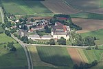
|
7028-301
|
555521784
|
DE7028301
|
2000
|
⊙
|
Landkreis Dillingen a. d. Donau
Landkreis Donau-Ries
|
000000,03
|
|
| Mausohrwochenstube in Steinwiesen
|
|
5734-301
|
555521099
|
DE5734301
|
2000
|
⊙
|
Landkreis Kronach
|
000000,01
|
|
| Mausohrwochenstuben im Maindreieck
|
|
6125-301
|
555521369
|
DE6125301
|
2000
|
⊙
|
Landkreis Würzburg
Landkreis Schweinfurt
|
000000,04
|
|
| Mausohrwochenstuben im Oberpfälzer Jura
|

|
6435-306
|
555521547
|
DE6435306
|
2000
|
⊙
|
Landkreis Neumarkt in der Oberpfalz
Landkreis Amberg-Sulzbach
Landkreis Regensburg
|
000000,12
|
|
| Mausohrwochenstuben im Spessart
|
|
6023-302
|
555521302
|
DE6023302
|
2000
|
⊙
|
Landkreis Miltenberg
Landkreis Main-Spessart
|
000000,09
|
|
| Mausohrwochenstuben in der mittleren Frankenalb
|

|
6833-302
|
555521724
|
DE6833302
|
2000
|
⊙
|
Landkreis Nürnberger Land
Landkreis Roth
Landkreis Weißenburg-Gunzenhausen
|
000000,1
|
|
| Mertinger Hölle und umgebende Feuchtgebiete
|

|
7330-301
|
555521898
|
DE7330301
|
1998
|
⊙
|
Landkreis Donau-Ries
|
000875,2
|
|
| Mettenbacher, Grießenbacher und Königsauer Moos (Unteres Isartal)
|

|
7341-371
|
555521905
|
DE7341371
|
2004
|
⊙
|
Landkreis Dingolfing-Landau
Landkreis Landshut
|
000220,41
|
|
| Mettenhamer Filz, Süssener und Lanzinger Moos mit Extensivwiesen
|
|
8240-371
|
555522197
|
DE8240371
|
2004
|
⊙
|
Landkreis Traunstein
|
000149,46
|
|
| Milztal und oberes Saaletal
|
|
5628-371
|
555521015
|
DE5628371
|
2004
|
⊙
|
Landkreis Rhön-Grabfeld
|
000751,62
|
|
| Mindelhänge zwischen Winzer und Mindelzell
|
|
7728-303
|
555522013
|
DE7728303
|
2000
|
⊙
|
Landkreis Günzburg
|
000090,07
|
|
| Mindelquellgebiet
|
|
8028-371
|
555522093
|
DE8028371
|
2004
|
⊙
|
Landkreis Unterallgäu
Landkreis Ostallgäu
|
000089,86
|
|
| Mittenwalder Buckelwiesen
|
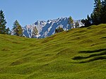
|
8533-301
|
555522290
|
DE8533301
|
1998
|
⊙
|
Landkreis Garmisch-Partenkirchen
|
001904,09
|
|
| Mittleres Altmühltal mit Wellheimer Trockental und Schambachtal
|
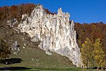
|
7132-371
|
555521819
|
DE7132371
|
2004
|
⊙
|
Landkreis Weißenburg-Gunzenhausen
Landkreis Eichstätt
Landkreis Neuburg-Schrobenhausen
|
004264,13
|
|
| Mittleres Aurach-Tal von Priesendorf bis Walsdorf
|

|
6030-303
|
555521314
|
DE6030303
|
2000
|
⊙
|
Landkreis Bamberg
|
000119,12
|
|
| Moor- und Drumlinlandschaft zwischen Hohenkasten und Antdorf
|
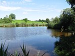
|
8233-301
|
555522184
|
DE8233301
|
2000
|
⊙
|
Landkreis Weilheim-Schongau
|
001400,88
|
|
| Moore bei Finsterau und Philippsreuth
|
|
7148-302
|
555521838
|
DE7148302
|
2000
|
⊙
|
Landkreis Freyung-Grafenau
|
000093,72
|
|
| Moore im Bereich Sonnen-Wegscheid mit Abschnitten des Rannatals
|
|
7348-371
|
555521911
|
DE7348371
|
2004
|
⊙
|
Landkreis Passau
|
000271,02
|
|
| Moore im oberen Ammertal
|
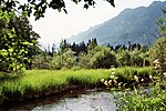
|
8332-371
|
555522243
|
DE8332371
|
2004
|
⊙
|
Landkreis Garmisch-Partenkirchen
|
000628,03
|
|
| Moore im Salzach-Hügelland
|
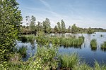
|
8142-371
|
555522152
|
DE8142371
|
2004
|
⊙
|
Landkreis Berchtesgadener Land
Landkreis Traunstein
|
001288,92
|
|
| Moore im Wirlinger Wald
|
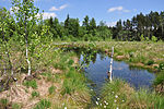
|
8327-301
|
555522226
|
DE8327301
|
2000
|
⊙
|
Landkreis Oberallgäu
|
000197,12
|
|
| Moore nördlich Bad Aibling
|
|
8038-372
|
555522108
|
DE8038372
|
2004
|
⊙
|
Landkreis Rosenheim
|
000102,67
|
|
| Moore südlich des Chiemsees
|
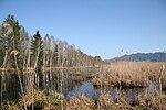
|
8140-371
|
555522149
|
DE8140371
|
2004
|
⊙
|
Landkreis Rosenheim
Landkreis Traunstein
|
003571,53
|
|
| Moore südlich Königsdorf, Rothenrainer Moore und Königsdorfer Alm
|

|
8134-371
|
555522141
|
DE8134371
|
2004
|
⊙
|
Landkreis Bad Tölz-Wolfratshausen
|
001071,62
|
|
| Moore um Bernbeuren
|

|
8230-371
|
555522181
|
DE8230371
|
2004
|
⊙
|
Landkreis Weilheim-Schongau
Landkreis Ostallgäu
|
000324,07
|
|
| Moore um Penzberg
|
|
8234-371
|
555522186
|
DE8234371
|
2004
|
⊙
|
Landkreis Bad Tölz-Wolfratshausen
Landkreis Weilheim-Schongau
|
001157,52
|
|
| Moore um Raubling
|

|
8138-372
|
555522147
|
DE8138372
|
2004
|
⊙
|
Landkreis Rosenheim
|
001226,23
|
|
| Moore um Wasserburg
|
|
7939-371
|
555522077
|
DE7939371
|
2004
|
⊙
|
Landkreis Rosenheim
|
000128,04
|
|
| Moore und Buchenwälder zwischen Etterschlag und Fürstenfeldbruck
|

|
7833-371
|
555522042
|
DE7833371
|
2004
|
⊙
|
Landkreis Fürstenfeldbruck
Landkreis Starnberg
|
000792,7
|
|
| Moore und Extensivwiesen bei Berchtesgaden
|

|
8343-371
|
555522253
|
DE8343371
|
2004
|
⊙
|
Landkreis Berchtesgadener Land
|
000031,91
|
|
| Moore und Seen nordöstlich Rosenheim
|

|
8039-302
|
555522109
|
DE8039302
|
2000
|
⊙
|
Landkreis Rosenheim
|
000545,8
|
|
| Moore und Wälder der Endmoräne bei Starnberg
|

|
7934-371
|
555522074
|
DE7934371
|
2004
|
⊙
|
Landkreis Starnberg
|
000580,7
|
|
| Moore und Wälder westlich Dießen
|

|
8032-372
|
555522099
|
DE8032372
|
2004
|
⊙
|
Landkreis Landsberg am Lech
Landkreis Weilheim-Schongau
|
002580,16
|
|
| Moore westlich Zwiesel
|

|
6944-302
|
555521770
|
DE6944302
|
2000
|
⊙
|
Landkreis Regen
|
000179,5
|
|
| Moore zwischen Dietramszell und Deining
|
|
8135-371
|
555522143
|
DE8135371
|
2004
|
⊙
|
Landkreis München
Landkreis Bad Tölz-Wolfratshausen
|
000941,12
|
|
| Moorgebiet bei Bärnau
|
|
6240-302
|
555521429
|
DE6240302
|
2000
|
⊙
|
Landkreis Tirschenreuth
|
000054,81
|
|
| Moorgebiet von Eggstätt-Hemhof bis Seeon
|
|
8040-371
|
555522111
|
DE8040371
|
2004
|
⊙
|
Landkreis Rosenheim
Landkreis Traunstein
|
002121,2
|
|
| Moorkette von Peiting bis Wessobrunn
|
|
8131-301
|
555522134
|
DE8131301
|
2000
|
⊙
|
Landkreis Landsberg am Lech
Landkreis Weilheim-Schongau
|
000933,17
|
|
| Moorreste im Freisinger und im Erdinger Moos
|

|
7636-371
|
555521991
|
DE7636371
|
2004
|
⊙
|
Landkreis Erding
Landkreis Freising
|
000459,41
|
|
| Moorweiher im Aischgrund und in der Grethelmark
|
|
6330-371
|
555521465
|
DE6330371
|
2004
|
⊙
|
Landkreis Erlangen-Höchstadt
Landkreis Neustadt a. d. Aisch-Bad Windsheim
|
000203,83
|
|
| Moosgraben und Dennenloher Weiher
|

|
6733-371
|
555521690
|
DE6733371
|
2004
|
⊙
|
Landkreis Neumarkt in der Oberpfalz
|
000323,68
|
|
| Moränenlandschaft zwischen Ammersee und Starnberger See
|
|
8033-371
|
555522100
|
DE8033371
|
2004
|
⊙
|
Landkreis Starnberg
Landkreis Weilheim-Schongau
|
002058,75
|
|
| Moränenlandschaft zwischen Staffelsee und Baiersoien
|

|
8332-372
|
555522244
|
DE8332372
|
2004
|
⊙
|
Landkreis Garmisch-Partenkirchen
Landkreis Weilheim-Schongau
|
002526,46
|
|
| Muggenbacher Tongruben
|

|
5730-302
|
555521085
|
DE5730302
|
2000
|
⊙
|
Landkreis Coburg
|
000027,58
|
|
| Münchshofener Berg
|

|
6738-371
|
555521696
|
DE6738371
|
2004
|
⊙
|
Landkreis Schwandorf
|
000180,38
|
|
| Murn, Murner Filz und Eiselfinger See
|

|
8039-371
|
555522110
|
DE8039371
|
2004
|
⊙
|
Landkreis Rosenheim
|
000440,4
|
|
| Murnauer Moos
|

|
8332-301
|
555522240
|
DE8332301
|
1998
|
⊙
|
Landkreis Garmisch-Partenkirchen
|
004274,95
|
|
| Muschelkalkhänge nordöstlich Bayreuth
|

|
6035-371
|
555521323
|
DE6035371
|
2004
|
⊙
|
Landkreis Bayreuth
Bayreuth
|
000378,53
|
|
| Muschelkalkzug von den Langen Bergen bis nach Weißenbrunn v. Wald
|

|
5631-371
|
555521023
|
DE5631371
|
2004
|
⊙
|
Landkreis Coburg
Coburg
|
001981
|
|
| Naab unterhalb Schwarzenfeld und Donau von Poikam bis Regensburg
|
|
6937-371
|
555521761
|
DE6937371
|
2004
|
⊙
|
Landkreis Regensburg
Regensburg
Landkreis Schwandorf
Landkreis Kelheim
|
001218,81
|
|
| Nadelwälder der Schwanenkirchner Tertiärbucht
|

|
7245-302
|
555521870
|
DE7245302
|
2000
|
⊙
|
Landkreis Deggendorf
Landkreis Passau
|
000260,1
|
|
| Nagelfluhkette Hochgrat-Steineberg
|

|
8426-302
|
555522265
|
DE8426302
|
2000
|
⊙
|
Landkreis Oberallgäu
|
001989,42
|
|
| Nationalpark Bayerischer Wald
|
|
6946-301
|
555579396
|
DE6946301
|
1998
|
⊙
|
Landkreis Freyung-Grafenau
Landkreis Regen
|
024361,91
|
|
| Nationalpark Berchtesgaden
|

|
8342-301
|
555579401
|
DE8342301
|
2006
|
⊙
|
Landkreis Berchtesgadener Land
|
021338,4
|
|
| NATO-Übungsplatz Siegenburg
|
|
7236-304
|
555579397
|
DE7236304
|
2000
|
⊙
|
Landkreis Kelheim
|
000273,71
|
|
| Naturdenkmal Unterer Klingelbachgraben
|
|
6123-372
|
555521365
|
DE6123372
|
2004
|
⊙
|
Landkreis Main-Spessart
|
000003,19
|
|
| Naturschutzgebiet 'Alzenauer Sande'
|

|
5920-301
|
555521225
|
DE5920301
|
1998
|
⊙
|
Landkreis Aschaffenburg
|
000095,34
|
|
| Naturschutzgebiet 'Aubachtal bei Wildensee'
|
|
6121-372
|
555521362
|
DE6121372
|
2004
|
⊙
|
Landkreis Miltenberg
|
000066,5
|
|
| Naturschutzgebiet 'Auwald bei Westheim'
|
|
7029-302
|
555521785
|
DE7029302
|
2000
|
⊙
|
Landkreis Weißenburg-Gunzenhausen
|
000049,96
|
|
| Naturschutzgebiet 'Bannwaldsee'
|
|
8430-301
|
555522275
|
DE8430301
|
1998
|
⊙
|
Landkreis Ostallgäu
|
000558,7
|
|
| Naturschutzgebiet 'Binnendünen bei Siegenburg und Offenstetten'
|
|
7236-301
|
555521861
|
DE7236301
|
1998
|
⊙
|
Landkreis Kelheim
|
000048,54
|
|
| Naturschutzgebiet 'Craimoosweiher'
|

|
6135-301
|
555521378
|
DE6135301
|
1998
|
⊙
|
Schnabelwaid
Landkreis Bayreuth
|
000018,46
|
|
| Naturschutzgebiet 'Graureiherkolonie am Salzberg'
|
|
5923-301
|
555521230
|
DE5923301
|
2000
|
⊙
|
Landkreis Main-Spessart
|
000159,06
|
|
| Naturschutzgebiet 'Großer Teich und Tambachaue'
|
|
5731-303
|
555521091
|
DE5731303
|
2000
|
⊙
|
Landkreis Coburg
|
000017,23
|
|
| Naturschutzgebiet Grubenfelder Leonie
|

|
6235-301
|
555521425
|
DE6235301
|
2004
|
⊙
|
Landkreis Amberg-Sulzbach
|
000092,09
|
|
| Naturschutzgebiet 'Gundelfinger Moos'
|
|
7427-371
|
555521927
|
DE7427371
|
2004
|
⊙
|
Landkreis Dillingen a. d. Donau
|
000226,15
|
|
| Naturschutzgebiet 'Haspelmoor'
|

|
7732-301
|
555522014
|
DE7732301
|
2000
|
⊙
|
Landkreis Fürstenfeldbruck
|
000158,5
|
|
| Naturschutzgebiet 'Hörnauer Wald'
|
|
6027-372
|
555521307
|
DE6027372
|
2004
|
⊙
|
Frankenwinheim
Sulzheim
Gerolzhofen
Landkreis Schweinfurt
|
000180,48
|
|
| Naturschutzgebiet 'Moore um die Wies'
|
|
8331-301
|
555522237
|
DE8331301
|
2000
|
⊙
|
Landkreis Weilheim-Schongau
|
000375,05
|
|
| Naturschutzgebiet 'Naturwaldreservat Hengstberg'
|
|
5839-302
|
555521184
|
DE5839302
|
2000
|
⊙
|
Landkreis Wunsiedel i. Fichtelgebirge
|
000040,96
|
|
| Naturschutzgebiet 'Osterseen'
|

|
8133-301
|
555522137
|
DE8133301
|
1998
|
⊙
|
Landkreis Weilheim-Schongau
|
001093
|
|
| Naturschutzgebiet 'Rohrachschlucht'
|

|
8424-302
|
555522262
|
DE8424302
|
2000
|
⊙
|
Landkreis Lindau
|
000169,79
|
|
| Naturschutzgebiet 'Romberg'
|
|
6023-301
|
555521301
|
DE6023301
|
2000
|
⊙
|
Landkreis Main-Spessart
|
000055,28
|
|
| Naturschutzgebiet 'Sandharlander Heide'
|
|
7136-302
|
555521824
|
DE7136302
|
1998
|
⊙
|
Landkreis Kelheim
|
000025,67
|
|
| Naturschutzgebiet 'Scheerweihergebiet bei Schalkhausen'
|

|
6629-301
|
555521640
|
DE6629301
|
2004
|
⊙
|
Ansbach
|
000052,85
|
|
| Naturschutzgebiet 'Seeholz und Seewiese'
|

|
8032-302
|
555522097
|
DE8032302
|
2000
|
⊙
|
Landkreis Landsberg am Lech
|
000096,69
|
|
| Naturschutzgebiet 'Sodenberg-Gans'
|

|
5824-302
|
555521159
|
DE5824302
|
2000
|
⊙
|
Landkreis Bad Kissingen
Landkreis Main-Spessart
|
000496,85
|
|
| Naturschutzgebiet 'Trockenhänge bei Böttigheim'
|

|
6223-301
|
555521408
|
DE6223301
|
1998
|
⊙
|
Landkreis Würzburg
|
000046,98
|
|
| Naturschutzgebiet 'Unteres Pfistertal nördlich Vilshofen'
|
|
6637-301
|
555521651
|
DE6637301
|
2000
|
⊙
|
Landkreis Amberg-Sulzbach
|
000013,67
|
|
| Naturschutzgebiet 'Urlesbachtal'
|
|
5828-301
|
555521165
|
DE5828301
|
2000
|
⊙
|
Landkreis Haßberge
|
000024,11
|
|
| Naturschutzgebiet 'Vogelfreistätte Glender Wiesen'
|
|
5731-301
|
555521089
|
DE5731301
|
2000
|
⊙
|
Landkreis Coburg
Coburg
|
000175,33
|
|
| Naturschutzgebiet 'Wasenlöcher bei Illerberg'
|
|
7726-302
|
555522006
|
DE7726302
|
2000
|
⊙
|
Landkreis Neu-Ulm
|
000069,32
|
|
| Naturschutzgebiet 'Weichser Moos'
|

|
7634-301
|
555521988
|
DE7634301
|
2000
|
⊙
|
Landkreis Dachau
|
000057,85
|
|
| Naturschutzgebiet 'Widdumer Weiher' und Wasenmoos
|
|
8327-372
|
555522229
|
DE8327372
|
2004
|
⊙
|
Landkreis Oberallgäu
|
000035,31
|
|
| Naturschutzgebiet 'Wildnis am Rathsberg'
|

|
6332-302
|
555521468
|
DE6332302
|
2000
|
⊙
|
Landkreis Erlangen-Höchstadt
|
000025,51
|
|
| Naturwaldreservat Damm
|
|
7236-302
|
555521862
|
DE7236302
|
2000
|
⊙
|
Landkreis Kelheim
|
000074,94
|
|
| Naturwaldreservat Hammerleite
|
|
5735-301
|
555521103
|
DE5735301
|
2000
|
⊙
|
Landkreis Hof
|
000052,57
|
|
| Naturwaldreservat Stachel
|
|
5930-302
|
555521239
|
DE5930302
|
2000
|
⊙
|
Landkreis Haßberge
|
000023,87
|
|
| Naturwaldreservat Stückstein
|
|
6441-302
|
555521553
|
DE6441302
|
2000
|
⊙
|
Landkreis Neustadt an der Waldnaab
|
000085,19
|
|
| Naturwaldreservat Waldstein
|

|
5837-301
|
555521178
|
DE5837301
|
2000
|
⊙
|
Landkreis Hof
|
000020,29
|
|
| Naturwaldreservate der Frankenhöhe
|
|
6527-372
|
555521586
|
DE6527372
|
2004
|
⊙
|
Landkreis Ansbach
Landkreis Neustadt a. d. Aisch-Bad Windsheim
|
000244,96
|
|
| Nebel-, Kloster- und Brunnenbach
|
|
7328-371
|
555521894
|
DE7328371
|
2004
|
⊙
|
Landkreis Dillingen a. d. Donau
|
000273,04
|
|
| Neubäuer Weiher
|

|
6740-301
|
555521698
|
DE6740301
|
1998
|
⊙
|
Roding
Landkreis Cham
|
000034,34
|
|
| Niedermoore und Quellsümpfe im Isar-Inn-Hügelland
|
|
7442-301
|
555521937
|
DE7442301
|
2000
|
⊙
|
Landkreis Dingolfing-Landau
Landkreis Rottal-Inn
|
000023,9
|
|
| Niederterrassenwälder zwischen Fristingen und Lauterbach
|
|
7330-302
|
555521899
|
DE7330302
|
2000
|
⊙
|
Landkreis Dillingen a. d. Donau
|
000216,24
|
|
| Nordostbayerische Bachtäler um Rehau
|
|
5738-371
|
555521105
|
DE5738371
|
2004
|
⊙
|
Landkreis Hof
Landkreis Wunsiedel i. Fichtelgebirge
|
000471,7
|
|
| NSG 'Aschau', NSG 'Schwarzbach' und Schwimmendes Moos
|
|
8342-302
|
555522251
|
DE8342302
|
2000
|
⊙
|
Landkreis Berchtesgadener Land
|
000808,78
|
|
| NSG Maisinger See
|
|
8033-373
|
555522102
|
DE8033373
|
2004
|
⊙
|
Landkreis Starnberg
|
000120,86
|
|
| NSG 'Regentalhänge zwischen Kirchenrohrbach und Zenzing'
|

|
6840-301
|
555521731
|
DE6840301
|
2000
|
⊙
|
Landkreis Cham
|
000022,25
|
|
| NSG 'Schwarzach-Durchbruch' und Rhätschluchten bei Burgthann
|
|
6633-371
|
555521646
|
DE6633371
|
2004
|
⊙
|
Landkreis Nürnberger Land
|
000149,73
|
|
| NSG südlich der Ismaninger Fischteiche
|
|
7736-372
|
555522020
|
DE7736372
|
2004
|
⊙
|
Landkreis München
|
000023,02
|
|
| Nymphenburger Park mit Allee und Kapuzinerhölzl
|

|
7834-301
|
555522043
|
DE7834301
|
2000
|
⊙
|
München
|
000182,63
|
|
| Obenhausener Ried und Muschelbäche im Rothtal
|
|
7726-372
|
555522009
|
DE7726372
|
2004
|
⊙
|
Landkreis Neu-Ulm
|
000404,47
|
|
| Obere Altmühl mit Brunst-Schwaigau und Wiesmet
|
|
6830-371
|
555521720
|
DE6830371
|
2004
|
⊙
|
Landkreis Ansbach
Landkreis Weißenburg-Gunzenhausen
|
004470,5
|
|
| Obere Hengersberger Ohe mit Hangwiesen
|
|
7144-373
|
555521835
|
DE7144373
|
2004
|
⊙
|
Landkreis Deggendorf
|
000347,13
|
|
| Obere Mindel
|
|
8028-373
|
555522095
|
DE8028373
|
2004
|
⊙
|
Landkreis Unterallgäu
Landkreis Ostallgäu
|
000089,04
|
|
| Oberes Isartal
|

|
8034-371
|
555522103
|
DE8034371
|
2004
|
⊙
|
Landkreis Garmisch-Partenkirchen
München
Landkreis München
Landkreis Bad Tölz-Wolfratshausen
|
004677,63
|
|
| Oberes Surtal und Urstromtal Höglwörth
|

|
8142-372
|
555522153
|
DE8142372
|
2004
|
⊙
|
Landkreis Berchtesgadener Land
Landkreis Traunstein
|
000877,8
|
|
| Oberes Weißachtal mit Lanzen-, Katzen- und Mittelbach
|

|
8426-301
|
555522264
|
DE8426301
|
2000
|
⊙
|
Landkreis Oberallgäu
|
000708,73
|
|
| Oberlauf der Ussel bis Itzing
|
|
7130-372
|
555521816
|
DE7130372
|
2004
|
⊙
|
Landkreis Donau-Ries
|
000026,58
|
|
| Oberlauf des Regens und Nebenbäche
|

|
7045-371
|
555521800
|
DE7045371
|
2004
|
⊙
|
Landkreis Deggendorf
Landkreis Freyung-Grafenau
Landkreis Regen
|
001915,07
|
|
| Oberlauf des Weißen Regens bis Kötzting mit Kaitersbachaue
|

|
6844-371
|
555521740
|
DE6844371
|
2004
|
⊙
|
Landkreis Cham
Landkreis Regen
|
000635,1
|
|
| Oberstimmer Schacht
|
|
7234-371
|
555521860
|
DE7234371
|
2004
|
⊙
|
Landkreis Pfaffenhofen a. d. Ilm
|
000019,03
|
|
| Örtlbergweiher mit Örtlberg
|
|
6232-303
|
555521418
|
DE6232303
|
2000
|
⊙
|
Landkreis Forchheim
|
000217,38
|
|
| Osterholz bei Rentershofen
|
|
8325-372
|
555522222
|
DE8325372
|
2004
|
⊙
|
Landkreis Lindau
|
000046,77
|
|
| Östliche Chiemgauer Alpen
|

|
8241-372
|
555522199
|
DE8241372
|
2004
|
⊙
|
Landkreis Berchtesgadener Land
Landkreis Traunstein
|
012932,87
|
|
| Östlicher Mönchrödener Forst
|
|
5632-371
|
555521029
|
DE5632371
|
2004
|
⊙
|
Landkreis Coburg
|
000214,94
|
|
| Östlicher Neuburger Wald und Innleiten bis Vornbach
|

|
7446-371
|
555521940
|
DE7446371
|
2004
|
⊙
|
Passau
Landkreis Passau
|
001243,67
|
|
| Östlicher Vogelherd im Veldensteiner Forst
|
|
6335-372
|
555521479
|
DE6335372
|
2004
|
⊙
|
Landkreis Nürnberger Land
Landkreis Bayreuth
|
000251,69
|
|
| Paar und Ecknach
|

|
7433-371
|
555521932
|
DE7433371
|
2004
|
⊙
|
Landkreis Neuburg-Schrobenhausen
Landkreis Pfaffenhofen a. d. Ilm
Landkreis Aichach-Friedberg
|
002947,93
|
|
| Paradiesteiche
|
|
5837-303
|
555521180
|
DE5837303
|
2000
|
⊙
|
Landkreis Wunsiedel i. Fichtelgebirge
|
000012,53
|
|
| Parkstein
|
|
6238-301
|
555521427
|
DE6238301
|
2000
|
⊙
|
Landkreis Neustadt an der Waldnaab
|
000002,01
|
|
| Pegnitz zwischen Michelfeld und Hersbruck
|

|
6335-371
|
555521478
|
DE6335371
|
2004
|
⊙
|
Landkreis Nürnberger Land
Landkreis Amberg-Sulzbach
Landkreis Bayreuth
|
000292,83
|
|
| Pfäfflinger Wiesen und Riedgraben bei Laub
|

|
7130-371
|
555521815
|
DE7130371
|
2004
|
⊙
|
Landkreis Donau-Ries
|
000266,47
|
|
| Pfahl
|
|
6842-301
|
555521734
|
DE6842301
|
2000
|
⊙
|
Landkreis Regen
|
000100,48
|
|
| Pfreimd und Lois-Bach
|

|
6340-371
|
555521484
|
DE6340371
|
2004
|
⊙
|
Landkreis Neustadt an der Waldnaab
|
000238,76
|
|
| Pfreimdtal und Kainzbachtal
|

|
6439-371
|
555521551
|
DE6439371
|
2004
|
⊙
|
Landkreis Neustadt an der Waldnaab
Landkreis Schwandorf
|
000343,4
|
|
| Pfrontener Wasenmoos und Moore bei Hopferau
|

|
8429-371
|
555522274
|
DE8429371
|
2004
|
⊙
|
Landkreis Ostallgäu
|
000156,57
|
|
| Philippsreuter Waldhufen
|
|
7148-371
|
555521839
|
DE7148371
|
2004
|
⊙
|
Landkreis Freyung-Grafenau
|
000068,73
|
|
| Piesenkopfmoore
|

|
8526-302
|
555522285
|
DE8526302
|
2000
|
⊙
|
Landkreis Oberallgäu
|
000781,49
|
|
| Prälatenweiher, alte Steinbrüche bei Oberringingen und Sternbach
|
|
7229-301
|
555521853
|
DE7229301
|
2000
|
⊙
|
Landkreis Dillingen a. d. Donau
Landkreis Donau-Ries
|
000007,04
|
|
| Probstalm und Probstenwand
|
|
8334-302
|
555522246
|
DE8334302
|
2000
|
⊙
|
Landkreis Bad Tölz-Wolfratshausen
|
000100,88
|
|
| Prosselsheimer Holz
|
|
6126-301
|
555521370
|
DE6126301
|
2000
|
⊙
|
Landkreis Würzburg
Landkreis Kitzingen
|
000223,73
|
|
| Quellflur bei Staig
|
|
8227-301
|
555522174
|
DE8227301
|
2000
|
⊙
|
Landkreis Oberallgäu
|
000000,76
|
|
| Rabensteiner Höhe mit Zeyerner Wand
|

|
5734-302
|
555521100
|
DE5734302
|
2000
|
⊙
|
Landkreis Kronach
|
000012,54
|
|
| Rednitztal in Nürnberg
|
|
6632-371
|
555521644
|
DE6632371
|
2004
|
⊙
|
Nürnberg
Schwabach
|
000338,01
|
|
| Regentalhänge bei Hirschling
|
|
6739-301
|
555521697
|
DE6739301
|
2000
|
⊙
|
Landkreis Regensburg
Landkreis Schwandorf
|
000358,16
|
|
| Regnitz, Stocksee und Sandgebiete von Neuses bis Hallstadt
|
|
6131-371
|
555521373
|
DE6131371
|
2004
|
⊙
|
Bamberg
Landkreis Bamberg
Landkreis Forchheim
|
000311,58
|
|
| Reutsee
|
|
5729-301
|
555521083
|
DE5729301
|
2000
|
⊙
|
Landkreis Rhön-Grabfeld
|
000012,33
|
|
| Rhätschluchten westlich Bayreuth
|

|
6034-301
|
555521319
|
DE6034301
|
2000
|
⊙
|
Landkreis Bayreuth
Bayreuth
|
000039,43
|
|
| Riedellandschaft-Talmoore
|
|
7628-301
|
555521982
|
DE7628301
|
2000
|
⊙
|
Landkreis Günzburg
Landkreis Unterallgäu
|
000325,26
|
|
| Rodachaue mit Bischofsaue westlich Bad Rodach
|

|
5630-371
|
555521019
|
DE5630371
|
2004
|
⊙
|
Landkreis Coburg
|
000265,88
|
|
| Rodacher Wald mit Ruhhügel
|

|
5630-372
|
555521020
|
DE5630372
|
2004
|
⊙
|
Landkreis Coburg
|
000706,39
|
|
| Röderbach-, Biberbach- und Schneybachtal
|
|
5732-373
|
555521095
|
DE5732373
|
2004
|
⊙
|
Landkreis Coburg
Landkreis Lichtenfels
|
000123,24
|
|
| Rodungsinseln im Reichswald
|

|
6533-371
|
555521593
|
DE6533371
|
2004
|
⊙
|
Nürnberg
|
000044,36
|
|
| Rotmain-, Mistelbach- und Ölschnitztal um Bayreuth
|
|
6035-372
|
555521324
|
DE6035372
|
2004
|
⊙
|
Landkreis Bayreuth
Bayreuth
Landkreis Kulmbach
|
000700,56
|
|
| Rottachberg und Rottachschlucht
|

|
8327-304
|
555522228
|
DE8327304
|
2000
|
⊙
|
Landkreis Oberallgäu
|
000520,04
|
|
| Röttenbacher Wald
|
|
6832-372
|
555521723
|
DE6832372
|
2004
|
⊙
|
Landkreis Weißenburg-Gunzenhausen
|
000279,14
|
|
| Rotter Forst und Rott
|

|
8038-371
|
555522107
|
DE8038371
|
2004
|
⊙
|
Landkreis Rosenheim
|
000799,45
|
|
| Ruine Rothenberg bei Schnaittach
|

|
6434-302
|
555521545
|
DE6434302
|
2000
|
⊙
|
Landkreis Nürnberger Land
|
000004,42
|
|
| Saaletal v. Joditz bis Blankenstein u. NSG Tannbach b. Mödlareuth
|
|
5536-371
|
555520917
|
DE5536371
|
2004
|
⊙
|
Landkreis Hof
|
000322,89
|
|
| Sallingbachtal
|
|
7237-371
|
555521864
|
DE7237371
|
2004
|
⊙
|
Landkreis Kelheim
|
000337,29
|
|
| Salzach und Unterer Inn
|

|
7744-371
|
555522025
|
DE7744371
|
2004
|
⊙
|
Landkreis Altötting
Landkreis Berchtesgadener Land
Landkreis Traunstein
Landkreis Passau
Landkreis Rottal-Inn
|
005662,79
|
|
| Sand- und Lehmgrube Loizersdorf
|
|
7246-372
|
555521872
|
DE7246372
|
2004
|
⊙
|
Landkreis Passau
|
000010,04
|
|
| Sandgebiete bei Schwarzach, Klein- und Großlangheim
|

|
6227-371
|
555521413
|
DE6227371
|
2004
|
⊙
|
Landkreis Kitzingen
|
001434,34
|
|
| Sandgrube bei Schachendorf
|
|
6842-371
|
555521735
|
DE6842371
|
2004
|
⊙
|
Landkreis Cham
|
000008,95
|
|
| Sandgrube und Teiche südlich Auerbach i. d. Opf.
|
|
6335-373
|
555521480
|
DE6335373
|
2004
|
⊙
|
Landkreis Amberg-Sulzbach
|
000005,55
|
|
| Sandheiden im mittelfränkischen Becken
|
|
6432-301
|
555521542
|
DE6432301
|
1998
|
⊙
|
Landkreis Erlangen-Höchstadt
Landkreis Fürth
|
001167,39
|
|
| Schambachried
|
|
7031-371
|
555521787
|
DE7031371
|
2004
|
⊙
|
Landkreis Weißenburg-Gunzenhausen
|
000011,11
|
|
| Schambachtal mit Seitentälern
|
|
7031-373
|
555521788
|
DE7031373
|
2004
|
⊙
|
Landkreis Weißenburg-Gunzenhausen
|
000200,71
|
|
| Scheibenwiese bei Ebnath
|
|
6037-372
|
555521328
|
DE6037372
|
2004
|
⊙
|
Landkreis Tirschenreuth
|
000004,31
|
|
| Schlappolt
|

|
8627-302
|
555522293
|
DE8627302
|
2000
|
⊙
|
Landkreis Oberallgäu
|
000196,08
|
|
| Schloßberg, Wolfgangshöhle und Hohllochberggruppe bei Velburg
|

|
6736-301
|
555521695
|
DE6736301
|
2000
|
⊙
|
Landkreis Neumarkt in der Oberpfalz
|
000159,88
|
|
| Schluifelder Moos und Bulachmoos
|
|
7933-301
|
555522070
|
DE7933301
|
2000
|
⊙
|
Landkreis Starnberg
|
000070,43
|
|
| Schmalwasser- und Premichtal
|
|
5626-372
|
555521009
|
DE5626372
|
2004
|
⊙
|
Landkreis Bad Kissingen
Landkreis Rhön-Grabfeld
|
000343,17
|
|
| Schmelzwasserrinnen und Toteislöcher bei Pfronten
|
|
8429-301
|
555522270
|
DE8429301
|
2000
|
⊙
|
Landkreis Ostallgäu
|
000038,83
|
|
| Schmuttertal
|
|
7630-371
|
555521985
|
DE7630371
|
2004
|
⊙
|
Landkreis Augsburg
|
000897,84
|
|
| Schneebergmassiv mit Fichtelseemoor
|
|
5937-371
|
555521261
|
DE5937371
|
2004
|
⊙
|
Landkreis Bayreuth
Landkreis Wunsiedel i. Fichtelgebirge
|
003052,49
|
|
| Schönberger Ach
|
|
8527-371
|
555522287
|
DE8527371
|
2004
|
⊙
|
Landkreis Oberallgäu
|
000029,69
|
|
| Schondratalsystem
|
|
5824-301
|
555521158
|
DE5824301
|
2000
|
⊙
|
Landkreis Bad Kissingen
Landkreis Main-Spessart
|
000306,56
|
|
| Schuttholzer Moor
|
|
7244-301
|
555521868
|
DE7244301
|
1998
|
⊙
|
Landkreis Deggendorf
|
000106,1
|
|
| Schwadengraben
|
|
6428-301
|
555521538
|
DE6428301
|
2000
|
⊙
|
Landkreis Neustadt a. d. Aisch-Bad Windsheim
|
000008,44
|
|
| Schwalbenstein
|
|
5933-302
|
555521249
|
DE5933302
|
2000
|
⊙
|
Landkreis Kulmbach
|
000014,22
|
|
| Schwarzach vom Main-Donau-Kanal bis Obermässing
|
|
6833-372
|
555521726
|
DE6833372
|
2004
|
⊙
|
Landkreis Roth
Landkreis Neumarkt in der Oberpfalz
|
000207,27
|
|
| Schwarzachtal zwischen Hocha und Schönthal
|

|
6641-371
|
555521655
|
DE6641371
|
2004
|
⊙
|
Landkreis Cham
|
000222,15
|
|
| Schwarze Laaber
|

|
6836-371
|
555521728
|
DE6836371
|
2004
|
⊙
|
Landkreis Neumarkt in der Oberpfalz
Landkreis Regensburg
|
001141,99
|
|
| Schwarzwihrberg bei Rötz
|

|
6640-371
|
555521654
|
DE6640371
|
2004
|
⊙
|
Landkreis Cham
Landkreis Schwandorf
|
000214,81
|
|
| Seibertsbachtal
|
|
6039-372
|
555521331
|
DE6039372
|
2004
|
⊙
|
Landkreis Tirschenreuth
|
000036,37
|
|
| Selbitz, Muschwitz und Höllental
|

|
5636-371
|
555521033
|
DE5636371
|
2004
|
⊙
|
Landkreis Hof
Landkreis Kronach
|
000433,89
|
|
| Senkele
|
|
8329-305
|
555522233
|
DE8329305
|
2000
|
⊙
|
Landkreis Ostallgäu
|
000158,06
|
|
| Serpentinstandorte am Haidberg südwestlich Zell
|

|
5836-371
|
555521177
|
DE5836371
|
2004
|
⊙
|
Landkreis Hof
|
000061,13
|
|
| Serpentinstandorte in der nördlichen Oberpfalz
|
|
6138-372
|
555521383
|
DE6138372
|
2004
|
⊙
|
Landkreis Neustadt an der Waldnaab
Landkreis Schwandorf
Landkreis Tirschenreuth
|
000119,34
|
|
| Silberberg (BY)
|

|
6944-301
|
555521769
|
DE6944301
|
2000
|
⊙
|
Landkreis Regen
|
000315,59
|
|
| Simsseegebiet
|

|
8139-371
|
555522148
|
DE8139371
|
2004
|
⊙
|
Landkreis Rosenheim
|
001032,98
|
|
| Sinngrund
|

|
5823-301
|
555521157
|
DE5823301
|
2000
|
⊙
|
Landkreis Bad Kissingen
Landkreis Main-Spessart
|
000414,28
|
|
| Sinswanger Moor nördlich Oberstaufen
|
|
8426-371
|
555522266
|
DE8426371
|
2004
|
⊙
|
Landkreis Lindau
Landkreis Oberallgäu
|
000062,76
|
|
| Sippach-Tal südöstlich Sippachsmühle
|
|
5824-372
|
555521161
|
DE5824372
|
2004
|
⊙
|
Landkreis Bad Kissingen
|
000003,98
|
|
| Sippenauer Moor
|

|
7137-301
|
555521828
|
DE7137301
|
1998
|
⊙
|
Landkreis Kelheim
|
000017,23
|
|
| Sonnensee und Birkenfelser Forst
|
|
6629-371
|
555521642
|
DE6629371
|
2004
|
⊙
|
Landkreis Ansbach
|
000174,56
|
|
| Spirkenmoor bei Griesbach
|
|
6141-301
|
555521385
|
DE6141301
|
2000
|
⊙
|
Landkreis Tirschenreuth
|
000066,83
|
|
| Spitzberg und Gänsleite bei Limbach
|
|
6029-372
|
555521311
|
DE6029372
|
2004
|
⊙
|
Landkreis Haßberge
|
000104,07
|
|
| Staffelwald bei Irsee und Lehmgrube Hammerschmiede
|
|
8029-371
|
555522096
|
DE8029371
|
2004
|
⊙
|
Kaufbeuren
Landkreis Ostallgäu
|
000329,61
|
|
| Standortübungsplatz Aschaffenburg
|

|
6021-302
|
555521298
|
DE6021302
|
2000
|
⊙
|
Aschaffenburg
|
000087,24
|
|
| Standortübungsplatz Bogen
|
|
7042-371
|
555521796
|
DE7042371
|
2004
|
⊙
|
Landkreis Straubing-Bogen
|
000072,62
|
|
| Standortübungsplatz 'Brönnhof' und Umgebung
|
|
5827-371
|
555521164
|
DE5827371
|
2004
|
⊙
|
Landkreis Bad Kissingen
Landkreis Schweinfurt
|
002338,09
|
|
| Standortübungsplatz Ingolstadt - Hepberg
|
|
7134-371
|
555521822
|
DE7134371
|
2004
|
⊙
|
Landkreis Eichstätt
|
000266,57
|
|
| Standortübungsplatz Kirchholz (Bad Reichenhall)
|
|
8243-301
|
555522200
|
DE8243301
|
2000
|
⊙
|
Landkreis Berchtesgadener Land
|
000116,18
|
|
| Standortübungsplatz Maising
|
|
8033-372
|
555522101
|
DE8033372
|
2004
|
⊙
|
Landkreis Starnberg
|
000101,65
|
|
| Standortübungsplatz Oberhinkofen
|
|
7038-371
|
555521794
|
DE7038371
|
2004
|
⊙
|
Landkreis Regensburg
|
000529,78
|
|
| Standortübungsplatz Oberviechtach
|
|
6540-371
|
555521600
|
DE6540371
|
2004
|
⊙
|
Landkreis Schwandorf
|
000238,67
|
|
| Standortübungsplatz Roding
|
|
6841-371
|
555521732
|
DE6841371
|
2004
|
⊙
|
Landkreis Cham
|
000160,7
|
|
| Standortübungsplatz Spatzenhausen nördlich Murnau
|
|
8233-371
|
555522185
|
DE8233371
|
2004
|
⊙
|
Landkreis Garmisch-Partenkirchen
Landkreis Weilheim-Schongau
|
000134,62
|
|
| Standortübungsplatz St. Margarethen/Brannenburg
|
|
8238-301
|
555522192
|
DE8238301
|
2000
|
⊙
|
Landkreis Rosenheim
|
000060,3
|
|
| Standortübungsplatz Traunstein
|

|
8041-371
|
555522114
|
DE8041371
|
2004
|
⊙
|
Landkreis Traunstein
|
000103,57
|
|
| Starnberger See
|

|
8133-371
|
555522139
|
DE8133371
|
2004
|
⊙
|
Landkreis Starnberg
|
005723,99
|
|
| Steinach- und Föritztal und Rodach von Fürth a.B. bis Marktzeuln
|
|
5733-371
|
555521098
|
DE5733371
|
2004
|
⊙
|
Landkreis Coburg
Landkreis Kronach
Landkreis Lichtenfels
|
000588,85
|
|
| Steinachtal mit Naturwaldreservat Kühberg
|

|
5835-301
|
555521173
|
DE5835301
|
2000
|
⊙
|
Landkreis Kulmbach
|
000086,89
|
|
| Steinbruch am Schrandelberg bei Langenaltheim
|
|
7131-372
|
555521818
|
DE7131372
|
2004
|
⊙
|
Landkreis Weißenburg-Gunzenhausen
|
000013,75
|
|
| Steinbruch Langenaltheim
|
|
7131-371
|
555521817
|
DE7131371
|
2004
|
⊙
|
Landkreis Weißenburg-Gunzenhausen
|
000078,21
|
|
| Steinbruch nördlich Bergheim
|
|
7328-302
|
555521890
|
DE7328302
|
2000
|
⊙
|
Landkreis Dillingen a. d. Donau
|
000000,3
|
|
| Steinbrüche nördlich Kirchheim
|
|
6325-371
|
555521460
|
DE6325371
|
2004
|
⊙
|
Landkreis Würzburg
Landkreis Miltenberg
|
000083,35
|
|
| Steinbruchgebiet nordwestlich Hauzenberg
|
|
7347-372
|
555521910
|
DE7347372
|
2004
|
⊙
|
Landkreis Passau
|
000013,54
|
|
| Steinbruchgelände bei Umpfenbach
|
|
6322-371
|
555521458
|
DE6322371
|
2004
|
⊙
|
Landkreis Miltenberg
|
000046,56
|
|
| Steinbruchgelände östlich Selbitz
|
|
5636-302
|
555521032
|
DE5636302
|
2000
|
⊙
|
Landkreis Hof
|
000034,23
|
|
| Stöckach, Lindach und Herrenwald
|
|
6425-371
|
555521535
|
DE6425371
|
2004
|
⊙
|
Landkreis Würzburg
|
001184,2
|
|
| Stockenweiler Weiher, Degermoos, Schwarzenbach
|
|
8324-301
|
555522215
|
DE8324301
|
2000
|
⊙
|
Landkreis Lindau
|
000235,24
|
|
| Streuobst, Kopfeichen und Quellen am Hetzleser Berg
|

|
6333-371
|
555521472
|
DE6333371
|
2004
|
⊙
|
Landkreis Forchheim
|
001440,63
|
|
| Streuobstwiesen zwischen Erbig und Bischberg
|

|
6020-301
|
555521297
|
DE6020301
|
2000
|
⊙
|
Aschaffenburg
|
000176,56
|
|
| Strogn mit Hammerbach und Köllinger Bächlein
|
|
7637-371
|
555521992
|
DE7637371
|
2004
|
⊙
|
Landkreis Erding
|
000254,14
|
|
| Stubenweiherbach
|
|
7528-371
|
555521961
|
DE7528371
|
2004
|
⊙
|
Landkreis Günzburg
|
000004,29
|
|
| Südhang des Steinert nordöstlich Jesserndorf
|
|
5930-372
|
555521241
|
DE5930372
|
2004
|
⊙
|
Landkreis Haßberge
|
000024,46
|
|
| Südlicher Staatsforst Langheim
|
|
5832-371
|
555521171
|
DE5832371
|
2004
|
⊙
|
Landkreis Lichtenfels
|
000185,25
|
|
| Sulzschneider Moore
|

|
8329-303
|
555522231
|
DE8329303
|
2000
|
⊙
|
Landkreis Ostallgäu
|
001793,24
|
|
| Tal der Brend
|
|
5626-371
|
555521008
|
DE5626371
|
2004
|
⊙
|
Landkreis Rhön-Grabfeld
|
000422,59
|
|
| Tal der Großen Laaber zwischen Sandsbach und Unterdeggenbach
|
|
7138-372
|
555521830
|
DE7138372
|
2004
|
⊙
|
Landkreis Regensburg
Landkreis Kelheim
|
000682,85
|
|
| Tal der oberen Itz
|
|
5632-302
|
555521026
|
DE5632302
|
2000
|
⊙
|
Landkreis Coburg
|
000227,59
|
|
| Täler der Odenwald-Bäche um Amorbach
|
|
6321-371
|
555521456
|
DE6321371
|
2004
|
⊙
|
Landkreis Miltenberg
|
000552,31
|
|
| Täler und Rodungsinseln im Frankenwald mit Geroldsgrüner Forst
|
|
5634-371
|
555521031
|
DE5634371
|
2004
|
⊙
|
Landkreis Hof
Landkreis Kronach
|
001857,17
|
|
| Talmoore an der Schwarzen Laaber
|
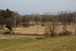
|
6735-301
|
555521693
|
DE6735301
|
1998
|
⊙
|
Landkreis Neumarkt in der Oberpfalz
|
000233,25
|
|
| Talsystem von Schwarzach, Auerbach und Ascha
|

|
6639-371
|
555521652
|
DE6639371
|
2004
|
⊙
|
Landkreis Schwandorf
|
000782,62
|
|
| Taubenberg
|

|
8136-302
|
555579399
|
DE8136302
|
1994
|
⊙
|
Landkreis Miesbach
|
001849,92
|
|
| Tauber- und Gollachtal bei Bieberehren
|
|
6425-372
|
555521536
|
DE6425372
|
2004
|
⊙
|
Landkreis Würzburg
|
000639,07
|
|
| Taubertal nördlich Rothenburg und Steinbachtal
|

|
6627-371
|
555521636
|
DE6627371
|
2004
|
⊙
|
Landkreis Ansbach
|
001050,38
|
|
| Teich östlich Oberreinbach
|
|
6435-372
|
555521548
|
DE6435372
|
2004
|
⊙
|
Landkreis Amberg-Sulzbach
|
000002,11
|
|
| Teiche bei Schönau an der Brend
|
|
5626-301
|
555521007
|
DE5626301
|
2000
|
⊙
|
Landkreis Rhön-Grabfeld
|
000002,72
|
|
| Teiche und Feuchtflächen im Aischgrund, Weihergebiet bei Mohrhof
|

|
6331-371
|
555521466
|
DE6331371
|
2004
|
⊙
|
Landkreis Erlangen-Höchstadt
|
000420,55
|
|
| Tiergarten Nürnberg mit Schmausenbuck
|

|
6532-372
|
555521592
|
DE6532372
|
2004
|
⊙
|
Nürnberg
Landkreis Nürnberger Land
|
000620,99
|
|
| Tierweiher bei Hinterholz und Weiher am Aubühl
|
|
6628-373
|
555521639
|
DE6628373
|
2004
|
⊙
|
Landkreis Ansbach
|
000012,06
|
|
| Todtenau und Gföhretwiesen bei Zell
|

|
7144-301
|
555521832
|
DE7144301
|
2000
|
⊙
|
Landkreis Regen
|
000151,33
|
|
| Torflohe
|
|
6341-301
|
555579363
|
DE6341301
|
2006
|
⊙
|
Landkreis Neustadt an der Waldnaab
|
000172,2
|
|
| Torfmoorhölle
|
|
5936-303
|
555521257
|
DE5936303
|
2000
|
⊙
|
Landkreis Wunsiedel i. Fichtelgebirge
|
000123,37
|
|
| Trauchberger Ach, Moore und Wälder am Nordrand des Ammergebirges
|

|
8331-303
|
555522239
|
DE8331303
|
2000
|
⊙
|
Landkreis Weilheim-Schongau
Landkreis Ostallgäu
|
001113,18
|
|
| Trauf der mittleren Frankenalb im Sulztal
|
|
6834-301
|
555521727
|
DE6834301
|
2000
|
⊙
|
Landkreis Neumarkt in der Oberpfalz
|
001231,74
|
|
| Trauf der südlichen Frankenalb
|

|
6833-371
|
555521725
|
DE6833371
|
2004
|
⊙
|
Landkreis Roth
Landkreis Weißenburg-Gunzenhausen
Landkreis Eichstätt
|
004285,15
|
|
| Traufhänge der Hersbrucker Alb
|

|
6434-301
|
555521544
|
DE6434301
|
2000
|
⊙
|
Landkreis Nürnberger Land
Landkreis Amberg-Sulzbach
|
001459,58
|
|
| Trockengebiete an den Werntalhängen zwischen Karsbach und Stetten
|

|
5924-371
|
555521232
|
DE5924371
|
2004
|
⊙
|
Landkreis Main-Spessart
|
000743,48
|
|
| Trockengebiete vor der Rhön
|
|
5527-372
|
555520901
|
DE5527372
|
2004
|
⊙
|
Landkreis Rhön-Grabfeld
|
000791,08
|
|
| Trockenhänge am Donaurandbruch
|

|
6939-371
|
555521764
|
DE6939371
|
2004
|
⊙
|
Landkreis Straubing-Bogen
Landkreis Regensburg
|
000521,95
|
|
| Trockenhänge bei Kallmünz
|

|
6838-301
|
555521730
|
DE6838301
|
1998
|
⊙
|
Landkreis Regensburg
|
000284,17
|
|
| Trockenhänge bei Regensburg
|

|
6938-301
|
555521762
|
DE6938301
|
1998
|
⊙
|
Landkreis Regensburg
Regensburg
Landkreis Kelheim
|
000384,51
|
|
| Trockenhänge im Saale-, Streu- und Löhriether Tal
|

|
5627-301
|
555521010
|
DE5627301
|
2000
|
⊙
|
Landkreis Rhön-Grabfeld
|
000146,23
|
|
| Trockenhänge im unteren Altmühltal mit Laaberleiten und Galgental
|

|
7036-371
|
555521791
|
DE7036371
|
2004
|
⊙
|
Landkreis Neumarkt in der Oberpfalz
Landkreis Kelheim
|
002726,36
|
|
| Trockenrasen nördlich Pförring
|
|
7136-305
|
555521827
|
DE7136305
|
2000
|
⊙
|
Landkreis Eichstätt
|
000004,45
|
|
| Trockenrasen, Wiesen und Wälder um Weismain
|
|
5933-371
|
555521250
|
DE5933371
|
2004
|
⊙
|
Landkreis Bamberg
Landkreis Lichtenfels
|
001993,76
|
|
| Trockenstandorte um Leinach
|
|
6124-371
|
555521366
|
DE6124371
|
2004
|
⊙
|
Landkreis Würzburg
|
000237,49
|
|
| Trockentalhänge im südlichen Maindreieck
|
|
6326-371
|
555521461
|
DE6326371
|
2004
|
⊙
|
Landkreis Würzburg
Landkreis Kitzingen
Würzburg
|
000510,85
|
|
| Trockenverbund am Rand des Nördlinger Rieses
|

|
7128-371
|
555521812
|
DE7128371
|
2004
|
⊙
|
Landkreis Donau-Ries
|
000922
|
|
| Trockenverbundgebiet Rhön - Grabfeld
|
|
5527-373
|
555520902
|
DE5527373
|
2004
|
⊙
|
Landkreis Rhön-Grabfeld
|
000610,58
|
|
| Truppenübungsplatz Hammelburg
|
|
5925-301
|
555579355
|
DE5925301
|
2003
|
⊙
|
Landkreis Bad Kissingen
Landkreis Main-Spessart
|
003583,98
|
|
| Truppenübungsplatz Hohenfels
|
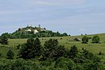
|
6736-302
|
555579384
|
DE6736302
|
2001
|
⊙
|
Landkreis Neumarkt in der Oberpfalz
|
014918,71
|
|
| Uferbereiche des Waginger Sees, Götzinger Achen und untere Sur
|
|
8143-371
|
555522154
|
DE8143371
|
2004
|
⊙
|
Landkreis Berchtesgadener Land
Landkreis Traunstein
|
000183,42
|
|
| Unkenbachaue mit Sulzheimer Gipshügel und Grettstädter Wiesen
|

|
6027-371
|
555521306
|
DE6027371
|
2004
|
⊙
|
Landkreis Schweinfurt
|
000277,66
|
|
| Untere Illerauen
|

|
7726-371
|
555522008
|
DE7726371
|
2004
|
⊙
|
Landkreis Neu-Ulm
|
000829,05
|
|
| Untere Isar zwischen Landau und Plattling
|

|
7243-301
|
555521866
|
DE7243301
|
2000
|
⊙
|
Landkreis Deggendorf
Landkreis Dingolfing-Landau
|
001358,73
|
|
| Unterer Halblech
|
|
8330-303
|
555522235
|
DE8330303
|
2000
|
⊙
|
Landkreis Ostallgäu
|
000130,17
|
|
| Unteres Isartal zwischen Niederviehbach und Landau
|

|
7341-301
|
555521904
|
DE7341301
|
1998
|
⊙
|
Landkreis Dingolfing-Landau
|
000321,59
|
|
| Unteres Vilstal
|

|
7344-301
|
555521906
|
DE7344301
|
2000
|
⊙
|
Landkreis Deggendorf
Landkreis Passau
|
000351,54
|
|
| Unterlauf der Rott von Bayerbach bis zur Mündung
|
|
7545-371
|
555521969
|
DE7545371
|
2004
|
⊙
|
Landkreis Passau
|
000253,75
|
|
| Unterreitnauer Moos und NSG 'Mittelseemoos bei Wasserburg'
|
|
8423-372
|
555522261
|
DE8423372
|
2004
|
⊙
|
Landkreis Lindau
|
000054,14
|
|
| Untersberg
|
|
8343-303
|
555522252
|
DE8343303
|
2000
|
⊙
|
Landkreis Berchtesgadener Land
|
003526,21
|
|
| Urspringer Filz, Premer Filz und Viehweiden
|
|
8330-371
|
555522236
|
DE8330371
|
2004
|
⊙
|
Landkreis Weilheim-Schongau
Landkreis Ostallgäu
|
000538,2
|
|
| US-Truppenübungsplatz Grafenwöhr
|

|
6336-301
|
555579359
|
DE6336301
|
2006
|
⊙
|
Landkreis Amberg-Sulzbach
Landkreis Neustadt an der Waldnaab
|
019266,52
|
|
| Vermoorung südwestlich Falkenstein
|
|
6940-371
|
555521765
|
DE6940371
|
2004
|
⊙
|
Landkreis Cham
|
000009,96
|
|
| Vermoorungen südlich Allersberg und bei Seligenporten
|
|
6733-372
|
555521691
|
DE6733372
|
2004
|
⊙
|
Landkreis Roth
Landkreis Neumarkt in der Oberpfalz
|
000012,23
|
|
| Veste Coburg, Bausenberger und Callenberger Forst
|
|
5731-302
|
555521090
|
DE5731302
|
2000
|
⊙
|
Landkreis Coburg
Coburg
|
000251,3
|
|
| Vils von Vilseck bis zur Mündung in die Naab
|

|
6537-371
|
555521596
|
DE6537371
|
2004
|
⊙
|
Landkreis Amberg-Sulzbach
Amberg
Landkreis Regensburg
Landkreis Schwandorf
|
000638,31
|
|
| Vilsecker Mulde mit den Tälern der Schmalnohe und Wiesenohe
|
|
6337-371
|
555521481
|
DE6337371
|
2004
|
⊙
|
Landkreis Amberg-Sulzbach
|
000949,65
|
|
| Vilshofener Donau-Engtal
|

|
7345-301
|
555521907
|
DE7345301
|
2000
|
⊙
|
Landkreis Passau
|
000111,54
|
|
| Vilstal zwischen Vilsbiburg und Marklkofen
|

|
7440-371
|
555521936
|
DE7440371
|
2004
|
⊙
|
Landkreis Dingolfing-Landau
Landkreis Landshut
|
000837,01
|
|
| Vogelfreistätte Graureiherkolonie Dippach am Main
|
|
6030-302
|
555521313
|
DE6030302
|
2000
|
⊙
|
Landkreis Haßberge
|
000031,69
|
|
| Vorderer Steigerwald mit Schwanberg
|

|
6327-371
|
555521463
|
DE6327371
|
2004
|
⊙
|
Landkreis Neustadt a. d. Aisch-Bad Windsheim
Landkreis Kitzingen
|
008365,58
|
|
| Vorkommen von Wiesenknopf-Ameisenbläulingen im Lkr. Aschaffenburg
|
|
5921-301
|
555521227
|
DE5921301
|
2000
|
⊙
|
Landkreis Aschaffenburg
|
000014,64
|
|
| Wälder im Donautal
|

|
7040-302
|
555579395
|
DE7040302
|
2000
|
⊙
|
Landkreis Regensburg
Landkreis Straubing-Bogen
|
001285,22
|
|
| Wälder im Oberpfälzer Jura
|

|
6535-371
|
555521595
|
DE6535371
|
2004
|
⊙
|
Landkreis Nürnberger Land
Landkreis Neumarkt in der Oberpfalz
Landkreis Amberg-Sulzbach
|
000801,25
|
|
| Wälder südwestlich Betzenstein
|
|
6334-371
|
555521474
|
DE6334371
|
2004
|
⊙
|
Landkreis Bayreuth
|
000061,8
|
|
| Wälder um Maroldsweisach, Königsberg u. Rentweinsdorf mit Schloss
|
|
5930-373
|
555521242
|
DE5930373
|
2004
|
⊙
|
Landkreis Haßberge
|
001383,76
|
|
| Wälder und Trockengebiete östlich Hammelburg
|
|
5825-371
|
555521163
|
DE5825371
|
2004
|
⊙
|
Landkreis Bad Kissingen
|
001332,22
|
|
| Wälder und Trockenstandorte bei Bad Kissingen und Münnerstadt
|

|
5726-371
|
555521080
|
DE5726371
|
2004
|
⊙
|
Landkreis Bad Kissingen
Landkreis Rhön-Grabfeld
|
004423,75
|
|
| Wälder zwischen Willanzheim, Mainbernheim und Tiefenstockheim
|
|
6327-372
|
555521464
|
DE6327372
|
2004
|
⊙
|
Landkreis Kitzingen
|
000301,42
|
|
| Waldgebiet Untere Mark
|
|
6231-371
|
555521416
|
DE6231371
|
2004
|
⊙
|
Landkreis Forchheim
|
000826,2
|
|
| Waldgebiete Buchrangen und Spendweg
|
|
5932-372
|
555521248
|
DE5932372
|
2004
|
⊙
|
Landkreis Lichtenfels
|
000666,86
|
|
| Waldnaabtal zwischen Tirschenreuth und Windisch-Eschenbach
|

|
6139-371
|
555521384
|
DE6139371
|
2004
|
⊙
|
Landkreis Neustadt an der Waldnaab
Landkreis Tirschenreuth
|
002622,71
|
|
| Waldweihergebiet im Postloher Forst
|
|
6740-302
|
555521699
|
DE6740302
|
2000
|
⊙
|
Landkreis Cham
Landkreis Schwandorf
|
000421,01
|
|
| Waldwiesen und Moore im Neuwirtshauser Forst
|
|
5725-301
|
555521078
|
DE5725301
|
2000
|
⊙
|
Landkreis Bad Kissingen
|
000184,64
|
|
| Wässernachtal
|
|
5928-371
|
555521235
|
DE5928371
|
2004
|
⊙
|
Landkreis Schweinfurt
Landkreis Haßberge
|
000750,66
|
|
| Wasserwerk Erlenstegen
|
|
6532-371
|
555521591
|
DE6532371
|
2004
|
⊙
|
Nürnberg
|
000211,87
|
|
| Wattersdorfer Moor
|
|
8137-301
|
555522145
|
DE8137301
|
2000
|
⊙
|
Landkreis Miesbach
|
000327,94
|
|
| Weiher bei Wiesenfelden
|
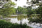
|
6941-301
|
555521766
|
DE6941301
|
2000
|
⊙
|
Landkreis Straubing-Bogen
|
000051,68
|
|
| Weiherkette nördlich Weinzierlein
|

|
6531-371
|
555521590
|
DE6531371
|
2004
|
⊙
|
Landkreis Fürth
|
000005,04
|
|
| Weihermoos Holzleuten
|
|
8329-302
|
555522230
|
DE8329302
|
2000
|
⊙
|
Landkreis Ostallgäu
|
000141,03
|
|
| Weisach-Aue und Nebenbäche um Maroldsweisach
|

|
5830-371
|
555521168
|
DE5830371
|
2004
|
⊙
|
Landkreis Haßberge
|
000110,5
|
|
| Weiße, Wissinger, Breitenbrunner Laaber u. Kreuzberg bei Dietfurt
|

|
6935-371
|
555521759
|
DE6935371
|
2004
|
⊙
|
Landkreis Neumarkt in der Oberpfalz
|
002296,51
|
|
| Wellucker Wald nördlich Königstein
|
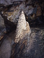
|
6335-302
|
555521475
|
DE6335302
|
2000
|
⊙
|
Landkreis Nürnberger Land
Landkreis Amberg-Sulzbach
|
000916,95
|
|
| 'Weltenburger Enge' und 'Hirschberg und Altmühlleiten'
|

|
7136-301
|
555521823
|
DE7136301
|
1998
|
⊙
|
Landkreis Kelheim
|
000934,1
|
|
| Wemdinger Ried
|

|
7130-301
|
555521813
|
DE7130301
|
2000
|
⊙
|
Landkreis Donau-Ries
|
000127,14
|
|
| Werdensteiner Moos
|

|
8327-303
|
555522227
|
DE8327303
|
2000
|
⊙
|
Landkreis Oberallgäu
|
000134,62
|
|
| Wertachdurchbruch
|
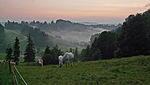
|
8329-301
|
555579400
|
DE8329301
|
2001
|
⊙
|
Landkreis Ostallgäu
Landkreis Oberallgäu
|
000858,94
|
|
| Westerholz
|

|
7831-301
|
555522040
|
DE7831301
|
2000
|
⊙
|
Landkreis Landsberg am Lech
|
000039,72
|
|
| Westerried nördlich Wertingen
|
|
7329-371
|
555521896
|
DE7329371
|
2004
|
⊙
|
Landkreis Dillingen a. d. Donau
|
000033,68
|
|
| Westliche Günz und Hundsmoor
|

|
8027-371
|
555522091
|
DE8027371
|
2004
|
⊙
|
Landkreis Unterallgäu
|
000166,46
|
|
| Wettersteingebirge
|

|
8532-371
|
555522289
|
DE8532371
|
2004
|
⊙
|
Landkreis Garmisch-Partenkirchen
|
004256,15
|
|
| Wiedergeltinger Wäldchen
|

|
7930-301
|
555522067
|
DE7930301
|
2000
|
⊙
|
Landkreis Unterallgäu
|
000027,1
|
|
| Wiesen östlich und westlich Unterlauter b. Coburg
|
|
5631-373
|
555521025
|
DE5631373
|
2004
|
⊙
|
Landkreis Coburg
|
000072,44
|
|
| Wiesen um die Altenburg bei Bamberg
|
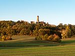
|
6131-372
|
555521374
|
DE6131372
|
2004
|
⊙
|
Bamberg
|
000056,79
|
|
| Wiesen und Magerrasen zwischen Hösbach und Rottenberg
|
|
5921-371
|
555521228
|
DE5921371
|
2004
|
⊙
|
Landkreis Aschaffenburg
|
000274,03
|
|
| Wiesen und Sandgrube bei Gaßenhof
|
|
6436-371
|
555521549
|
DE6436371
|
2004
|
⊙
|
Landkreis Amberg-Sulzbach
|
000024,67
|
|
| Wiesen und Triften um Rohrmünz, Grafling und Frath
|
|
7144-371
|
555521833
|
DE7144371
|
2004
|
⊙
|
Landkreis Deggendorf
Landkreis Regen
|
000101,85
|
|
| Wiesengebiete u. Wälder um den Brotjackelriegel und um Schöllnach
|

|
7145-371
|
555521836
|
DE7145371
|
2004
|
⊙
|
Landkreis Deggendorf
Landkreis Freyung-Grafenau
|
000416,17
|
|
| Wiesent-Tal mit Seitentälern
|
|
6233-371
|
555521422
|
DE6233371
|
2004
|
⊙
|
Landkreis Bamberg
Landkreis Forchheim
Landkreis Bayreuth
Landkreis Kulmbach
|
006877,22
|
|
| Wildflusssystem Bolgenach
|
|
8526-301
|
555522284
|
DE8526301
|
2000
|
⊙
|
Landkreis Oberallgäu
|
000163,81
|
|
| Windach
|

|
7932-371
|
555522068
|
DE7932371
|
2004
|
⊙
|
Landkreis Landsberg am Lech
|
000310,8
|
|
| Winterquartier der Mopsfledermaus in Burg Stein
|

|
8041-301
|
555522112
|
DE8041301
|
2000
|
⊙
|
Landkreis Traunstein
|
000000,01
|
|
| Winterquartiere der Mopsfledermaus bei Karlstadt
|
|
6024-301
|
555521303
|
DE6024301
|
2000
|
⊙
|
Landkreis Main-Spessart
|
000000,02
|
|
| Winterquartiere der Mopsfledermaus bei Neustadt
|
|
5627-304
|
555521012
|
DE5627304
|
2000
|
⊙
|
Landkreis Rhön-Grabfeld
|
000000,02
|
|
| Winterquartiere der Mopsfledermaus im Oberpfälzer Wald
|
|
6843-301
|
555521736
|
DE6843301
|
2000
|
⊙
|
Landkreis Cham
|
000000,01
|
|
| Winterquartiere der Mopsfledermaus im Spessart
|
|
5923-302
|
555521231
|
DE5923302
|
2000
|
⊙
|
Landkreis Main-Spessart
|
000006,68
|
|
| Winterquartiere der Mopsfledermaus in der Rhön
|
|
5527-301
|
555520899
|
DE5527301
|
2000
|
⊙
|
Landkreis Rhön-Grabfeld
|
000000,02
|
|
| Wittislinger Ried
|

|
7328-305
|
555521893
|
DE7328305
|
2000
|
⊙
|
Landkreis Dillingen a. d. Donau
|
000089,48
|
|
| Wochenstuben der Wimperfledermaus im Chiemgau
|

|
7841-371
|
555522046
|
DE7841371
|
2004
|
⊙
|
Landkreis Altötting
Landkreis Rosenheim
Landkreis Traunstein
|
000000,07
|
|
| Woja- und Haidleite
|

|
5737-371
|
555521104
|
DE5737371
|
2004
|
⊙
|
Landkreis Hof
|
000042,55
|
|
| Wolfertsrieder Bach
|
|
7043-372
|
555521799
|
DE7043372
|
2004
|
⊙
|
Landkreis Regen
|
000062,88
|
|
| Wondreb zwischen Leonberg und Waldsassen
|
|
6039-371
|
555521330
|
DE6039371
|
2004
|
⊙
|
Landkreis Tirschenreuth
|
000096,19
|
|
| Wondrebaue und angrenzende Teichgebiete
|
|
6040-371
|
555521332
|
DE6040371
|
2004
|
⊙
|
Landkreis Tirschenreuth
|
000237,35
|
|
| Wörnitztal
|

|
7029-371
|
555521786
|
DE7029371
|
2004
|
⊙
|
Landkreis Ansbach
Landkreis Donau-Ries
|
003847,41
|
|
| Zeitelmoos bei Wunsiedel
|
|
5937-301
|
555521259
|
DE5937301
|
1998
|
⊙
|
Landkreis Wunsiedel i. Fichtelgebirge
|
000400,54
|
|
| Zellinger Gemeindewald
|
|
6124-373
|
555521368
|
DE6124373
|
2004
|
⊙
|
Landkreis Würzburg
Landkreis Main-Spessart
|
000842,13
|
|
| Zenn von Stöckach bis zur Mündung
|
|
6530-371
|
555521588
|
DE6530371
|
2004
|
⊙
|
Fürth
Landkreis Fürth
Landkreis Neustadt a. d. Aisch-Bad Windsheim
|
000604,52
|
|
| Zeyerner Grund
|
|
5734-303
|
555521101
|
DE5734303
|
2000
|
⊙
|
Landkreis Kronach
|
000201,78
|
|
| Zusamtal von Ziemetshausen bis Schönebach
|
|
7629-371
|
555521983
|
DE7629371
|
2004
|
⊙
|
Landkreis Augsburg
Landkreis Günzburg
|
000344,6
|
|
| Zwischenmoore nördlich Creußen
|
|
6135-302
|
555521379
|
DE6135302
|
2000
|
⊙
|
Landkreis Bayreuth
|
000004,6
|
|


