Liste der Naturschutzgebiete in Brandenburg
Diese sortierbare Liste enthält 477 Naturschutzgebiete in Brandenburg (Stand: März 2017).
Gesamtliste
| Name | Bild | Kennung | WDPA | Kreis / Stadt | Anmerkungen | Standort | Hektar | seit |
|---|---|---|---|---|---|---|---|---|
| Alte Elster und Rieke | 1340 | 14432 | Landkreis Elbe-Elster | Position | 175,64 | 26.03.1981, 01.07.2007 | ||
| Alte Röder bei Prieschka |  | 1373 | 162094 | Landkreis Elbe-Elster | Position | 78,65 | 26.03.1981, 01.07.2007 | |
| Alte Spreemündung | 1249 | 14414 | Landkreis Oder-Spree | Position | 108,06 | 16.05.1990 | ||
| Alteno-Radden | 1302 | 318096 | Landkreis Dahme-Spreewald, Landkreis Oberspreewald-Lausitz | Position | 33,43 | 29.03.2003 | ||
| Arnimswalde | 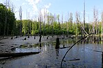 | 1045 | 64663 | Landkreis Uckermark | Position | 1406,88 | 01.10.1990 | |
| Ausstichgelände Röntgental | 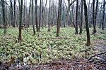 | 1108 | 162301 | Landkreis Barnim | Position | 24,84 | 16.05.1990 | |
| Bagower Bruch |  | 1516 | 162328 | Landkreis Potsdam-Mittelmark | Position | 98,49 | 13.02.1998 | |
| Bäketal | 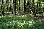 | 1139 | 162332 | Landkreis Potsdam-Mittelmark | Position | 12,66 | 10.10.1995 | |
| Bärenbusch | 1395 | 318163 | Landkreis Ostprignitz-Ruppin | Position | 375,01 | 30.10.2001 | ||
| Bärluch | 1584 | 318165 | Landkreis Teltow-Fläming | Position | 160,33 | 30.09.2000 | ||
| Barssee | 1579 | 318684 | Landkreis Teltow-Fläming | Position | 13,8 | 10.12.2002 | ||
| Beerenbusch |  | 1178 | 162357 | Landkreis Oder-Spree | Position | 66,98 | 19.10.1967 | |
| Beesenberg | 1595 | 329272 | Landkreis Uckermark | Position | 87,07 | 09.10.2004 | ||
| Belziger Landschaftswiesen |  | 1137 | 344575 | Landkreis Potsdam-Mittelmark | Position | 4427,92 | 15.06.2005 | |
| Bergbaufolgelandschaft Grünhaus |  | 1596 | 378057 | Landkreis Elbe-Elster, Landkreis Oberspreewald-Lausitz | Position | 1780,78 | 28.11.2006 | |
| Bergen-Weißacker Moor |  | 1319 | 318185 | Landkreis Dahme-Spreewald | Position | 115,47 | 26.03.1981, 01.07.2007 | |
| Bergsoll | 1627 | 555546324 | Landkreis Prignitz | Position | 8,47 | 13.01.2011 | ||
| Biebersdorfer Wiesen | 1272 | 318194 | Landkreis Dahme-Spreewald | Position | 16,5 | 01.10.1990 | ||
| Biesdorfer Kehlen |  | 1094 | 162410 | Landkreis Märkisch-Oderland | Position | 64,79 | 16.05.1990 | |
| Biesenthaler Becken |  | 1089 | 162411 | Landkreis Barnim | Position | 957,81 | 11.11.1999 | |
| Binnendüne Waltersberge |  | 1203 | 162421 | Landkreis Oder-Spree | Position | 13,66 | 16.05.1990 | |
| Biotopverbund Spreeaue |  | 1304 | 318200 | Stadt Cottbus, Landkreis Spree-Neiße | Position | 633,9 | 25.06.2003 | |
| Biotopverbund Welsengraben |  | 1169 | 329287 | Landkreis Oberhavel | Position | 289,14 | 16.06.2004 | |
| Birkenwald | 1293 | 162432 | Landkreis Dahme-Spreewald | Position | 64,97 | 01.10.1990 | ||
| Blumberger Wald | 1015 | 162464 | Landkreis Uckermark | Position | 310,07 | 16.05.1990 | ||
| Blumenthal | 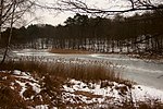 | 1102 | 162467 | Landkreis Märkisch-Oderland | Position | 135,29 | 01.05.1984 | |
| Boitzenburger Tiergarten und Strom |  | Verordnung über das Naturschutzgebiet „Boitzenburger Tiergarten und Strom“ vom 18. Oktober 2017 | 555690839 | Landkreis Uckermark | Position | 1215 | 18.10.2017 | |
| Bollwiesen/Großer Gollinsee | 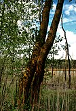 | 1057 | 162490 | Landkreis Uckermark | Position | 907,47 | 01.10.1990 | |
| Booßener Teichgebiet | 1602 | 389578 | Landkreis Märkisch-Oderland, Stadt Frankfurt (Oder) | Position | 103,92 | 21.03.2000 | ||
| Borcheltsbusch und Brandkieten | 1307 | 14429 | Landkreis Dahme-Spreewald | Position | 141,74 | 26.03.1981 | ||
| Börnichen | 1271 | 162506 | Landkreis Dahme-Spreewald | Position | 21,59 | 01.10.1990 | ||
| Brasinski-Luch | 1234 | 162537 | Landkreis Dahme-Spreewald | Position | 12,41 | 01.10.1990 | ||
| Bredower Forst |  | 1126 | 14398 | Landkreis Havelland | Position | 250,87 | 26.06.1978 | |
| Breitefenn |  | 1072 | 9339 | Landkreis Barnim | Position | 28,99 | 01.10.1990 | |
| Breitenteichische Mühle | 1049 | 162553 | Landkreis Uckermark | Position | 147,9 | 01.10.1990 | ||
| Briesener Luch | 1277 | 162562 | Landkreis Dahme-Spreewald | Position | 46,55 | 24.06.1992 | ||
| Briesensee und Klingeberg |  | 1245 | 318240 | Landkreis Dahme-Spreewald | Position | 79,19 | 01.07.2002 | |
| Bruchwald Roßdunk | 1182 | 162584 | Stadt Brandenburg an der Havel | Position | 96,54 | 27.02.1996 | ||
| Brüsenwalde | 1590 | 389580 | Landkreis Uckermark | Position | 1979,65 | 06.11.2009 | ||
| Buchheide (1) |  | 1035 | 162617 | Landkreis Ostprignitz-Ruppin | Position | 37,58 | 01.05.1961 | |
| Buchheide (2) | 1050 | 162616 | Landkreis Uckermark | Position | 566,38 | 01.10.1990 | ||
| Buchwald | 1355 | 162622 | Landkreis Elbe-Elster | Position | 36,13 | 26.03.1981 | ||
| Buckower See und Luch | 1221 | 318261 | Landkreis Havelland | Position | 152,79 | 08.07.1998 | ||
| Buckowseerinne |  | 1450 | 329312 | Landkreis Barnim | Position | 507,15 | 16.06.2004 | |
| Bückwitzer See und Rohrlacker Graben | 1396 | 318262 | Landkreis Ostprignitz-Ruppin | Position | 157,27 | 30.10.2001 | ||
| Buhnenwerder-Wusterau |  | 1478 | 318263 | Stadt Brandenburg an der Havel | Position | 191,86 | 12.03.2003 | |
| Bukoitza |  | 1291 | 162635 | Landkreis Dahme-Spreewald | Position | 14,54 | 01.10.1990 | |
| Bullenberger Bach/Klein Briesener Bach |  | 1586 | 318265 | Landkreis Potsdam-Mittelmark | Position | 296,74 | 24.05.2003 | |
| Buschschleuse | 1556 | 318273 | Landkreis Oder-Spree | Position | 1239,62 | 11.11.1999 | ||
| Byhleguhrer See |  | 1289 | 162669 | Landkreis Dahme-Spreewald | Position | 853,45 | 01.10.1990 | |
| Calauer Schweiz | 1487 | 162670 | Landkreis Oberspreewald-Lausitz | Position | 1406,54 | 16.01.1997 | ||
| Calpenzmoor | 1287 | 329317 | Landkreis Spree-Neiße | Position | 134,25 | 25.06.2004 | ||
| Charlottenhöhe |  | 1003 | 162675 | Landkreis Uckermark | Position | 235,1 | 03.06.2003 | |
| Dahmetal bei Briesen | 1257 | 389581 | Landkreis Dahme-Spreewald | Position | 423,45 | 31.07.2008 | ||
| Damerower Wald | 1467 | 162697 | Landkreis Uckermark | Position | 37,87 | 30.06.1992 | ||
| Damerower Wald, Schlepkower Wald und Jagenbruch | 1612 | 555560664 | Landkreis Uckermark | Position | 671,3 | 20.06.2013 | ||
| Dammer Moor | 1263 | 162699 | Landkreis Dahme-Spreewald | Position | 171,04 | 16.05.1990 | ||
| Dammühlenfließniederung | 1452 | 318279 | Landkreis Dahme-Spreewald, Landkreis Oder-Spree | Position | 79,13 | 29.10.1998 | ||
| Der Loben |  | 1369 | 14427 | Landkreis Elbe-Elster, Landkreis Oberspreewald-Lausitz | Position | 702,45 | 26.03.1981, 01.07.2007 | |
| Der Weinberg bei Perleberg | 1379 | 318287 | Landkreis Prignitz | Position | 7,28 | 11.03.1971 | ||
| Döberitzer Heide |  | 1401 | 162766 | Landkreis Havelland, Stadt Potsdam | Position | 3414,53 | 17.12.1997 | |
| Dolgensee |  | 1207 | 162769 | Landkreis Dahme-Spreewald | Position | 308,45 | 28.06.1995, 26.08.2011 | |
| Dolgensee-Ragollinsee | 1636 | 555552560 | Landkreis Uckermark | Position | 432,08 | 12.05.2012 | ||
| Dollgener Grund |  | 1270 | 162774 | Landkreis Dahme-Spreewald | Position | 71,61 | 24.06.1992 | |
| Dömnitz | [1] | Landkreis Prignitz | Position | 160 | 26.03.2018 | |||
| Drehnaer Weinberg und Stiebsdorfer See |  | 1594 | 329334 | Landkreis Elbe-Elster, Landkreis Dahme-Spreewald | Position | 154,47 | 11.09.2004 | |
| Dubrow |  | 1218 | 14400 | Landkreis Dahme-Spreewald | Position | 212,52 | 01.05.1961 | |
| Dürrenhofer Moor | 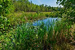 | 1625 | 555552558 | Landkreis Dahme-Spreewald | Position | 14,03 | 23.06.2012 | |
| Eh. Blankenfelder See | 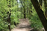 | 1191 | 162861 | Landkreis Teltow-Fläming | Position | 47,58 | 17.03.1986 | |
| Eichwald und Buschmühle |  | 1187 | 162893 | Stadt Frankfurt (Oder) | Position | 234,44 | 16.05.1990 | |
| Eiskellerberge - Os bei Malchow | 1597 | 329344 | Landkreis Uckermark | Position | 5,16 | 25.06.2004 | ||
| Eldeichhinterland | 1388 | 162909 | Landkreis Prignitz | Position | 815,63 | 16.05.1990 | ||
| Elbdeichvorland | 1383 | 162910 | Landkreis Prignitz | Position | 687,29 | 16.05.1990 | ||
| Ellerborn | 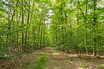 | 1295 | 162923 | Landkreis Dahme-Spreewald | Position | 57,49 | 01.10.1990 | |
| Endmoränenlandschaft bei Ringenwalde |  | 1052 | 14378 | Landkreis Uckermark | Position | 568,85 | 01.10.1990 | |
| Erikasee bei Großkoschen |  | 1571 | 318357 | Landkreis Oberspreewald-Lausitz | Position | 80,67 | 27.09.2003 | |
| Erpetal |  | 1531 | 318372 | Landkreis Märkisch-Oderland | Position | 183,61 | 26.06.2003 | |
| Espenluch und Stülper See | 1475 | 329360 | Landkreis Teltow-Fläming | Position | 72,8 | 16.06.2004 | ||
| Eulenberge |  | 1027 | 64677 | Landkreis Uckermark | Position | 1988,14 | 01.10.1990 | |
| Euloer Bruch | 1317 | 163009 | Landkreis Spree-Neiße | Position | 79,85 | 26.03.1981 | ||
| Falkenrehder Wublitz | 1504 | 318381 | Landkreis Havelland | Position | 97,62 | 05.06.2002 | ||
| Faltenbogen südlich Döbern | 1351 | 163025 | Landkreis Spree-Neiße | Position | 93,32 | 02.10.1992 | ||
| Fasanerie Bohsdorf | 1345 | 163026 | Landkreis Spree-Neiße | Position | 19,46 | 01.10.1992 | ||
| Faule Wiesen bei Bernau |  | 1553 | 318384 | Landkreis Barnim | Position | 37,93 | 01.06.2000 | |
| Fauler See | 1578 | 318167 | Landkreis Teltow-Fläming | Position | 14,72 | 10.12.2002 | ||
| Fauler See/Markendorfer Wald |  | 1526 | 318386 | Stadt Frankfurt (Oder) | Position | 171,09 | 04.04.2003 | |
| Felchowseegebiet |  | 1055 | 14407 | Landkreis Uckermark | Position | 970,99 | 03.06.2003 | |
| Ferbitzer Bruch |  | 1141 | 163045 | Landkreis Havelland, Stadt Potsdam | Position | 1156,36 | 12.10.1996 | |
| Fettseemoor | 1074 | 163049 | Landkreis Barnim | Position | 14,68 | 01.10.1990 | ||
| Feuchtgebiet Schönberg-Blankenberg | 1394 | 318392 | Landkreis Ostprignitz-Ruppin | Position | 215,77 | 30.10.2001 | ||
| Feuchtwiesen Atterwasch | 1279 | 329372 | Landkreis Spree-Neiße | Position | 192,96 | 09.10.2004 | ||
| Finowtal-Pregnitzfließ |  | 1601 | 378079 | Landkreis Barnim | Position | 1804,56 | 30.12.2006 | |
| Fischteiche Blumberger Mühle |  | 1058 | 163108 | Landkreis Uckermark | Position | 320,31 | 01.10.1990 | |
| Flämingbuchen | 1261 | 163111 | Landkreis Potsdam-Mittelmark | Position | 60,47 | 19.10.1972 | ||
| Fledermausquartier Brauereikeller Frankfurt (Oder) |  | 1583 | 378081 | Stadt Frankfurt (Oder) | Position | 1,34 | 26.01.2006 | |
| Flutgrabenaue Waltersdorf |  | 1180 | 318405 | Landkreis Dahme-Spreewald | Position | 287,98 | 03.04.1998 | |
| Forst Zinna-Jüterbog-Keilberg |  | 1536 | 318408 | Landkreis Potsdam-Mittelmark, Landkreis Teltow-Fläming | Position | 7193,18 | 30.12.1999 | |
| Forsthaus Prösa |  | 1368 | 163133 | Landkreis Elbe-Elster | Position | 3788,79 | 21.05.1996 | |
| Fredersdorfer Mühlenfließ, Langes Luch und Breites Luch |  | 1530 | 344585 | Landkreis Märkisch-Oderland | Position | 840,43 | 16.11.2004 | |
| Friedersdorfer Tiergarten | 1335 | 163151 | Landkreis Elbe-Elster | Position | 13,84 | 26.03.1981 | ||
| Friedländer Tal |  | 1457 | 318415 | Landkreis Oder-Spree | Position | 104,02 | 29.05.1998 | |
| Friesacker Zootzen | 1085 | 163154 | Landkreis Havelland, Landkreis Ostprignitz-Ruppin | Position | 29,25 | 01.05.1961 | ||
| Fuchsberg |  | 1465 | 163163 | Stadt Cottbus | Position | 4,59 | 25.11.1992 | |
| Gadow | 1421 | 163180 | Landkreis Prignitz | Position | 422,18 | 16.05.1990 | ||
| Gadsdorfer Torfstiche und Luderbusch |  | 1576 | 389594 | Landkreis Teltow-Fläming | Position | 136,96 | 30.09.2009 | |
| Gahroer Buchheide | 1325 | 14434 | Landkreis Elbe-Elster | Position | 106,78 | 26.03.1981 | ||
| Gandower Schweineweide | 1426 | 318423 | Landkreis Prignitz | Position | 79,4 | 28.02.2003 | ||
| Gartzsee |  | 1129 | 163200 | Landkreis Märkisch-Oderland | Position | 35,19 | 01.10.1990 | |
| Geesower Hügel | 1013 | 163208 | Landkreis Uckermark | Position | 39,05 | 01.05.1984 | ||
| Gehron-See |  | 1166 | 318428 | Landkreis Oberhavel | Position | 213,43 | 29.01.2003 | |
| Glashütte | 1587 | 318441 | Landkreis Teltow-Fläming | Position | 1357,98 | 29.07.2003 | ||
| Glasowbachniederung |  | 1582 | 378086 | Landkreis Teltow-Fläming | Position | 90,31 | 30.09.2009 | |
| Glieningmoor |  | 1183 | 163262 | Landkreis Oder-Spree | Position | 150,71 | 16.05.1990 | |
| Glindower Alpen |  | 1163 | 163263 | Landkreis Potsdam-Mittelmark | Position | 106,75 | 10.10.1995 | |
| Glinziger Teich- und Wiesengebiet | 1455 | 555552557 | Landkreis Spree-Neiße | Position | 287,92 | 27.11.2012 | ||
| Gohrische Heide | 1523 | 318446 | Landkreis Elbe-Elster | Position | 232,89 | 29.07.2003 | ||
| Gollenberg | 1093 | 163280 | Landkreis Havelland | Position | 58,13 | 27.02.1996 | ||
| Görlsdorfer Wald |  | 1438 | 318450 | Landkreis Dahme-Spreewald | Position | 195,2 | 01.07.2002 | |
| Görner See | 1100 | 163288 | Landkreis Havelland | Position | 228,24 | 12.10.1996 | ||
| Gränert | 1406 | 318457 | Stadt Brandenburg an der Havel | Position | 467,28 | 20.02.1998 | ||
| Gräninger See | 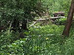 | 1123 | 14397 | Landkreis Havelland | Position | 137,71 | 19.10.1967 | |
| Groß Schauener Seenkette | 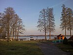 | 1437 | 318463 | Landkreis Oder-Spree | Position | 1904,36 | 27.04.2000 | |
| Große Freiheit bei Plaue | 1477 | 318464 | Stadt Brandenburg an der Havel | Position | 78,22 | 28.02.2003 | ||
| Große Göhlenze und Fichtengrund | 1264 | 14417 | Landkreis Oder-Spree | Position | 267,8 | 16.05.1990 | ||
| Große Hölle bei Luckow-Petershagen | 1494 | 163342 | Landkreis Uckermark | Position | 18,79 | 01.02.1997 | ||
| Große und Kleine Jahnberge | 1097 | 163347 | Landkreis Havelland | Position | 20,44 | 19.10.1967 | ||
| Großer Briesensee | 1042 | 163350 | Landkreis Uckermark | Position | 113,61 | 01.10.1990 | ||
| Großer Lubowsee | 1067 | 163356 | Landkreis Barnim | Position | 46,69 | 01.10.1990 | ||
| Großer Plötzsee | 1054 | 163357 | Landkreis Uckermark | Position | 46,16 | 01.10.1990 | ||
| Großer und Kleiner Möggelinsee |  | 1233 | 318471 | Landkreis Teltow-Fläming | Position | 333,38 | 15.02.2000 | |
| Großer und Westufer Kleiner Zeschsee |  | 1248 | 318472 | Landkreis Teltow-Fläming | Position | 106,1 | 29.01.2000 | |
| Großes Fenn | 1131 | 163370 | Landkreis Havelland | Position | 83,72 | 10.10.1995 | ||
| Großes Fürstenwalder Stadtluch |  | 1181 | 163371 | Landkreis Oder-Spree | Position | 88,02 | 16.05.1990 | |
| Groß-Machnower Weinberg |  | 1204 | 318473 | Landkreis Teltow-Fläming | Position | 8,53 | 13.06.1936 | |
| Grumsiner Forst/Redernswalde |  | 1056 | 163396 | Landkreis Barnim, Landkreis Uckermark | Position | 6157,89 | 01.10.1990 | |
| Grünauer Fenn | 1128 | 163398 | Landkreis Havelland | Position | 10,56 | 10.10.1995 | ||
| Gülitzer Kohlegruben | 1599 | 378092 | Landkreis Prignitz | Position | 105,48 | 27.06.2006 | ||
| Gülper See |  | 1091 | 14395 | Landkreis Havelland | Position | 1205,25 | 01.07.2010, 01.10.2010 | |
| Gumnitz und Großer Schlagenthinsee | 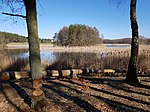 | 1135 | 163411 | Landkreis Märkisch-Oderland | Position | 231,59 | 01.10.1990 | |
| Gusower Niederheide | 1605 | 389598 | Landkreis Märkisch-Oderland | Position | 76,75 | 29.03.2008 | ||
| Hain Lübben | 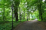 | 1284 | 163483 | Landkreis Dahme-Spreewald | Position | 18,26 | 01.10.1990 | |
| Hainholz an der Stepenitz | 1007 | 163487 | Landkreis Prignitz | Position | 0,1 | 06.03.1993 | ||
| Harenzacken | 1524 | 318504 | Landkreis Oberhavel | Position | 822,4 | 27.08.2003 | ||
| Häsener Luch | 1069 | 163543 | Landkreis Oberhavel | Position | 51,65 | 19.10.1967 | ||
| Havelländisches Luch |  | 1124 | 329418 | Landkreis Havelland, Landkreis Potsdam-Mittelmark | Position | 5529,95 | 01.07.2004 | |
| Heidehof - Golmberg |  | 1570 | 318516 | Landkreis Teltow-Fläming | Position | 9833,59 | 30.12.1999 | |
| Heidekrug | 1103 | 318518 | Landkreis Märkisch-Oderland | Position | 31,45 | 01.05.1961 | ||
| Heideseen |  | 1252 | 163592 | Landkreis Dahme-Spreewald | Position | 238,64 | 01.10.1990 | |
| Heideweiher | 1066 | 163594 | Landkreis Prignitz | Position | 61,85 | 01.06.1972 | ||
| Herrensee, Lange-Damm-Wiesen und Barnim-Hänge | 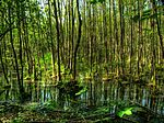 | 1528 | 389601 | Landkreis Märkisch-Oderland | Position | 1081,88 | 01.10.2005 | |
| Himmelreich-See | 1036 | 163680 | Landkreis Ostprignitz-Ruppin | Position | 7,14 | 19.10.1967 | ||
| Hintenteiche bei Biesenbrow | 1039 | 163685 | Landkreis Uckermark | Position | 102,62 | 01.10.1990 | ||
| Hispe | 1332 | 163702 | Landkreis Spree-Neiße | Position | 14,53 | 10.10.1995 | ||
| Hohe Warte | 1349 | 163739 | Landkreis Elbe-Elster | Position | 89,1 | 26.03.1981 | ||
| Hohenleipisch | 1608 | 344588 | Landkreis Elbe-Elster | Position | 166,48 | 09.12.2005 | ||
| Hölle | 1316 | 163761 | Landkreis Elbe-Elster | Position | 10,3 | 26.03.1981 | ||
| Höllengrund – Pulverberg |  | 1188 | 163767 | Landkreis Dahme-Spreewald | Position | 15,15 | 28.06.1995 | |
| Horstfelder und Hechtsee |  | 1215 | 14405 | Landkreis Teltow-Fläming | Position | 248,27 | 17.03.1986 | |
| Hutelandschaft Altranft-Sonnenburg | 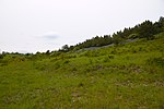 | 1162 | 318581 | Landkreis Märkisch-Oderland | Position | 561,08 | 31.07.2001 | |
| Hutung Sähle | 1545 | 318583 | Landkreis Uckermark | Position | 43,52 | 24.05.2003 | ||
| Innerer Oberspreewald | 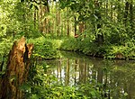 | 1288 | 102244 | Landkreis Dahme-Spreewald, Landkreis Oberspreewald-Lausitz, Landkreis Spree-Neiße | Position | 5744,8 | 01.10.1990 | |
| Innerer Unterspreewald | 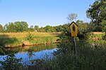 | 1254 | 64688 | Landkreis Dahme-Spreewald | Position | 2231,33 | 01.10.1990 | |
| Insel im Senftenberger See |  | 1370 | 14428 | Landkreis Oberspreewald-Lausitz | Position | 889,9 | 26.03.1981 | |
| Jackel | 1546 | 318609 | Landkreis Prignitz | Position | 348,33 | 27.07.2002 | ||
| Jägersberg-Schirknitzberg |  | 1552 | 318610 | Landkreis Teltow-Fläming | Position | 1599,73 | 11.11.1999 | |
| Jakobsdorfer Feuchtland | 1628 | 555546325 | Landkreis Prignitz | Position | 137,05 | 15.01.2011 | ||
| Josinsky-Luch | 1235 | 163955 | Landkreis Dahme-Spreewald | Position | 172,1 | 01.10.1990 | ||
| Jungfernheide |  | 1591 | 389610 | Landkreis Uckermark | Position | 1732,12 | 06.11.2009 | |
| Kanalwiesen Wendisch Rietz | 1441 | 318629 | Landkreis Oder-Spree | Position | 106,63 | 18.03.2003 | ||
| Kanonen- und Schloßberg, Schäfergrund | 1079 | 164017 | Landkreis Barnim, Landkreis Märkisch-Oderland | Position | 90,49 | 01.10.1990 | ||
| Karauschsee | 1212 | 164024 | Landkreis Oder-Spree | Position | 35,63 | 10.10.1981 | ||
| Kastavenseen-Molkenkammersee | 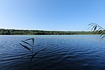 | 1621 | 389611 | Landkreis Oberhavel, Landkreis Uckermark | Position | 268,27 | 14.10.2009 | |
| Katzenberge | 1547 | 329481 | Landkreis Dahme-Spreewald | Position | 141,23 | 25.06.2004 | ||
| Kersdorfer See |  | 1613 | 389612 | Landkreis Oder-Spree | Position | 199,06 | 28.08.2009 | |
| Ketziner Havelinseln | 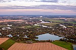 | 1154 | 318646 | Landkreis Havelland, Landkreis Potsdam-Mittelmark | Position | 237,55 | 12.03.2003 | |
| Kiecker | 1000 | 318647 | Landkreis Uckermark | Position | 260,77 | 30.06.1992 | ||
| Kienhorst /Köllnseen/ Eichheide |  | 1064 | 64690 | Landkreis Barnim | Position | 5005,07 | 01.10.1990 | |
| Kindelsee-Springluch |  | 1110 | 318652 | Landkreis Oberhavel | Position | 69,38 | 31.07.2001 | |
| Klapperberge |  | 1632 | 555552559 | Landkreis Uckermark | Position | 1455,52 | 03.10.2012 | |
| Klautzkesee und Waldmoore mit Kobbelke |  | 1414 | 164170 | Landkreis Oder-Spree | Position | 382,45 | 25.06.2004 | |
| Klein Marzehns | 1266 | 164111 | Landkreis Potsdam-Mittelmark | Position | 17,62 | 30.03.1961 | ||
| Kleine Röder |  | 1623 | 555546323 | Landkreis Elbe-Elster | Position | 381,31 | 10.06.2011 | |
| Kleine Schorfheide |  | 1032 | 318663 | Landkreis Oberhavel, Landkreis Uckermark | Position | 7375,46 | 30.09.2000 | |
| Kleine und Mittelleber |  | 1240 | 164115 | Landkreis Dahme-Spreewald | Position | 77,49 | 28.06.1995 | |
| Kleine Wiesen - An den Horsten bei Kahla |  | 1493 | 344592 | Landkreis Elbe-Elster | Position | 21,74 | 11.03.2005 | |
| Kleiner Griesensee | 1216 | 164122 | Landkreis Oder-Spree | Position | 24,33 | 29.08.1937 | ||
| Kleiner Plessower See |  | 1177 | 318664 | Landkreis Potsdam-Mittelmark | Position | 103,57 | 18.03.2003 | |
| Klienitz |  | 1400 | 318667 | Landkreis Oberhavel | Position | 201,69 | 24.05.2003 | |
| Klobichsee |  | 1127 | 164146 | Landkreis Märkisch-Oderland | Position | 558,93 | 01.10.1990 | |
| Knehden Moor | 164161 | Landkreis Uckermark | Position | 23 | 30.03.1989 | |||
| Kockot |  | 1255 | 164176 | Landkreis Dahme-Spreewald | Position | 286,77 | 01.10.1990 | |
| Königsberger See, Kattenstiegsee | bravors.brandenburg.de | Landkreis Ostprignitz-Ruppin | 225 | 17.11.2016 | ||||
| Köhntoptal | 1017 | 164191 | Landkreis Uckermark | Position | 67,84 | 04.09.1980 | ||
| Königsfließ | 1473 | 329493 | Landkreis Ostprignitz-Ruppin, Landkreis Prignitz | Position | 260,32 | 24.02.2004 | ||
| Koselmühlenfließ | 1323 | 378113 | Landkreis Spree-Neiße | Position | 111,15 | 31.05.2006 | ||
| Krähenfuß | 1393 | 164222 | Landkreis Prignitz | Position | 28,71 | 16.05.1990 | ||
| Krahner Busch | 1195 | 164226 | Landkreis Potsdam-Mittelmark | Position | 166,74 | 30.07.1997 | ||
| Kranichteich | 1382 | 164236 | Landkreis Prignitz | Position | 4,12 | 16.05.1990 | ||
| Kraynedr Teiche/ Lutzketal | 1513 | 555560663 | Landkreis Spree-Neiße | Position | 544,75 | 13.02.2013 | ||
| Kremmener Luch | 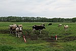 | 1083 | 164249 | Landkreis Oberhavel | Position | 1186,43 | 04.11.2009 | |
| Krielower See |  | 1170 | 329498 | Landkreis Potsdam-Mittelmark | Position | 155,11 | 09.10.2004 | |
| Krinertseen | 1048 | 164259 | Landkreis Uckermark | Position | 351,31 | 01.10.1990 | ||
| Krossener Busch | 1292 | 318692 | Landkreis Dahme-Spreewald | Position | 60,71 | 05.06.2002 | ||
| Krötenluch | 1381 | 164265 | Landkreis Prignitz | Position | 8,64 | 16.05.1990 | ||
| Kuhwinkel | 1053 | 164293 | Landkreis Prignitz | Position | 55,62 | 01.06.1972 | ||
| Kummersdorfer Heide/Breiter Steinbusch |  | 1243 | 389617 | Landkreis Teltow-Fläming | Position | 1001,84 | 17.09.2009 | |
| Kunsterspring | 1062 | 14393 | Landkreis Ostprignitz-Ruppin | Position | 100,64 | 19.10.1967 | ||
| Küstrinchen |  | 1643 | 555558905 | Landkreis Uckermark | Position | 2979,72 | 01.01.2015 | |
| Labüskewiesen | 1046 | 164314 | Landkreis Uckermark | Position | 162,94 | 01.10.1990 | ||
| Ladeburger Schäferpfühle |  | 1554 | 318703 | Landkreis Barnim | Position | 26,66 | 17.02.2001 | |
| Laie-Langes Luch | 1419 | 318705 | Landkreis Oder-Spree | Position | 88,11 | 12.03.2003 | ||
| Landiner Haussee | 1551 | 318706 | Landkreis Uckermark | Position | 122,62 | 13.12.2002 | ||
| Lange Dammwiesen und Unteres Annatal |  | 1134 | 164339 | Landkreis Märkisch-Oderland | Position | 1,26 | 16.05.1990 | |
| Langer Grund-Kohlberg | 1606 | 344594 | Landkreis Märkisch-Oderland | Position | 142,19 | 01.07.2006 | ||
| Langes Elsenfließ und Wegendorfer Mühlenfließ | 1533 | 318710 | Landkreis Märkisch-Oderland | Position | 204,9 | 26.06.2003 | ||
| Lauschika |  | 1376 | 318719 | Landkreis Elbe-Elster | Position | 32,45 | 12.12.2003 | |
| Lehmannsteich | 1331 | 14433 | Landkreis Elbe-Elster | Position | 140,54 | 26.03.1981 | ||
| Lehnigksberg |  | 1280 | 164415 | Landkreis Dahme-Spreewald | Position | 13,06 | 01.10.1990 | |
| Lehnitzer Mittelheide und Quellgebiet Emster |  | 1509 | 164416 | Landkreis Potsdam-Mittelmark | Position | 594,54 | 12.10.1996 | |
| Lenzen-Wustrower Elbniederung | 1427 | 164437 | Landkreis Prignitz | Position | 999,12 | 16.05.1990 | ||
| Leue | 1225 | 164441 | Landkreis Dahme-Spreewald | Position | 3,79 | 15.01.1938 | ||
| Leuenberger Soll | 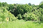 | 1096 | 164442 | Landkreis Märkisch-Oderland | Position | 9,27 | 01.06.1950 | |
| Liebenberger Bruch | 1399 | 164449 | Landkreis Oberhavel | Position | 290,51 | 17.05.1992 | ||
| Lieberoser Endmoräne |  | 1275 | 318731 | Landkreis Dahme-Spreewald, Landkreis Spree-Neiße | Position | 6714,15 | 18.01.2000 | |
| Lienewitz-Caputher Seen- und Feuchtgebietskette | 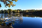 | 1517 | 318732 | Landkreis Potsdam-Mittelmark | Position | 368,11 | 10.06.2002 | |
| Lietzener Mühlental |  | 1507 | 164457 | Landkreis Märkisch-Oderland | Position | 143,13 | 02.11.1993 | |
| Lindholz | 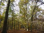 | 1101 | 14396 | Landkreis Havelland | Position | 112,13 | 26.06.1978 | |
| Linowsee-Dutzendsee |  | 1222 | 164469 | Landkreis Dahme-Spreewald, Landkreis Oder-Spree | Position | 60 | 10.10.1995 | |
| Löcknitztal |  | 1157 | 164498 | Landkreis Oder-Spree | Position | 499,84 | 01.05.1984 | |
| Lönnewitzer Heide |  | 1538 | 318748 | Landkreis Elbe-Elster | Position | 160,99 | 18.10.2003 | |
| Löptener Fenne-Wustrickwiesen |  | 1144 | 318749 | Landkreis Dahme-Spreewald | Position | 218,01 | 29.05.1998 | |
| Lubowsee |  | 1092 | 164661 | Landkreis Barnim, Landkreis Oberhavel | Position | 68,44 | 25.06.2004 | |
| Luchsee |  | 1259 | 164516 | Landkreis Dahme-Spreewald | Position | 113,14 | 01.10.1990 | |
| Luchwiesen | 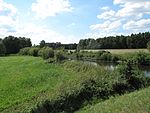 | 1205 | 16788 | Landkreis Oder-Spree | Position | 104,11 | 16.05.1990 | |
| Luckreichgebiet | 1603 | 389622 | Landkreis Elbe-Elster | Position | 326,62 | 18.04.2008 | ||
| Luisensee | 1339 | 164524 | Landkreis Spree-Neiße | Position | 57,36 | 10.10.1995 | ||
| Machnower See |  | 1201 | 164532 | Landkreis Teltow-Fläming | Position | 48,37 | 17.03.1986 | |
| Mahlheide | 1217 | 164543 | Landkreis Oder-Spree | Position | 33,38 | 16.05.1990 | ||
| Mahnigsee-Dahmetal |  | 1246 | 318761 | Landkreis Dahme-Spreewald | Position | 329,62 | 20.02.1998 | |
| Marienfließ |  | 1548 | 318765 | Landkreis Prignitz | Position | 1214,97 | 09.10.1999 | |
| Marxdorfer Moor | 1150 | 164576 | Landkreis Märkisch-Oderland | Position | 20,91 | 10.10.1981 | ||
| Matheswall, Schmielen- und Gabelsee | bravors.brandenburg.de | 555558902 | Landkreis Märkisch-Oderland | Position | 189 | 07.10.2014 | ||
| Meiereisee | 1269 | 164598 | Landkreis Dahme-Spreewald | Position | 25,06 | 01.10.1990 | ||
| Mellensee bei Lychen | 1031 | 164602 | Landkreis Uckermark | Position | 37,45 | 30.03.1989 | ||
| Melzower Forst | 1025 | 64691 | Landkreis Uckermark | Position | 2827,62 | 01.10.1990 | ||
| Mendeluch | 1392 | 164604 | Landkreis Prignitz | Position | 23,64 | 16.05.1990 | ||
| Mewenbruch | 1041 | 164619 | Landkreis Uckermark | Position | 19,08 | 30.03.1989 | ||
| Milaseen | 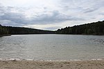 | 1230 | 164622 | Landkreis Oder-Spree | Position | 116,39 | 17.09.2003 | |
| Mittlere Havel | 1165 | 318792 | Stadt Brandenburg an der Havel | Position | 795,68 | 12.03.2003 | ||
| Mittlere Oder | 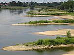 | 1410 | 329522 | Stadt Frankfurt (Oder), Landkreis Oder-Spree | Position | 1444,19 | 16.06.2004 | |
| Mloder Teichgebiet | 1112 | 164644 | Landkreis Oberspreewald-Lausitz | Position | 24,46 | 16.01.1997 | ||
| Moddersee | 1398 | 164647 | Landkreis Oberhavel | Position | 35,65 | 17.05.1992 | ||
| Mögeliner Luch | 1155 | 318798 | Landkreis Havelland | Position | 82,24 | 13.03.1998 | ||
| Moncapricesee | 1397 | 164645 | Landkreis Oberhavel | Position | 113,55 | 17.05.1992 | ||
| Mönnigsee | 1577 | 318385 | Landkreis Teltow-Fläming | Position | 35,98 | 29.07.2003 | ||
| Moosfenn |  | 1184 | 164688 | Landkreis Potsdam-Mittelmark | Position | 3,04 | 13.11.1937 | |
| Mörickeluch | 1391 | 164694 | Landkreis Prignitz | Position | 11,32 | 16.05.1990 | ||
| Möweninsel Buhnenwerder |  | 1148 | 164702 | Stadt Brandenburg an der Havel | Position | 7,75 | 18.03.1949 | |
| Mühlenfließ-Sägebach | 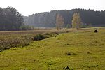 | 1239 | 318819 | Landkreis Dahme-Spreewald | Position | 163,23 | 13.02.1998 | |
| Mühlenteich | 1403 | 318820 | Landkreis Ostprignitz-Ruppin | Position | 71,06 | 13.09.2002 | ||
| Müllerberge | 1520 | 164731 | Landkreis Uckermark | Position | 61,06 | 01.02.1997 | ||
| NP Unteres Odertal |  | 1564 | 164757 | Landkreis Barnim, Landkreis Uckermark | Position | 10444,72 | 29.06.1995, 17.11.2006 | |
| Naturentwicklungsgebiet Abramka | 1288 | 555558900 | Landkreis Dahme-Spreewald | Position | 101,74 | 22.09.2014 | ||
| Naturentwicklungsgebiet Kockot | 1255 | 555558899 | Landkreis Dahme-Spreewald | Position | 26,24 | 22.09.2014 | ||
| Naturentwicklungsgebiet Redernswalde | 1056 | 555558896 | Landkreis Barnim | Position | 5850,03 | 04.01.2008 | ||
| Netzowsee-Metzelthiner Feldmark | 1635 | 555558903 | Landkreis Uckermark | Position | 1261,86 | 01.01.2015 | ||
| Neu Zaucher Weinberg |  | 1290 | 164783 | Landkreis Dahme-Spreewald | Position | 37,6 | 01.10.1990 | |
| Neubrück | 1511 | 164785 | Landkreis Oder-Spree | Position | 7,94 | 01.05.1961 | ||
| Neudorfer Wald | 1631 | 555546326 | Landkreis Prignitz | Position | 49,91 | 25.01.2011 | ||
| Neuendorfer Seewiesen | 1241 | 164790 | Landkreis Dahme-Spreewald | Position | 67,82 | 01.10.1990 | ||
| Neuenhagener Mühlenfließ | 1532 | 318847 | Landkreis Märkisch-Oderland | Position | 120,74 | 26.06.2003 | ||
| Niederoderbruch |  | 1076 | 164811 | Landkreis Barnim, Landkreis Märkisch-Oderland | Position | 863,17 | 01.10.1990 | |
| Nonnenfließ–Schwärzetal |  | 1164 | 318859 | Landkreis Barnim, Landkreis Märkisch-Oderland | Position | 488,58 | 13.12.1996 | |
| Nuthe-Nieplitz-Niederung |  | 1481 | 164853 | Landkreis Potsdam-Mittelmark, Landkreis Teltow-Fläming | Position | 5566,5 | 28.06.1995, 12.01.2011 | |
| Obere Wublitz | 1156 | 164868 | Stadt Potsdam | Position | 100 | 17.03.1986 | ||
| Oberes Demnitztal | 1219 | 164874 | Landkreis Oder-Spree | Position | 87,42 | 10.10.1981 | ||
| Oberes Klingetal |  | 1521 | 164880 | Stadt Frankfurt (Oder) | Im Naturschutzgebiet wurden 2020 vierzig Bäume gefällt. Ihre Schatten gefährdeten den Bestand an Breitblättrigem Knabenkraut.[1][2] | Position | 19,16 | 25.04.1996 |
| Oberes Pfefferfließ |  | 1436 | 318888 | Landkreis Teltow-Fläming | Position | 125,38 | 18.06.2003 | |
| Oberes Rhinluch | 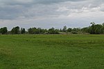 | 1622 | 555560665 | Landkreis Oberhavel, Landkreis Ostprignitz-Ruppin | Position | 2764,92 | 26.03.2013 | |
| Oberheide | 1018 | 318897 | Landkreis Ostprignitz-Ruppin | Position | 145,14 | 18.09.2002 | ||
| Oberseemoor | 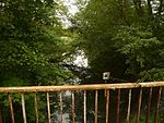 | 1575 | 318801 | Landkreis Barnim | Position | 55,32 | 25.03.2004 | |
| Oderaue Genschmar |  | 1106 | 164913 | Landkreis Märkisch-Oderland | Position | 257,69 | 16.05.1990 | |
| Oderberge | 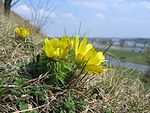 | 1168 | 164914 | Landkreis Märkisch-Oderland | Position | 12,59 | 19.10.1967 | |
| Oderhänge Mallnow |  | 1145 | 164915 | Landkreis Märkisch-Oderland | Position | 304,68 | 25.06.2003 | |
| Oderinsel Küstrin-Kietz |  | 1615 | 555514004 | Landkreis Märkisch-Oderland | Position | 209,02 | 18.11.2010 | |
| Oder-Neiße | 1416 | 329559 | Landkreis Oder-Spree, Landkreis Spree-Neiße | Position | 594,81 | 16.06.2004 | ||
| Odervorland Gieshof |  | 1088 | 164916 | Landkreis Märkisch-Oderland | Position | 489,38 | 16.05.1990 | |
| Oderwiesen Neurüdnitz | 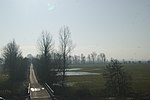 | 1619 | 389962 | Landkreis Märkisch-Oderland | Position | 1046,32 | 24.06.2008 | |
| Oderwiesen nördlich Frankfurt |  | 1172 | 164917 | Stadt Frankfurt (Oder) | Position | 220,12 | 16.05.1990 | |
| Oelsiger Luch | 1336 | 318907 | Landkreis Elbe-Elster | Position | 39,46 | 13.12.2002 | ||
| Orchideenwiese Bad Freienwalde |  | 1559 | 318917 | Landkreis Märkisch-Oderland | Position | 3,62 | 17.07.1998 | |
| Ostufer Stoßdorfer See | 1569 | 318928 | Landkreis Dahme-Spreewald | Position | 122,99 | 18.12.2003 | ||
| Pastlingsee | 1462 | 318932 | Landkreis Spree-Neiße | Position | 61,21 | 18.10.2003 | ||
| Pätzer Hintersee | 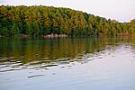 | 1213 | 318935 | Landkreis Dahme-Spreewald | Position | 461,78 | 20.02.1998 | |
| Pätzer Kiesgrube |  | 1220 | 318936 | Landkreis Dahme-Spreewald | Position | 15,48 | 07.05.2002 | |
| Peickwitzer Teiche und Schwarzbacher Heide | 1572 | 555514003 | Landkreis Oberspreewald-Lausitz | Position | 133,63 | 16.01.2010 | ||
| Peitzer Teiche mit dem Teichgebiet Bärenbrück und Laßzinswiesen | 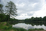 | 1299 | 164983 | Stadt Cottbus, Landkreis Spree-Neiße | Position | 1605,46 | 28.09.1990 | |
| Perleberger Schießplatz | 1620 | 389966 | Landkreis Prignitz | Position | 354,3 | 28.05.2008 | ||
| Piepergrund | 1486 | 165000 | Landkreis Uckermark | Position | 106,7 | 01.02.1997 | ||
| Pimpinellenberg | 1075 | 165004 | Landkreis Barnim | Position | 5,91 | 01.10.1990 | ||
| Pinnower Läuche und Tauersche Eichen |  | 1460 | 318945 | Landkreis Spree-Neiße | Position | 1531,4 | 29.01.2003 | |
| Pinnower See |  | 1095 | 14408 | Landkreis Oberhavel | Position | 67,71 | 27.08.2002 | |
| Plagefenn |  | 1073 | 14410 | Landkreis Barnim | Position | 1053,71 | 01.10.1990 | |
| Planetal | 1260 | 14402 | Landkreis Potsdam-Mittelmark | Position | 109,24 | 19.10.1967 | ||
| Platkowsee |  | 1033 | 329573 | Landkreis Uckermark | Position | 660,27 | 12.11.2004 | |
| Plattenburg | 1549 | 318949 | Landkreis Prignitz | Position | 352,11 | 25.06.2003 | ||
| Pohlitzer Mühlenfließ | 1413 | 378342 | Landkreis Oder-Spree | Position | 90,65 | 06.05.2006 | ||
| Pontische Hänge von Lebus a. d. O. | 1588 | 318954 | Landkreis Märkisch-Oderland | Position | 1,87 | 10.09.1921 | ||
| Poratzer Moränenlandschaft | 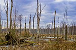 | 1047 | 64694 | Landkreis Barnim, Landkreis Uckermark | Position | 3908,78 | 01.10.1990 | |
| Postluch Ganz | 1402 | 165024 | Landkreis Ostprignitz-Ruppin | Position | 36,67 | 21.06.1997 | ||
| Prämer Berge | 1090 | 165033 | Landkreis Ostprignitz-Ruppin | Position | 18,78 | 19.10.1967 | ||
| Preschener Mühlbusch | 1341 | 165036 | Landkreis Spree-Neiße | Position | 23,87 | 26.03.1981 | ||
| Prierow bei Golßen | 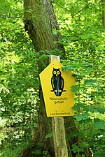 | 1273 | 165038 | Landkreis Dahme-Spreewald | Position | 60,63 | 26.03.1981 | |
| Prierowsee |  | 1210 | 14403 | Landkreis Dahme-Spreewald, Landkreis Teltow-Fläming | Position | 210,75 | 26.06.1978 | |
| Priesterschlucht | 1142 | 165040 | Landkreis Märkisch-Oderland | Position | 5,61 | 19.10.1967 | ||
| Pritzerber Laake | 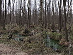 | 1133 | 165044 | Landkreis Havelland, Landkreis Potsdam-Mittelmark | Position | 511,34 | 17.03.1986 | |
| Puhlsee | 1117 | 165050 | Landkreis Havelland | Position | 68,07 | 10.05.1997 | ||
| Pulsnitz | 1378 | 165051 | Landkreis Oberspreewald-Lausitz | Position | 18,63 | 26.03.1981, 01.07.2007 | ||
| Putgolla | 1322 | 318957 | Landkreis Spree-Neiße | Position | 64,26 | 29.06.2001 | ||
| Putlitzer Stadtheide | 1630 | 555514006 | Landkreis Prignitz | Position | 44,79 | 28.10.2010 | ||
| Quaßliner Moor | 1149 | 318959 | Landkreis Prignitz | Position | 23,41 | 19.11.1999 | ||
| Rabenluch |  | 1084 | 165074 | Landkreis Barnim | Position | 8,59 | 19.10.1967 | |
| Rabenstein | 1265 | 165077 | Landkreis Potsdam-Mittelmark | Position | 39,04 | 26.06.1978 | ||
| Radeberge | 1223 | 329584 | Landkreis Dahme-Spreewald | Position | 286,09 | 16.06.2004 | ||
| Rambower Torfmoor |  | 1044 | 165093 | Landkreis Prignitz | Position | 411,25 | 16.05.1990 | |
| Randowhänge bei Schmölln | 1598 | 344830 | Landkreis Uckermark | Position | 156,79 | 09.02.2005 | ||
| Rangsdorfer See |  | 1199 | 318968 | Landkreis Teltow-Fläming | Position | 668,27 | 29.05.1998 | |
| Rarangseen | 1065 | 165101 | Landkreis Barnim | Position | 65,07 | 01.10.1990 | ||
| Rauhes Luch |  | 1232 | 165112 | Landkreis Teltow-Fläming | Position | 42,01 | 29.05.1937 | |
| Rauhes Soll | 1574 | 318969 | Landkreis Prignitz | Position | 3,34 | 12.03.1938 | ||
| Rehagen |  | 1510 | 165123 | Landkreis Oder-Spree | Position | 28,03 | 01.05.1961 | |
| Reicherskreuzer Heide und Schwansee | 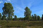 | 1418 | 165130 | Landkreis Dahme-Spreewald, Landkreis Oder-Spree, Landkreis Spree-Neiße | Position | 2809,03 | 09.12.1995 | |
| Reiersdorf | 1060 | 165131 | Landkreis Uckermark | Position | 249,46 | 01.10.1990 | ||
| Replinchener See | 1539 | 318976 | Landkreis Dahme-Spreewald | Position | 12,28 | 07.05.2002 | ||
| Reptener Teiche | 1318 | 318977 | Landkreis Oberspreewald-Lausitz | Position | 63,55 | 29.03.2003 | ||
| Reuthener Moor | 1354 | 165148 | Landkreis Spree-Neiße | Position | 95,52 | 30.09.1992 | ||
| Rheinsberger Rhind und Hellberge | 1617 | 389968 | Landkreis Ostprignitz-Ruppin | Position | 978,23 | 12.03.2009 | ||
| Ribocka |  | 1294 | 165171 | Landkreis Dahme-Spreewald | Position | 49,59 | 01.10.1990 | |
| Riesenbruch | 1563 | 82419 | Landkreis Havelland | Position | 297,04 | 04.07.2003 | ||
| Rietzer See |  | 1179 | 14399 | Landkreis Potsdam-Mittelmark | Position | 1128,02 | 09.10.2004 | |
| Rochauer Heide |  | 1310 | 14436 | Landkreis Dahme-Spreewald, Landkreis Teltow-Fläming | Position | 557,29 | 26.03.1981 | |
| Rodewaldsches Luch | 1122 | 165197 | Landkreis Havelland | Position | 139,35 | 21.06.1997 | ||
| Rohatsch zwischen Guteborn und Hohenbocka | 1573 | 318999 | Landkreis Oberspreewald-Lausitz | Position | 336,5 | 27.09.2003 | ||
| Ruhlsdorfer Bruch |  | 1125 | 165250 | Landkreis Märkisch-Oderland | Position | 162,4 | 01.10.1990 | |
| Ruppiner Schweiz |  | 1061 | 165259 | Landkreis Ostprignitz-Ruppin | Position | 93,56 | 01.05.1961 | |
| Sacrower See und Königswald |  | 1470 | 165282 | Stadt Potsdam | Position | 801,33 | 22.03.1941 | |
| Sadenbecker Brandhorst | 1491 | 165283 | Landkreis Prignitz | Position | 80,82 | 26.06.1997 | ||
| Salveytal | 1020 | 319039 | Landkreis Uckermark | Position | 381,51 | 26.11.2003 | ||
| Saugberge | 1626 | 555514005 | Landkreis Prignitz | Position | 78,52 | 25.11.2010 | ||
| Schadewitz | 1362 | 165348 | Landkreis Elbe-Elster | Position | 33,83 | 26.03.1981 | ||
| Schadewitzer Feuchtbiotop | 1153 | 165349 | Landkreis Elbe-Elster | Position | 43,27 | 09.05.1992 | ||
| Schlabendorfer Bergbaufolgelandschaft - Lichtenauer See | 1116 | 165396 | Landkreis Oberspreewald-Lausitz | Position | 465,28 | 16.01.1997 | ||
| Schlatbach |  | 1380 | 378356 | Landkreis Prignitz | Position | 127,73 | 10.06.2006 | |
| Schlaubetal |  | 1229 | 165404 | Landkreis Oder-Spree | Position | 1501,67 | 01.05.2002 | |
| Schnelle Havel |  | 1071 | 555558897 | Landkreis Barnim, Landkreis Oberhavel | Position | 2462,93 | 01.01.2015 | |
| Schnepfenried |  | 1566 | 165450 | Stadt Cottbus | Position | 40,12 | 20.12.1996 | |
| Schöberndorfer Busch |  | 1253 | 14404 | Landkreis Teltow-Fläming | Position | 831,23 | 26.06.1978 | |
| Schönerlinder Teiche |  | 1105 | 165461 | Landkreis Barnim, Landkreis Oberhavel | Position | 40,76 | 26.06.1997 | |
| Schönower Heide | 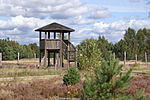 | 1544 | 319086 | Landkreis Barnim | Position | 533,38 | 01.12.2000 | |
| Quellgebiet der Schuge und des Mühlenfließes | 1439 | 319089 | Landkreis Dahme-Spreewald | Position | 350,16 | 01.07.2002 | ||
| Schulzensee | 1231 | 165472 | Landkreis Teltow-Fläming | Position | 17,73 | 11.09.1937 | ||
| Schwarzberge und Spreenierung | 1209 | 165495 | Landkreis Oder-Spree | Position | 694,45 | 03.06.2003 | ||
| Schwarze Grube | 1353 | 165497 | Landkreis Spree-Neiße | Position | 4,06 | 26.03.1981 | ||
| Schwarzer See | 1618 | 378362 | Landkreis Oberhavel | Position | 57,73 | 14.07.2006 | ||
| Schwarzer Tanger | 1488 | 165508 | Landkreis Uckermark | Position | 153,26 | 01.02.1997 | ||
| Schwarzes Luch | 1268 | 165510 | Landkreis Dahme-Spreewald | Position | 18,04 | 05.07.1992 | ||
| Schwarzwasser bei Lipsa |  | 1377 | 319095 | Landkreis Oberspreewald-Lausitz | Position | 26,29 | 01.07.2002 | |
| Schweinert |  | 1350 | 165526 | Landkreis Elbe-Elster | Position | 110,38 | 27.01.1999 | |
| Schwemmpfuhl | 1624 | 555560666 | Landkreis Uckermark | Position | 125,96 | 07.05.2013 | ||
| Schwenower Forst | 1541 | 329624 | Landkreis Oder-Spree | Position | 745,7 | 09.10.2004 | ||
| Schwimmhafenwiesen |  | 1114 | 165532 | Landkreis Oberhavel | Position | 37,09 | 27.02.1996 | |
| Seeburger Fenn - Sümpelfichten |  | 1561 | 319101 | Landkreis Havelland, Stadt Potsdam | Position | 98,34 | 08.05.2002 | |
| Seeser Bergbaufolgelandschaft | 1113 | 165543 | Landkreis Oberspreewald-Lausitz | Position | 892,11 | 16.01.1997 | ||
| Seewald | 1372 | 14430 | Landkreis Oberspreewald-Lausitz | Position | 265,55 | 26.03.1981, 01.07.2007 | ||
| Serghen-Kthlower Teich- und Wiesenlandschaft | 1328 | 165560 | Landkreis Spree-Neiße | Position | 683,9 | 22.02.2013 | ||
| Silberberge Gartz | 1022 | 165575 | Landkreis Uckermark | Position | 44,42 | 01.05.1984 | ||
| Skabyer Torfgraben | 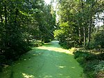 | 1192 | 319115 | Landkreis Dahme-Spreewald | Position | 304,89 | 26.09.1998 | |
| Sölla | 1244 | 165592 | Landkreis Dahme-Spreewald | Position | 33,39 | 01.10.1990 | ||
| Sorgenteich | 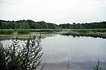 | 1374 | 165601 | Landkreis Oberspreewald-Lausitz | Position | 49,98 | 26.03.1981 | |
| Sorno-Rosendorfer Buchten | 1638 | 555558904 | Landkreis Oberspreewald-Lausitz | Position | 1086,22 | 15.04.2014 | ||
| Sperenberger Gipsbrüche |  | 1237 | 82611 | Landkreis Teltow-Fläming | Position | 24,11 | 13.03.1998 | |
| Spreebögen bei Briescht |  | 1447 | 319129 | Landkreis Oder-Spree | Position | 110,38 | 27.08.2002 | |
| Spreewiesen südlich Beeskow |  | 1451 | 319130 | Landkreis Oder-Spree | Position | 486,63 | 03.06.2003 | |
| Spring | 1258 | 165624 | Landkreis Potsdam-Mittelmark | Position | 25,19 | 17.03.1986 | ||
| Stadthavel | 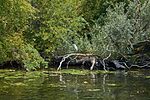 | 1407 | 319133 | Stadt Brandenburg an der Havel | Position | 249,08 | 28.02.2003 | |
| Stärtchen und Freibusch | 1474 | 319135 | Landkreis Teltow-Fläming | Position | 178,71 | 10.06.2002 | ||
| Stechlin | 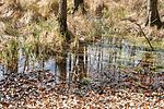 | 1030 | 319138 | Landkreis Oberhavel, Landkreis Ostprignitz-Ruppin | Position | 8658,18 | 06.12.2002 | |
| Stepenitz |  | 1012 | 329655 | Landkreis Prignitz | Position | 1651,36 | 17.09.2004 | |
| Stintgraben |  | 1130 | 165742 | Landkreis Dahme-Spreewald | Position | 109,31 | 28.06.1995 | |
| Stobbertal |  | 1115 | 165744 | Landkreis Märkisch-Oderland | Position | 883,4 | 01.10.1990 | |
| Stöbritzer See | 1118 | 165745 | Landkreis Oberspreewald-Lausitz | Position | 42,33 | 16.01.1997 | ||
| Stockshof – Behlower Wiesen | 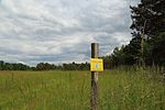 | 1433 | 319163 | Landkreis Dahme-Spreewald | Position | 487,48 | 18.12.2003 | |
| Storkower Kanal | 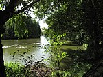 | 1202 | 329658 | Landkreis Dahme-Spreewald, Landkreis Oder-Spree | Position | 96,19 | 16.06.2004 | |
| Stegranzsee-Dahme | 1214 | 319168 | Landkreis Dahme-Spreewald | Position | 435,64 | 09.10.1999 | ||
| Streuobstwiese Zossen |  | 1147 | 319169 | Landkreis Teltow-Fläming | Position | 24,85 | 09.10.1999 | |
| Stromtal | 1479 | 165768 | Landkreis Uckermark | Position | 611,01 | 30.06.1992 | ||
| Suckower Haussee | 1040 | 165776 | Landkreis Uckermark | Position | 137,19 | 01.10.1990 | ||
| Suckowseen | 1633 | 555546327 | Landkreis Uckermark | Position | 118,5 | 25.05.2011 | ||
| Suden bei Gorden | 1367 | 165779 | Landkreis Elbe-Elster | Position | 90,73 | 26.03.1981, 01.07.2007 | ||
| Sukzessionslandschaft Nebendorf | 1120 | 165796 | Landkreis Oberspreewald-Lausitz | Position | 43,08 | 16.01.1997 | ||
| Sutschketal |  | 1208 | 165806 | Landkreis Dahme-Spreewald | Position | 59,66 | 10.10.1995 | |
| Swatzke- und Skabyberge | 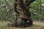 | 1537 | 319189 | Landkreis Oder-Spree | Position | 459,04 | 19.11.1999 | |
| Talsperre Spremberg |  | 1338 | 319196 | Landkreis Spree-Neiße | Position | 985,54 | 11.09.2004 | |
| Tanneberger Sumpf - Gröbitzer Busch | 1342 | 319197 | Landkreis Elbe-Elster | Position | 46,82 | 29.03.2003 | ||
| Tannenbusch und Teichlandschaft Groß Mehßow |  | 1107 | 165829 | Landkreis Oberspreewald-Lausitz | Position | 202,64 | 16.01.1997 | |
| Tannenwald | 1296 | 165830 | Landkreis Spree-Neiße | Position | 21,26 | 26.03.1981 | ||
| Tegeler Fließtal |  | 1560 | 319200 | Landkreis Barnim, Landkreis Oberhavel | Position | 457,87 | 06.12.2002 | |
| Teichlandschaft Buchwäldchen-Muckwar | 1109 | 165849 | Landkreis Oberspreewald-Lausitz | Position | 95,34 | 16.01.1997 | ||
| Teufels- oder Rhinsberg | 1104 | 319205 | Landkreis Havelland | Position | 4,63 | 01.05.1961 | ||
| Teufelsluch |  | 1256 | 165866 | Landkreis Dahme-Spreewald | Position | 38,48 | 24.06.1992 | |
| Teufelssee bei Sperenberg | 1236 | 165869 | Landkreis Teltow-Fläming | Position | 11,06 | 25.09.2012, 16.03.2013 | ||
| Teufelssee |  | 1228 | 165870 | Landkreis Oder-Spree | Position | 54,74 | 01.05.1961 | |
| Thymen | 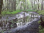 | 1021 | 14392 | Landkreis Oberhavel | Position | 809,87 | 23.08.2012 | |
| Tiefer See |  | 1068 | 165890 | Landkreis Uckermark | Position | 11,08 | 01.10.1990 | |
| Tiergarten (2) |  | 1132 | 165894 | Landkreis Märkisch-Oderland | Position | 23,58 | 01.10.1990 | |
| Tiergarten |  | 1197 | 165895 | Landkreis Dahme-Spreewald | Position | 155,47 | 10.10.1995 | |
| Tiergarten Boizenburg | 1006 | 165896 | Landkreis Uckermark | Position | 302,31 | 21.10.1981, 18.01.1989 | ||
| Tongruben Neuenhagen | 1078 | 165919 | Landkreis Märkisch-Oderland | Position | 119,64 | 01.10.1990 | ||
| Töpchiner Seen | 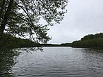 | 1224 | 319219 | Landkreis Dahme-Spreewald | Position | 373,34 | 29.05.1998 | |
| Torfbruch bei Polßen | 1038 | 165925 | Landkreis Uckermark | Position | 13,61 | 01.10.1990 | ||
| Torfbusch |  | 1565 | 165926 | Landkreis Dahme-Spreewald | Position | 47,48 | 06.01.1937 | |
| Torfstich Klosterfelde | 1555 | 319220 | Landkreis Barnim | Position | 30,92 | 27.02.2002 | ||
| Tornower Niederung | 1593 | 344839 | Landkreis Oberspreewald-Lausitz | Position | 851,37 | 19.08.2005 | ||
| Trautzke-Seen und Moore | 1417 | 319221 | Landkreis Oder-Spree | Position | 68,35 | 31.05.2002 | ||
| Treplin-Alt Zeschdorfer Fließtal | 1506 | 555558901 | Landkreis Märkisch-Oderland | Position | 131,3 | 02.11.1993 | ||
| Triebschsee |  | 1186 | 165947 | Landkreis Oder-Spree | Position | 46,72 | 16.05.1990 | |
| Trittsee-Bruchbach | 1198 | 319222 | Landkreis Havelland | Position | 70,51 | 13.02.1998 | ||
| Trockenhänge Lawitz | 1415 | 319226 | Landkreis Oder-Spree | Position | 35,16 | 18.12.2003 | ||
| Trockenrasen Geesow | 1159 | 165959 | Landkreis Uckermark | Position | 42,92 | 01.02.1997 | ||
| Trockenrasen Groß Pinnow | 1522 | 165960 | Landkreis Uckermark | Position | 47,66 | 01.02.1997 | ||
| Trockenrasen Jamikow | 1160 | 165961 | Landkreis Uckermark | Position | 81,72 | 01.02.1997 | ||
| Trockenrasen Wriezen und Biesdorfer Kehlen | bravors.brandenburg.de | 555518728 | Landkreis Märkisch-Oderland | Position | 140 | 17.11.2016 | ||
| Tuschensee | 1461 | 319230 | Landkreis Spree-Neiße | Position | 22,24 | 20.06.2001 | ||
| Uferwiesen bei Niewisch | 1453 | 319233 | Landkreis Dahme-Spreewald, Landkreis Oder-Spree | Position | 5,36 | 19.11.1999 | ||
| Untere Havel Nord |  | 1086 | 329682 | Landkreis Havelland | Position | 4706,81 | 01.07.2004 | |
| Untere Havel Süd |  | 1121 | 389986 | Landkreis Havelland | Position | 3933,37 | 14.10.2009 | |
| Untere Pulsnitztalniederung |  | 1375 | 378373 | Landkreis Elbe-Elster | Position | 667,69 | 31.05.2006 | |
| Unteres Schlaubetal | 1409 | 319246 | Landkreis Oder-Spree | Position | 362,41 | 04.04.2003 | ||
| Urstromtal bei Golßen | 1609 | 389988 | Landkreis Dahme-Spreewald | Position | 433,66 | 28.10.2009 | ||
| Urwald Fünfeichen |  | 1227 | 166040 | Landkreis Oder-Spree | Position | 8,65 | 01.05.1961 | |
| Verlandungszone Köthener See | 1251 | 166052 | Landkreis Dahme-Spreewald | Position | 66,46 | 01.10.1990 | ||
| Verlorenwasserbach Oberlauf | 1589 | 344841 | Landkreis Potsdam-Mittelmark | Position | 221,58 | 26.05.2005 | ||
| Vogelsang Wildau-Wentdorf | 1297 | 319260 | Landkreis Teltow-Fläming | Position | 5,62 | 12.12.2003 | ||
| Wacholderjagen | 1070 | 166116 | Landkreis Barnim | Position | 26,96 | 01.10.1990 | ||
| Wacholderschluchten Hohendorf |  | 1285 | 166117 | Landkreis Dahme-Spreewald | Position | 34,4 | 26.03.1981 | |
| Wanninchen |  | 1313 | 319290 | Landkreis Dahme-Spreewald | Position | 692,47 | 23.12.1999 | |
| Weesower Luch | 1158 | 319295 | Landkreis Barnim | Position | 57,55 | 13.02.1998 | ||
| Weißer Berg bei Bahnsdorf | 1604 | 389993 | Landkreis Oberspreewald-Lausitz | Position | 28,64 | 14.10.2009 | ||
| Welkteich | 1371 | 14431 | Landkreis Oberspreewald-Lausitz | Position | 113,1 | 26.03.1981 | ||
| Werbiger Heide | 1540 | 319313 | Landkreis Potsdam-Mittelmark | Position | 20,28 | 19.11.1999 | ||
| Werder Besandten | 1425 | 166245 | Landkreis Prignitz | Position | 112,91 | 16.05.1990 | ||
| Werder Kietz |  | 1423 | 166246 | Landkreis Prignitz | Position | 126,98 | 16.05.1990 | |
| Werder Mödlich | 1424 | 166247 | Landkreis Prignitz | Position | 154,98 | 16.05.1990 | ||
| Wernsdorfer See |  | 1176 | 14411 | Landkreis Dahme-Spreewald, Landkreis Oder-Spree | Position | 139,22 | 19.10.1967 | |
| Westmarkscheide - Mariensumpf | 1364 | 319324 | Landkreis Oberspreewald-Lausitz | Position | 22,91 | 30.10.2001 | ||
| Wiesenau |  | 1276 | 166301 | Landkreis Dahme-Spreewald | Position | 134,85 | 01.10.1990 | |
| Wiesengrund | 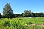 | 1535 | 319331 | Landkreis Märkisch-Oderland | Position | 117,49 | 26.06.2003 | |
| Wilder Berg bei Seelow | 1607 | 344844 | Landkreis Märkisch-Oderland | Position | 82,3 | 22.12.2005 | ||
| Winkel | 1059 | 166330 | Landkreis Uckermark | Position | 144,62 | 01.10.1990 | ||
| Wischsee |  | 1081 | 166338 | Landkreis Barnim | Position | 6,88 | 19.10.1967 | |
| Wittenberge-Rühstädter Elbniederung |  | 1567 | 329727 | Landkreis Prignitz | Position | 2124,14 | 30.10.2004 | |
| Wolfsbruch | 1171 | 166353 | Landkreis Potsdam-Mittelmark | Position | 112,4 | 27.02.1996 | ||
| Wudritzniederung Willmersdorf-Stöbritz | 1550 | 319355 | Landkreis Dahme-Spreewald | Position | 43,07 | 07.05.2002 | ||
| Wumm-See und Twern-See |  | 1029 | 166368 | Landkreis Ostprignitz-Ruppin | Position | 381,33 | 19.10.1967 | |
| Wuppen | 555632782 | Landkreis Oberspreewald-Lausitz | Position | 11,15 | 2018 | |||
| Wutscherogge | 1238 | 166385 | Landkreis Dahme-Spreewald | Position | 7,7 | 01.10.1990 | ||
| Zarth |  | 1250 | 14401 | Landkreis Potsdam-Mittelmark | Position | 262,22 | 26.06.1978 | |
| Zeisigberg bei Wuhden | 1146 | 166396 | Landkreis Märkisch-Oderland | Position | 7 | 19.10.1967 | ||
| Zerna | 1357 | 166403 | Landkreis Spree-Neiße | Position | 17,08 | 26.03.1981 | ||
| Zerweliner Koppel |  | 1001 | 344837 | Landkreis Uckermark | Position | 193,01 | 19.04.2005 | |
| Zichower Wald – Weinberg | 1483 | 166405 | Landkreis Uckermark | Position | 116,63 | 01.02.1997 | ||
| Zimmersee |  | 1529 | 389997 | Landkreis Märkisch-Oderland | Position | 68,74 | 01.10.2005 | |
| Zschornoer Wald | 1466 | 319370 | Landkreis Spree-Neiße | Position | 627,03 | 13.05.2002 | ||
| Zülowgrabenniederung |  | 1581 | 319371 | Landkreis Teltow-Fläming | Position | 108,6 | 10.12.2002 | |
| Zützener Busch | 1281 | 319372 | Landkreis Dahme-Spreewald | Position | 91,03 | 18.06.2003 |
Siehe auch
- Liste der Landschaftsschutzgebiete in Brandenburg
- Liste der FFH-Gebiete in Brandenburg
- Liste der EU-Vogelschutzgebiete in Brandenburg
- Liste der Naturwaldreservate in Brandenburg
Weblinks
Commons: Naturschutzgebiete in Brandenburg – Sammlung von Bildern, Videos und Audiodateien
Quelle
- Naturschutzgebiete in Brandenburg Stand Dezember 2019 (PDF; 1,2 MB) auf brandenburg.de
- Natur- und Landschaftsschutzgebiete im Land Brandenburg
- Common Database on Designated Areas Datenbank, Version 14
Einzelnachweise
- ↑ Jan-Henrik Hnida: Naturschutzgebiet: 40 Bäume werden wegen Orchideen-Wiese in Frankfurt (Oder) gefällt. In: moz.de. 16. September 2020, abgerufen am 20. Dezember 2020.
- ↑ Thomas Gutke: Beschluss: Orchideen im Naturschutzgebiet in Frankfurt (Oder) bringen Bäume zu Fall. In: moz.de. 9. Dezember 2020, abgerufen am 20. Dezember 2020.


