
Datei:Crete relief map.svg

Größe der PNG-Vorschau dieser SVG-Datei: 800 × 380 Pixel. Weitere aus SVG automatisch erzeugte PNG-Grafiken in verschiedenen Auflösungen: 320 × 152 Pixel | 640 × 304 Pixel | 1.024 × 486 Pixel | 1.280 × 607 Pixel | 2.560 × 1.215 Pixel | 3.370 × 1.599 Pixel
Originaldatei (SVG-Datei, Basisgröße: 3.370 × 1.599 Pixel, Dateigröße: 1,21 MB)
![]()
Diese Datei und die Informationen unter dem roten Trennstrich werden aus dem zentralen Medienarchiv Wikimedia Commons eingebunden.
![]()
Beschreibung
| Beschreibung |
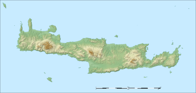
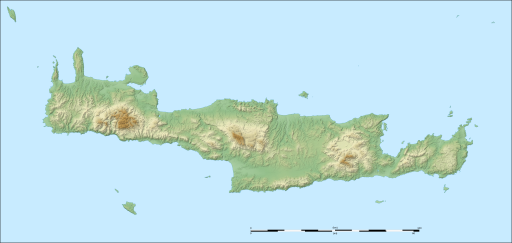
English: Blank physical map of Crete, Greece. Note: The background map is a raster image embedded in the SVG file. Français : Carte physique de la Crète, Grèce. UTM projection ; WGS84 datum ; shaded reliefNote: Le fond de carte est une image bitmap embarquée dans le fichier SVG. |
| Datum | (UTC) |
| Quelle | |
| Urheber |
|
| Dieses Bild wurde digital nachbearbeitet. Das Originalbild kann hier eingesehen werden: Crete relief map-fr.svg:
|
Lizenz
Ich, der Urheberrechtsinhaber dieses Werkes, veröffentliche es hiermit unter der folgenden Lizenz:
Diese Datei ist unter den Creative-Commons-Lizenzen „Namensnennung – Weitergabe unter gleichen Bedingungen 3.0 nicht portiert“, „2.5 generisch“, „2.0 generisch“ und „1.0 generisch“ lizenziert.
- Dieses Werk darf von dir
- verbreitet werden – vervielfältigt, verbreitet und öffentlich zugänglich gemacht werden
- neu zusammengestellt werden – abgewandelt und bearbeitet werden
- Zu den folgenden Bedingungen:
- Namensnennung – Du musst angemessene Urheber- und Rechteangaben machen, einen Link zur Lizenz beifügen und angeben, ob Änderungen vorgenommen wurden. Diese Angaben dürfen in jeder angemessenen Art und Weise gemacht werden, allerdings nicht so, dass der Eindruck entsteht, der Lizenzgeber unterstütze gerade dich oder deine Nutzung besonders.
- Weitergabe unter gleichen Bedingungen – Wenn du das Material wiedermischst, transformierst oder darauf aufbaust, musst du deine Beiträge unter der gleichen oder einer kompatiblen Lizenz wie das Original verbreiten.

|
Es ist erlaubt, die Datei unter den Bedingungen der GNU-Lizenz für freie Dokumentation, Version 1.2 oder einer späteren Version, veröffentlicht von der Free Software Foundation, zu kopieren, zu verbreiten und/oder zu modifizieren; es gibt keine unveränderlichen Abschnitte, keinen vorderen und keinen hinteren Umschlagtext.
Der vollständige Text der Lizenz ist im Kapitel GNU-Lizenz für freie Dokumentation verfügbar. |
Du darfst es unter einer der obigen Lizenzen deiner Wahl verwenden.
Ursprüngliches Datei-Logbuch
This image is a derivative work of the following images:
- File:Crete_relief_map-fr.svg licensed with Cc-by-sa-3.0,2.5,2.0,1.0, GFDL
- 2008-09-06T21:10:51Z Sting 3370x1599 (1384095 Bytes) New standard colors
- 2007-10-12T18:22:46Z Sting 3370x1599 (1414147 Bytes) Typo correction ; additional names
- 2007-10-10T22:58:10Z Sting 3370x1599 (1411524 Bytes) {{Information |Description=Map in French of the relief of [[:en:Crete|Crete]], Greece |Source=Own work ;Topographic background map : [http://www2.jpl.nasa.gov/srtm NASA Shuttle Radar Topography Mission] (SRTM3 v.2) (public do
Hochgeladen mit derivativeFX
Dateiversionen
Klicke auf einen Zeitpunkt, um diese Version zu laden.
| Version vom | Vorschaubild | Maße | Benutzer | Kommentar | |
|---|---|---|---|---|---|
| aktuell | 18:38, 28. Okt. 2010 | | 3.370 × 1.599 (1,21 MB) | Xfigpower | {{Information |Description={{en|Physical map in French of Crete, Greece.<br/>''Note:'' The background map is a raster image embedded in the SVG file.}} {{fr|Carte physique de la Crète, Grèce.<br/>''Note:'' Le fond de carte e |
Dateiverwendung
Die folgenden 45 Seiten verwenden diese Datei:
- Agia Paraskevi (Kalogeros)
- Agios Georgios Papoura
- Agria Gramvousa
- Chrysi
- Dia (Insel)
- Dikti
- Dionysaden
- Elafonisi (Kreta)
- Etiani Kefala
- Fortezza von Rethymno
- Gavdopoula
- Höhle von Psychro
- Imeri Gramvousa
- Karfi
- Kavali
- Kloster Preveli
- Koufonisi
- Kournas-See
- Kreta
- Megali Koprana
- Mikri Koprana
- Naos Panagias (Thronos)
- Nikolos
- Paralia Argilos
- Paralia Chiona (Palekastro)
- Paralia Diaskari
- Paralia Episkopis
- Paralia Gerondolakkos
- Paralia Karoumes
- Paralia Langada
- Paralia Vourlia
- Pass von Ambelos
- Paximadia-Inseln
- Potamon-See
- Psili Korfi (Giouchtas)
- Psira
- Sideros
- Souda-Bucht
- Spinalonga
- Spinalonga-Halbinsel
- Theodorou
- Voulismeni-See
- Wikipedia:Kartenwerkstatt/Positionskarten/Europa
- Wikipedia:Redaktion Bilder/Charts
- Vorlage:Positionskarte Griechenland Kreta
Globale Dateiverwendung
Die nachfolgenden anderen Wikis verwenden diese Datei:
- Verwendung auf az.wikipedia.org
- Verwendung auf ba.wikipedia.org
- Verwendung auf bg.wikipedia.org
- Verwendung auf cv.wikipedia.org
- Verwendung auf de.wikivoyage.org
- Verwendung auf el.wikipedia.org
- Ηράκλειο
- Καλονύκτης Ρεθύμνης
- Πρότυπο:Location map Κρήτη
- Άγιος Ανδρέας Ρεθύμνης
- Θέρισο Χανίων
- Δρίμισκος Ρεθύμνης
- Κρήνη του Σπηλίου
- Κρήνη Ριμόντι
- Ανώσκελη Χανίων
- Αγία Παρασκευή Αμαρίου Ρεθύμνης
- Μονή Μυριοκεφάλων
- Γερακάρι Ρεθύμνης
- Κισσού Κάμπος Ρεθύμνου
- Κρητική κουκουβάγια
- Ασώματος Ρεθύμνης
- Αχλαδές Ρεθύμνης
- Αγία Φωτεινή Αμαρίου Ρεθύμνης
- Μικρονήσι Ηρακλείου
- Πρότυπο:Location map Κρήτη/τεκμηρίωση
- Verwendung auf en.wikipedia.org
Weitere globale Verwendungen dieser Datei anschauen.


