
Xigazê གཞིས་ཀ་རྩེ་གྲོང་ཁྱེར། · 日喀则市 Shigatse | |
|---|---|
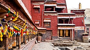
 Samtse Dzongbuk, Shigatse | |
| Nickname: Gateway to Everest | |
 Location of Shigatse within China | |
| Coordinates: 29°16′01″N 88°52′52″E / 29.267°N 88.881°E | |
| Country | People's Republic of China |
| Autonomous region | Tibet |
| County-level divisions |
|
| Municipal seat | Samzhubzê District |
| Area | |
| • Total | 182,000 km2 (70,000 sq mi) |
| Population (2020) | |
| • Total | 798,153 |
| • Density | 4.4/km2 (11/sq mi) |
| GDP | |
| • Total | CN¥ 16.7 billion US$ 2.7 billion |
| • Per capita | CN¥ 22,469 US$ 3,608 |
| Time zone | UTC+8 (China Standard) |
| ISO 3166 code | CN-XZ-02 |
| Shigatse | |||||||||||||||||||
|---|---|---|---|---|---|---|---|---|---|---|---|---|---|---|---|---|---|---|---|
| Chinese name | |||||||||||||||||||
| Simplified Chinese | 日喀则 | ||||||||||||||||||
| Traditional Chinese | 日喀則 | ||||||||||||||||||
| Hanyu Pinyin | Rìkāzé | ||||||||||||||||||
| |||||||||||||||||||
| Tibetan name | |||||||||||||||||||
| Tibetan | གཞིས་ཀ་རྩེ་ | ||||||||||||||||||
| |||||||||||||||||||

Shigatse, officially known as Xigazê, or Rikaze (Tibetan:གཞིས་ཀ་རྩེ་, Wylie: gzhis ka rtse, ZYPY: xigazê; Chinese: 日喀则; pinyin: Rìkāzé),[1][2] is a prefecture-level city of the Tibet Autonomous Region of the People's Republic of China. Its area of jurisdiction, with an area of 182,000 km2 (70,271 sq mi), corresponds to the historical Ü-Tsang region of Tibet.
Overview
The administrative center of the prefecture-level city is the Samzhubzê District. It is roughly equivalent to the historical Shigatse urban center, the second-largest city in Tibet, located about 280 km (170 mi) southwest of Lhasa and home to the Tashilhunpo Monastery, traditionally the seat of the Panchen Lama.[3]
Some of the towns in the prefecture are: Gyantse (Gyantse County), Tingri (Tingri County), and Nyalam (Nyalam County).
On 11 July 2014 Shigatse Prefecture was upgraded into a prefecture-level city (the same status as Lhasa).[4]

History
In the eighth century, the Tibetan Empire of Tibetan King Chisong Dezan invited Indian monk Padmasambhava into Tibet to build the Samye Mighur Lhundrub Tsula Khang, passing through the place of Rikaze where the practice of preaching, and predicated Lhasa as the center of snowy plateau followed by Nianmai (Shigatse). In the eleventh century the Sakya dynasty, Nianmai has initially begun urbanization.
In October 1959, Rikaze prefecture was established.[5] In 1970, Rikaze Prefecture was abolished and Rikaze District was established.[6] On 26 June 2014, by the State Council of the People's Republic of China agreed, the original Rikaze area abolished, the establishment of prefecture-level Shigatse city, the original county-level Shigatse city merged into the Sangzhuzi District. This was the second prefecture-level city established in the Tibet Autonomous Region. [7]
On 18 December 2014, prefecture-level Shigatse City was officially established.[8][9]
Population
According to the 2020 Chinese census, the resident population of the city was 798,153.[10] Compared to 703,292 in the 6th Chinese Census, there was a total increase of 94,861 or 13.49% in ten years, with an average annual growth rate of 1.27%. Among them, the male population was 416,384, accounting for 52.17% of the total population, while the female population was 381,769, accounting for 47.83% of the total population. The sex ratio of the total population (100 females) was 109.07. The population aged 0-14 years was 209,900, accounting for 26.3% of the total population; the population aged 15-59 years was 516,838, accounting for 64.75% of the total population; and the population aged 60 years and above was 71,415, accounting for 8.95% of the total population, of which the population aged 65 years and above was 8.95%. 8.95% of the total population, of which 44,772 were aged 65 and above, accounting for 5.61% of the total population. The population living in towns and cities was 184,323, or 23.09% of the total population, while the population living in villages was 613,830, or 76.91% of the total population.
Ethnicity
Of the city's resident population, 42,501, or 5.32%, were Han Chinese; 748,443, or 93.77%, were Tibetans; and 7,209, or 0.9%, were other ethnic minorities. Compared with the 2010 Chinese Census, the Han population increased by 16,691, or 64.67%, and accounted for 1.66 percentage points of the total population; the populations of various ethnic minorities increased by 78,170, or 11.54%, and accounted for 1.66 percentage points of the total population. Among them, the Tibetan population increased by 76,779, an increase of 11.43%, accounting for a decrease of 1.73 percentage points in the proportion of the total population.[10]
| Ethnic Group | Tibetan | Han | Kirghiz | Hui | Unidentified Ethnic Groups | Kazakh | Turkish | Dongxiang | Manchu | Hmong | Other Ethnic Groups |
|---|---|---|---|---|---|---|---|---|---|---|---|
| Population | 671664 | 25810 | 2669 | 1434 | 703 | 250 | 162 | 138 | 98 | 66 | 298 |
| Proportion of total population (%) | 95.50 | 3.67 | 0.38 | 0.20 | 0.10 | 0.04 | 0.02 | 0.02 | 0.01 | 0.01 | 0.04 |
| Proportion of ethnic minority population (%) | 99.14 | --- | 0.39 | 0.21 | 0.10 | 0.04 | 0.02 | 0.02 | 0.01 | 0.01 | 0.04 |
Transport
Rail

The Lhasa–Shigatse Railway connects Shigatse Railway Station with Lhasa and further connects with Qinghai via Qinghai–Tibet Railway. It takes about three hours to travel between Lhasa and Shigatse by train. It is possible to get back to Lhasa within the same day by train.[12]
Air

Shigatse Peace Airport began operations on 30 October 2010 after an Airbus A319 landed safely, making it Tibet's fifth commercial airport. It is located 43 kilometres from Samzhubzê District at Jangdam Township at an elevation of 3,782 metres. The airport will be capable of supporting 230,000 passengers annually by 2020.[13]
Shigatse Tingri Airport opened in December 2022.[14]
Road
China National Highway 318 and China National Highway 219 are the main roads in and out of Shigatse.[15][16][17]
Counties
| Map | ||||||||||||
|---|---|---|---|---|---|---|---|---|---|---|---|---|
| Name | Simplified Chinese | Hanyu Pinyin | Tibetan | Wylie | Population (2010 Census) | Area (km2) | Density (/km2) | |||||
| City proper | ||||||||||||
| Samzhubzê District | 桑珠孜区 | Sāngzhūzī Qū | བསམ་འགྲུབ་རྩེ་ཆུས། | bsam 'grub rtse chus | 120,374 | 3,654 | 32.94 | |||||
| Rural | ||||||||||||
| Namling County | 南木林县 | Nánmùlín Xiàn | རྣམ་གླིང་རྫོང་། | rnam gling rdzong | 74,930 | 8,113 | 9.23 | |||||
| Gyantse County | 江孜县 | Jiāngzī Xiàn | རྒྱལ་རྩེ་རྫོང་། | rgyal rtse rdzong | 63,503 | 3,859 | 16.45 | |||||
| Tingri County | 定日县 | Dìngrì Xiàn | དིང་རི་རྫོང་། | ding ri rdzong | 50,818 | 13,859 | 3.66 | |||||
| Sa'gya County | 萨迦县 | Sàjiā Xiàn | ས་སྐྱ་རྫོང་། | sa skya rdzong | 47,304 | 7,510 | 6.29 | |||||
| Lhatse County | 拉孜县 | Lāzī Xiàn | ལྷ་རྩེ་རྫོང་། | lha rtse rdzong | 49,286 | 4,505 | 10.94 | |||||
| Ngamring County | 昂仁县 | Ángrén Xiàn | ངམ་རིང་རྫོང་། | ngam ring rdzong | 51,472 | 20,105 | 2.56 | |||||
| Xaitongmoin County | 谢通门县 | Xiètōngmén Xiàn | བཞད་མཐོང་སྨོན་རྫོང་། | bzhad mthong smon rdzong | 42,280 | 13,960 | 3.02 | |||||
| Bainang County | 白朗县 | Báilǎng Xiàn | པ་སྣམ་རྫོང་། | pa snam rdzong | 42,551 | 2,806 | 15.16 | |||||
| Rinbung County | 仁布县 | Rénbù Xiàn | རིན་སྤུངས་རྫོང་། | rin spungs rdzong | 27,826 | 2,123 | 13.10 | |||||
| Kangmar County | 康马县 | Kāngmǎ Xiàn | ཁང་དམར་རྫོང་། | khang dmar rdzong | 20,522 | 6,165 | 3.32 | |||||
| Dinggyê County | 定结县 | Dìngjié Xiàn | གཏིང་སྐྱེས་རྫོང་། | gding skyes rdzong | 20,319 | 5,816 | 3.49 | |||||
| Zhongba County | 仲巴县 | Zhòngbā Xiàn | འབྲོང་པ་རྫོང་། | 'brong pa rdzong | 22,147 | 43,594 | 0.50 | |||||
| Yadong County | 亚东县 | Yàdōng Xiàn | གྲོ་མོ་རྫོང་། | gro mo rdzong | 12,920 | 4,306 | 3.00 | |||||
| Gyirong County | 吉隆县 | Jílóng Xiàn | སྐྱིད་གྲོང་རྫོང་། | skyid grong rdzong | 14,972 | 9,009 | 1.66 | |||||
| Nyalam County | 聂拉木县 | Nièlāmù Xiàn | གཉའ་ལམ་རྫོང་། | gnya' lam rdzong | 17,568 | 7,903 | 2.22 | |||||
| Saga County | 萨嘎县 | Sàgā Xiàn | ས་དགའ་རྫོང་། | sa dga' rdzong | 14,036 | 12,411 | 1.13 | |||||
| Kamba County | 岗巴县 | Gǎngbā Xiàn | གམ་པ་རྫོང་། | gam pa rdzong | 10,464 | 3,936 | 2.65 | |||||

Climate
Shigatse has an elevation-influenced humid continental climate (Köppen climate classification: Dwb).
| Climate data for Shigatse, elevation 3,836 m (12,585 ft), (1991–2020 normals) | |||||||||||||
|---|---|---|---|---|---|---|---|---|---|---|---|---|---|
| Month | Jan | Feb | Mar | Apr | May | Jun | Jul | Aug | Sep | Oct | Nov | Dec | Year |
| Mean daily maximum °C (°F) | 7.0 (44.6) | 9.0 (48.2) | 12.5 (54.5) | 16.0 (60.8) | 19.9 (67.8) | 22.9 (73.2) | 21.8 (71.2) | 21.0 (69.8) | 20.0 (68.0) | 16.7 (62.1) | 11.9 (53.4) | 8.4 (47.1) | 15.6 (60.1) |
| Daily mean °C (°F) | −2.6 (27.3) | 0.5 (32.9) | 4.6 (40.3) | 8.1 (46.6) | 12.0 (53.6) | 15.3 (59.5) | 14.9 (58.8) | 14.1 (57.4) | 12.6 (54.7) | 7.4 (45.3) | 1.2 (34.2) | −2.5 (27.5) | 7.1 (44.8) |
| Mean daily minimum °C (°F) | −12.2 (10.0) | −8.9 (16.0) | −4.0 (24.8) | 0.4 (32.7) | 4.5 (40.1) | 8.6 (47.5) | 9.8 (49.6) | 9.2 (48.6) | 6.8 (44.2) | −0.8 (30.6) | −8.0 (17.6) | −11.9 (10.6) | −0.5 (31.0) |
| Average precipitation mm (inches) | 0.1 (0.00) | 0.4 (0.02) | 0.6 (0.02) | 5.2 (0.20) | 20.7 (0.81) | 66.0 (2.60) | 149.8 (5.90) | 145.2 (5.72) | 52.0 (2.05) | 3.7 (0.15) | 0.5 (0.02) | 0.5 (0.02) | 444.7 (17.51) |
| Average precipitation days (≥ 0.1 mm) | 0.3 | 0.4 | 0.8 | 2.6 | 6.1 | 12.6 | 20.2 | 20.7 | 12.5 | 1.8 | 0.3 | 0.1 | 78.4 |
| Average snowy days | 0.6 | 1.2 | 1.7 | 4.3 | 1.6 | 0.1 | 0 | 0 | 0 | 0.6 | 0.6 | 0.4 | 11.1 |
| Average relative humidity (%) | 28 | 25 | 25 | 32 | 40 | 50 | 64 | 68 | 61 | 44 | 34 | 33 | 42 |
| Mean monthly sunshine hours | 260.4 | 244.0 | 280.0 | 278.5 | 301.8 | 278.6 | 227.4 | 222.5 | 247.5 | 286.3 | 276.5 | 267.8 | 3,171.3 |
| Percent possible sunshine | 80 | 77 | 75 | 72 | 71 | 67 | 54 | 55 | 68 | 82 | 87 | 84 | 73 |
| Source: China Meteorological Administration[18][19] | |||||||||||||
Gallery
 Mountains in Shigatse Prefecture
 Monastery along the road from Shigatse to Mount Everest
 Photo of the Shigatse abbot taken around 1910
 Tibetan Army soldiers circa 1938 on parade. They are equipped with Lee-Enfield rifles.


See also
References
- ^ Powers, John (2016). The Buddha party : how the People's Republic of China works to define and control Tibetan Buddhism. New York, NY: Oxford University Press. pp. Appendix B, page 16. ISBN 9780199358182. OCLC 967694121.
- ^ 国家测绘局地名研究所 (1997). 中国地名录 [Gazetteer of China]. Beijing: SinoMaps Press. p. 311. ISBN 7-5031-1718-4.
- ^ Mapping the Tibetan World. Yukyasu Osada, Gavin Allwright, and Atushi Kanamaru. 1st edition 200. Reprint 2004. Kotan Books, Japan, pp. 109, 113.
- ^ Li, Zhe. 西藏日喀则成为中国最年轻地级市. 中国网. Archived from the original on 14 July 2014. Retrieved 13 July 2014.
- ^ Translations on People's Republic of China. JPRS (Series). Joint Publications Research Service. 1972. p. 9. Retrieved 7 March 2024.
- ^ 陈至立主编 (2020). 辞海. 上海: 上海辞书出版社. p. 3644. ISBN 978-7-5326-5325-6.
- ^ "国务院批复西藏设立第四个地级市". 中国政府网. 3 April 2015. Archived from the original on 21 January 2021. Retrieved 3 September 2021.
- ^ "西藏海拔最高地级市挂牌成立 助力藏西南经济发展_中华人民共和国国务院新闻办公室". www.scio.gov.cn. Retrieved 6 March 2024.
- ^ "西藏海拔最高市日喀则市挂牌成立". paper.people.com.cn. Retrieved 6 March 2024.
- ^ a b 日喀则市统计局、日喀则市第七次全国人口普查领导小组办公室. "日喀则市第七次全国人口普查主要数据公报". Archived from the original on 16 September 2021. Retrieved 23 July 2023.
- ^ 西藏自治区第六次全国人口普查领导小组办公室、西藏自治区统计局、国家统计局西藏调查总队 (2012). 《西藏自治区2010年人口普查资料》. 中国统计出版社. ISBN 978-7-5037-6517-9.
- ^ "Shigatse Travel" ChinaTour.net Archived 16 August 2015 at Wikiwix Accessed 21 April 2013
- ^ "Tibet's Xigaze Airport begins operations - People's Daily Online". Archived from the original on 7 November 2010. Retrieved 1 November 2010.
- ^ "公司动态:公司重点保障项目——日喀则定日机场顺利通过行业验收". weixin.qq.com. 中航质. 12 December 2022. Retrieved 23 May 2023.
- ^ IIRF Strategic Yearbook 2022-23. Notion Press. p. 251. ISBN 979-8-88883-276-9. Retrieved 7 March 2024.
- ^ Bakshi, A. (2001). Silk Road on Wheels: Travels Through Central Asia and Tibet. Odyssey Books. p. x. ISBN 978-81-900861-1-0. Retrieved 7 March 2024.
- ^ Bhattacharya, A. (2017). Journeys on the Silk Road Through Ages—Romance, Legend, Reality. Repro Knowledgcast Limited. p. 132. ISBN 978-93-86407-81-8. Retrieved 7 March 2024.
- ^ 中国气象数据网 – WeatherBk Data (in Simplified Chinese). China Meteorological Administration. Retrieved 27 September 2023.
- ^ "Experience Template" 中国气象数据网 (in Simplified Chinese). China Meteorological Administration. Retrieved 27 September 2023.
Further reading
External links
- . Encyclopædia Britannica (11th ed.). 1911.
Notes: *Provincial capitals, ★Sub-provincial cities, ☆Sub-provincial autonomous prefecture *Sub prefectural-level divisions, ✧"Comparatively larger city" (较大的市) as approved by the State Council | |||||||||||||||||||||||||||||||||||||||||||||||||||||||||||||||||
| |||||||||||||||||||||||||||||||||||||||||||||||||||||||||||||||||
| |||||||||||||||||||||||||||||||||||||||||||||||||||||||||||||||||
| International | |
|---|---|
| National | |


