
Correntina | |
|---|---|
.jpg) Bridge crossing the Das Éguas River with Church of Our Lady of Gloria in the background | |
 Flag | |
 Location of Correntina in Bahia | |
 Correntina  Correntina | |
| Coordinates: 13°20′35″S 44°38′10″W / 13.34306°S 44.63611°W | |
| Country | |
| Region | Northeast |
| State | |
| Founded | 15 May 1866[2] |
| Government | |
| • Mayor | Nilson José Rodrigues (PCdoB) (2021-2024)[3][4] |
| • Vice Mayor | Lormino Antonio Laranjeira (PCdoB) (2021-2024)[5][4] |
| Area | |
| • Total | 11,504.314 km2 (4,441.840 sq mi) |
| Elevation | 575 m (1,886 ft) |
| Population (2022) | |
| • Total | 32,457[1] |
| • Density | 2.82/km2 (7.3/sq mi) |
| Demonym | Correntinense (Brazilian Portuguese)[1] |
| Time zone | UTC-03:00 (Brasília Time) |
| Postal code | 47650-000, 47654-000[6] |
| HDI (2010) | 0.603 – medium[1] |
| Website | correntina.ba.gov.br |
Correntina is a municipality in the state of Bahia in Brazil, 500 km from Brasilia and 980 km from Salvador. In 2020, the population was estimated at 32,191.[7]
History
Correntina was first mentioned in the dispatches of the Entradistas and Bandereirantes who visited the city in 1700 and 1790.
The Decree Federal Law of nº 311 signed by Getúlio Vargas on March 2, 1938, authorizing that the States made the territorial divisions, it was that, for the State Decree of nº 10.724, signed for the Federal interventor Landulpho Alves, in 30 of March 1938, the Village received the forum from City, under the baton of the Intendant Major Félix Joaquin de Araújo, however, they had only come to commemorate in 01 of January 1939, considering the delay in the art of if communicating.
Geography
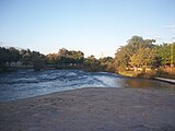
The "Correntina", "Arojado", "Saint Antonio", "Guará" and "Rio do meio" rivers run near or through Correntina, and the Island of the Ranchão lies in the Correntina river. 1,200 meters away from the central city, the "Sete Ilhas" ("Seven Islands") form an archipelago, typical of the city's natural environment.[8]
Climate
| Climate data for Correntina (1981–2010) | |||||||||||||
|---|---|---|---|---|---|---|---|---|---|---|---|---|---|
| Month | Jan | Feb | Mar | Apr | May | Jun | Jul | Aug | Sep | Oct | Nov | Dec | Year |
| Mean daily maximum °C (°F) | 31.0 (87.8) |
31.4 (88.5) |
30.9 (87.6) |
31.1 (88.0) |
31.3 (88.3) |
30.4 (86.7) |
30.6 (87.1) |
31.8 (89.2) |
33.6 (92.5) |
34.1 (93.4) |
31.8 (89.2) |
30.8 (87.4) |
31.6 (88.9) |
| Daily mean °C (°F) | 24.7 (76.5) |
25.0 (77.0) |
24.6 (76.3) |
24.5 (76.1) |
23.6 (74.5) |
21.9 (71.4) |
22.0 (71.6) |
23.2 (73.8) |
25.7 (78.3) |
26.7 (80.1) |
25.5 (77.9) |
24.8 (76.6) |
24.4 (75.9) |
| Mean daily minimum °C (°F) | 19.9 (67.8) |
20.0 (68.0) |
20.0 (68.0) |
19.3 (66.7) |
17.2 (63.0) |
14.5 (58.1) |
14.2 (57.6) |
14.9 (58.8) |
18.2 (64.8) |
20.3 (68.5) |
20.6 (69.1) |
20.1 (68.2) |
18.3 (64.9) |
| Average precipitation mm (inches) | 130 (5.1) |
104.4 (4.11) |
145.5 (5.73) |
62.0 (2.44) |
9.0 (0.35) |
0.5 (0.02) |
0.3 (0.01) |
2.3 (0.09) |
10.2 (0.40) |
74.2 (2.92) |
164.7 (6.48) |
220.8 (8.69) |
923.9 (36.37) |
| Average precipitation days (≥ 1.0 mm) | 9 | 8 | 11 | 5 | 1 | 0 | 0 | 0 | 2 | 6 | 12 | 13 | 67 |
| Average relative humidity (%) | 77.9 | 76.0 | 77.2 | 73.8 | 68.4 | 64.0 | 59.9 | 54.7 | 50.1 | 57.8 | 72.0 | 77.2 | 67.4 |
| Mean monthly sunshine hours | 224.4 | 204.0 | 222.4 | 240.5 | 264.8 | 271.5 | 284.0 | 299.2 | 276.4 | 241.8 | 180.6 | 190.3 | 2,899.9 |
| Source: Instituto Nacional de Meteorologia[9] | |||||||||||||
Gallery
-
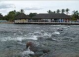 Looking towards Ranchão Island
 -
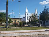
 On Ranchão Island looking towards Church of Our Lady of Gloria
 -
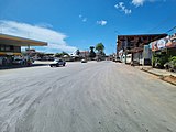 Avenue Tancredo Neves
 -
 Terminal bus station
 -
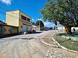 Boa Vista Road
 -
 Boa Vista Road
 -
 Aleixo Caetano Road
 -
 Immaculate Conception Church
 -
 Municipal Museum of Natural History Raimundo Sales
 -
 Avenue Tancredo Neves
 -
 Aerial view of Ranchão Island


.jpg)
.jpg)
.jpg)
.jpg)


See also
References
- ^ a b c "Correntina". Instituto Brasileiro de Geografia e Estatística. Instituto Brasileiro de Geografia e Estatística. Retrieved 3 September 2024.
- ^ "História". Instituto Brasileiro de Geografia e Estatística. Instituto Brasileiro de Geografia e Estatística. Retrieved 3 September 2024.
- ^ "Gabinete do Prefeito". Prefeitura de Correntina-BA. Prefeitura de Correntina-BA. Retrieved 3 September 2024.
- ^ a b "Prefeito e vereadores de Correntina tomam posse; veja lista de eleitos". globo.com. globo.com. Retrieved 3 September 2024.
- ^ "Vice-prefeito". Prefeitura de Correntina-BA. Prefeitura de Correntina-BA. Retrieved 3 September 2024.
- ^ "Código Postal Correntina/BA - Brasil". Código Postal. Código Postal. Retrieved 4 September 2024.
- ^ IBGE 2020
- ^ Revista brasileira de geociências: órgão da Sociedade Brasileira de Geologia (in Brazilian Portuguese). O Sociedade. 2005.
- ^ "Normais Climatológicas Do Brasil 1981–2010" (in Portuguese). Instituto Nacional de Meteorologia. Retrieved 21 May 2024.

| International | |
|---|---|
| National | |


