
Datei:Markagunt Plateau.jpg
Es ist keine höhere Auflösung vorhanden.
Markagunt_Plateau.jpg (640 × 431 Pixel, Dateigröße: 96 KB, MIME-Typ: image/jpeg)
![]()
Diese Datei und die Informationen unter dem roten Trennstrich werden aus dem zentralen Medienarchiv Wikimedia Commons eingebunden.
![]()
| Beschreibung |
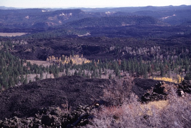
Black Rock Desert volcanic field — Markagunt Plateau.
|
|||
| Datum | ||||
| Quelle | http://www.volcano.si.edu/world/volcano.cfm?vnum=1207-04-&volpage=photos&photo=045096 | |||
| Urheber | Lee Siebert (Smithsonian Institution) | |||
| Genehmigung (Weiternutzung dieser Datei) |
|
Dateiversionen
Klicke auf einen Zeitpunkt, um diese Version zu laden.
| Version vom | Vorschaubild | Maße | Benutzer | Kommentar | |
|---|---|---|---|---|---|
| aktuell | 02:44, 29. Jan. 2011 | | 640 × 431 (96 KB) | Michael Metzger | {{Information |Description=Blocky unvegetated lava flows known as the Black Rock Desert extend from near Miller Knoll to the SE. These flows, which also extend NE to near Panguitch Lake, are among the youngest features of the Markagunt Plateau volcanic fi |
Dateiverwendung
Die folgende Seite verwendet diese Datei:
Globale Dateiverwendung
Die nachfolgenden anderen Wikis verwenden diese Datei:
- Verwendung auf ceb.wikipedia.org
- Verwendung auf en.wikipedia.org
- Verwendung auf he.wikipedia.org
- Verwendung auf ms.wikipedia.org
- Verwendung auf no.wikipedia.org
- Verwendung auf ru.wikipedia.org
- Verwendung auf www.wikidata.org


