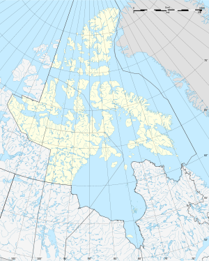
Thor Island (Kanada)
| Thor Island | ||
|---|---|---|
| Gewässer | Arktischer Ozean | |
| Inselgruppe | Sverdrup-Inseln (Königin-Elisabeth-Inseln) | |
| Geographische Lage | 78° 12′ N, 103° 0′ W | |
|
| ||
| Länge | 16,8 km | |
| Breite | 6,6 km | |
| Fläche | 123 km² | |
| Einwohner | unbewohnt | |
Thor Island ist eine unbewohnte Insel der Königin-Elisabeth-Inseln in Nunavut, Kanada.
Lage
Die südlich von Ellef Ringnes Island in der Danish Strait liegende Insel ist 16,8 Kilometer lang, 6,6 Kilometer breit und hat eine Fläche von 123 km². Die Insel ist relativ flach und erreicht keine 100 Meter Höhe.
Anfang der 1970er Jahre wurde auf Thor Island Erdgas gefunden.[1]
Einzelnachweise
- ↑ Charles R. Hetherington: The Future of Oil and Gas Exploration and Development in the Canadian Arctic (PDF; 12,8 MB). In: The Arctic Circle 23 (3), 1975, S. 97–105
Weblinks
- Thor Island bei Natural Resources Canada


