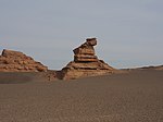
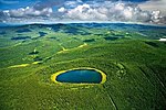
Liste der UNESCO Global Geoparks in Asien

Auf dieser Seite sind nach Staaten geordnet die Stätten in dem Kontinent Asien aufgelistet, die von der UNESCO im Rahmen des International Geoscience and Geoparks Programme (IGGP) als UNESCO Global Geopark anerkannt wurden und somit Mitglieder des Global Geopark Network sind.
Die Jahreszahl bezeichnet das Jahr der Anerkennung der Stätte als UNESCO Global Geopark. Jahreszahlen vor 2015 bedeuten, dass der Geopark in diesem Jahr als Mitglied des Global Geoparks Network aufgenommen wurde, das 2015 in das IGGP integriert wurde und dessen Mitgliedern dann der Titel UNESCO Global Geopark verliehen wurde.
Indonesien
| Bild | Bezeichnung | Jahr | Fläche | Anmerkungen |
|---|---|---|---|---|
 Batur (Vulkan) (weitere Bilder) | Batur UNESCO Global Geopark (Lage – Link) | 2012 | 370,5 km² | Der Geopark erstreckt sich um den aktiven Vulkan Batur im Nordosten Balis zwischen 920 und 2152 m Höhe. Er umfasst zwei Calderen, die bei Ausbrüchen vor 29.000 (äußere Caldera) bzw. 20.000 Jahren (innere Caldera) entstanden. |
 Jomblang-Höhle (weitere Bilder) | Gunung Sewu UNESCO Global Geopark (Lage) | 2015 | 1802 km² | Der Geopark liegt in der südlichen Bergregion Ost-Javas. Der nördliche Teil wird von einer Depression begrenzt und den aktiven Vulkanen Merapi und Lawu, während der Süden vom Indischen Ozean begrenzt wird. Die Karstlandschaft wird von Kalkstein aus dem Neogen dominiert. (UNESCO) |
 (weitere Bilder) | Ciletuh - Palanuhanratu UNESCO Global Geopark (Lage – Link) | 2018 | 1260 km² | |
 | Rinjani-Lombok UNESCO Global Geopark (Lage – Link) | 2018 | 2800 km² | |
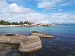 (weitere Bilder) | Belitong UNESCO Global Geopark (Lage – Link) | 2021 | 4800 km² | |
 Kratersee des Kawah Ijen | Ijen UNESCO Global Geopark (Lage – Link) | 2023 | 4723 km² | Ijen ist der Name eines Vulkankomplexes der Insel Java |
 (weitere Bilder) | Maros Pangkep UNESCO Global Geopark (Lage – Link) | 2023 | 5077,25 km² | |
 | Merangin Jambi UNESCO Global Geopark (Lage – Link) | 2023 | 4832,31 km² | |
 Waiaginseln | Raja Ampat UNESCO Global Geopark (Lage – Link) | 2023 | 36.660 km² | |
 (weitere Bilder) | Toba Caldera UNESCO Global Geopark (Lage – Link) | Tobasee |
Iran
| Bild | Bezeichnung | Jahr | Fläche | Anmerkungen |
|---|---|---|---|---|
 Namakdan-Höhle (weitere Bilder) | Qeshm Island UNESCO Global Geopark (Lage – Link) | 2017 | 2063 km² | war bereits 2006–2012 Mitglied des Global Network of National Geoparks; der Geopark liegt auf der Insel Qeschm |
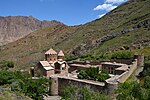 Kloster Sankt Stephanos (weitere Bilder) | Aras UNESCO Global Geopark (Lage – Link) | 2023 | 1670 km² | Der Fluss Aras bildet die Nordgrenze |
 Foto von der ISS (weitere Bilder) | Tabas UNESCO Global Geopark (Lage – Link) | 2023 | 22771 km² |
Japan
| Bild | Bezeichnung | Jahr | Fläche | Anmerkungen |
|---|---|---|---|---|
 Kryptodom Shōwa-Shinzan (weitere Bilder) | Toya - Usu UNESCO Global Geopark (Lage – Link) | 2009 | 1181 km² | Geopark auf Japans nördlichster Hauptinsel Hokkaidō, der nach dem Tōya-Caldera-See und dem Vulkan Usu benannt ist. |
 Yakeyama (weitere Bilder) | Itoigawa UNESCO Global Geopark (Lage – Link) | 2009 | 750 km² | Geopark in der Präfektur Niigata, der im Norden an das Japanische Meer grenzt und im Süden bis in die Japanischen Alpen reicht. Hauptinformationszentrum für Besucher ist das Fossa Magna Museum. |
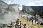 Jigoku Onsen (weitere Bilder) | Unzen Volcanic Area UNESCO Global Geopark (Lage – Link) | 2009 | 459,52 km² | Befindet sich auf der Shimabara-Halbinsel im Nordwesten der japanischen Hauptinsel Kyūshū in der Präfektur Nagasaki und umfasst den namensgebenden Vulkankomplex Unzen. Vulkanegipfel des Komplexes sind der Heisei Shinzan (1482,7 m), Fugen-dake (1359,3 m), Kunimi-dake (1347 m) und Myōken-dake (1333 m). |
 Tottori-Dünen (weitere Bilder) | San’in Kaigan UNESCO Global Geopark (Lage – Link) | 2010 | 2458 km² | siehe San’in-Kaigan-Nationalpark, Tottori-Düne, Kasumi-Küste, Takeno-Küste, Tajima-mihonoura |
 Turbidit am Kap Muroto (weitere Bilder) | Muroto UNESCO Global Geopark (Lage – Link) | 2011 | 248,2 km² | umfasst das Kap Muroto |
 Kuniga-Küste (weitere Bilder) | Oki Islands UNESCO Global Geopark (Lage – Link) | 2013 | 673,5 km² | umfasst die Oki-Inseln |
 (weitere Bilder) | Aso UNESCO Global Geopark (Lage – Link) | 2014 | 1198 km² | umfasst den Vulkan Aso |
 Apoi | Mt. Apoi UNESCO Global Geopark (Lage – Link) | 2015 | 364,3 km² | umfasst Peridotite, die durch Plattenkollision entstanden sind sowie die alpine Flora am Berg Apoi |
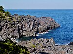 Jōgasaki-Küste (weitere Bilder) | Izu Peninsula UNESCO Global Geopark (Lage – Link) | 2018 | 2027 km² | Geopark auf der Izu-Halbinsel. Der höchste Berg der Halbinsel ist der Banzaburō (1405 m). |
 Haku-san | Hakusan Tedorigawa UNESCO Global Geopark (Lage – Link) | 2023 | 754,93 km² |
Malaysia
| Bild | Bezeichnung | Jahr | Fläche | Anmerkungen |
|---|---|---|---|---|
 Kilim Geoforest Park (weitere Bilder) | Langkawi UNESCO Global Geopark (Lage – Link) | 2007 | 478 km² | |
 Kinabalu (weitere Bilder) | Kinabalu UNESCO Global Geopark (Lage – Link) | 2023 | 4750 km² | umfasst den Kinabalu, den höchsten Berg Malaysias |
Philippinen
| Bild | Bezeichnung | Jahr | Fläche | Anmerkungen |
|---|---|---|---|---|
 Chocolate Hills (weitere Bilder) | Bohol Island UNESCO Global Geopark (Lage – Link) | 2023 | 8808 km² |
Südkorea
| Bild | Bezeichnung | Jahr | Fläche | Anmerkungen |
|---|---|---|---|---|
 Yongcheon-Höhle (weitere Bilder) | Jeju Island UNESCO Global Geopark (Lage – Link) | 2010 | 1847 km² | |
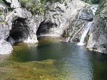 Juwangsan-Nationalpark (weitere Bilder) | Cheongsong UNESCO Global Geopark (Lage – Link) | 2017 | 845,71 km² | |
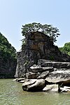 Goseokjeong (Granitfelsen am Fluss Hantan) (weitere Bilder) | Hantangang UNESCO Global Geopark (Lage – Link) | 1165,61 km² | ||
 (weitere Bilder) | Jeonbuk West Coast UNESCO Global Geopark (Lage – Link) | 2023 | 1892,5 km² | umfasst u. a. die Dolmenstätten von Gochang, Hwasun und Ganghwa |
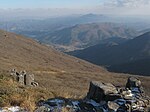 (weitere Bilder) | Mudeungsan UNESCO Global Geopark (Lage – Link) | 2018 | 1051 km² |
Thailand
| Bild | Bezeichnung | Jahr | Fläche | Anmerkungen |
|---|---|---|---|---|
 Nationalpark Mu Ko Phetra (weitere Bilder) | Satun UNESCO Global Geopark (Lage – Link) | 2018 | 2597 km² | umfasst den Nationalpark Mu Ko Phetra |
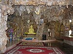 (weitere Bilder) | Khorat UNESCO Global Geopark (Lage – Link) | 2023 | 3167 km² |
Türkei
| Bild | Bezeichnung | Jahr | Fläche | Anmerkungen |
|---|---|---|---|---|
 Erdpyramiden im Park (weitere Bilder) | Kula-Salihli UNESCO Global Geopark (Lage – Link) | 2013 | 2320 km² | um den Vulkan Kula; 2020 von Kula Volcanic UNESCO Global Geopark umbenannt und erweitert |
Vietnam
| Bild | Bezeichnung | Jahr | Fläche | Anmerkungen |
|---|---|---|---|---|
 Gia-Long-Wasserfall | Dak Nong UNESCO Global Geopark (Lage – Link) | 4760 km² | ||
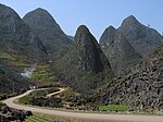 | Dong Van Karst Plateau UNESCO Global Geopark (Lage – Link) | 2010 | 2356 km² | Karstplateau Đồng Văn |
 | Non Nuoc Cao Bang UNESCO Global Geopark (Lage – Link) | 2018 | 3000 km² |
Volksrepublik China
Zypern
| Bild | Bezeichnung | Jahr | Fläche | Anmerkungen |
|---|---|---|---|---|
 (weitere Bilder) | Troodos UNESCO Global Geopark (Lage – Link) | 2015 | 1.147 km² | Ophiolithe und plutonische Gesteine im Troodos-Gebirge |
Weblinks
- List of UNESCO Global Geoparks auf der Website der UNESCO (englisch)
- Members list auf der Website des Global Geoparks Network (englisch)


