„Liste der Kategorie-A-Bauwerke in Aberdeen“ – Versionsunterschied
| [ungesichtete Version] | [gesichtete Version] |
Inhalt gelöscht Inhalt hinzugefügt
Semi-automated addition of image(s) and/or commonscat link(s) to monument list |
lf |
||
| (47 dazwischenliegende Versionen von 15 Benutzern werden nicht angezeigt) | |||
| Zeile 1: | Zeile 1: | ||
[[Datei:Aberdeen council.PNG|mini|Lage von Highland in Schottland]] |
|||
{{Use dmy dates|date=December 2016}} |
|||
Die '''Liste der Kategorie-A-Gebäude in Aberdeen''' umfasst sämtliche in der [[Statutory List of Buildings of Special Architectural or Historic Interest#Schottland|Kategorie A]] eingetragenen Baudenkmäler in der [[Schottland|schottischen]] [[Unitary Authority|Council Area]] [[Aberdeen]]. Die Einstufung wird anhand der Kriterien von [[Historic Scotland]] vorgenommen, wobei in die höchste Kategorie '''A''' Bauwerke von nationaler oder internationaler Bedeutung einsortiert sind. In Highland sind derzeit 69 Bauwerke in der Kategorie A gelistet. |
|||
{{Use British English|date=December 2016}} |
|||
[[File:Aberdeen council.PNG|thumb|Aberdeen shown within Scotland]] |
|||
{| class="wikitable sortable" style="text-align:left" |
|||
This is a list of [[listed building#Scotland|Category A]] [[listed building]]s in [[Aberdeen]], [[Scotland]]. |
|||
! Name !! Lage !! Typ !! Eintrag !! class="unsortable" | Bild |
|||
|- |
|||
In Scotland, the term listed building refers to a building or other structure officially designated as being of "special architectural or historic interest".<ref>{{cite book |url=http://www.historic-scotland.gov.uk/scotlands-listed-buildings.pdf |title=Guide to the Protection of Scotland's Listed Buildings |accessdate=2010-05-05 |last= |first= |coauthors= |year=2009 |work= |publisher=Historic Scotland |page=4 |isbn= 978-1-84917-013-0}}</ref> Category A structures are those considered to be "buildings of national or international importance, either architectural or historic, or fine little-altered examples of some particular period, style or building type."<ref>{{cite web |url=http://www.historic-scotland.gov.uk/index/heritage/historicandlistedbuildings/listing.htm |title=What is Listing? |accessdate=2010-05-05 |last= |first= |coauthors= |date= |work= |publisher=Historic Scotland }}</ref> Listing was begun by a provision in the Town and Country Planning (Scotland) Act 1947, and the current legislative basis for listing is the Planning (Listed Buildings and Conservation Areas) (Scotland) Act 1997.<ref name=shep>{{cite book |url=http://www.historic-scotland.gov.uk/shep.pdf |title=Scottish Historic Environment Policy |accessdate=2010-05-05 |last= |first= |coauthors= |date=October 2008 |publisher=Historic Scotland |pages=24–25 |isbn=978-1-84917-002-4}}</ref> The authority for listing rests with [[Historic Scotland]], an [[executive agency]] of the [[Scottish Government]], which inherited this role from the Scottish Development Department in 1991. Once listed, severe restrictions are imposed on the modifications allowed to a building's structure or its fittings. Listed building consent must be obtained from local authorities prior to any alteration to such a structure.<ref name=shep/> There are approximately 47,400 listed buildings in Scotland, of which around 8% (some 3,800) are Category A.<ref>''Guide to the Protection of Scotland's Listed Buildings'', p. 17.</ref> |
|||
|[[Lidell’s Monument]] |
|||
|{{Coordinate|text=DMS|NS=57/13/38.3/N|EW=2/13/5.4/W|type=building|region=GB-ABE|name=Lidell’s Monument}} |
|||
The [[subdivisions of Scotland|council area]] of [[Politics of Aberdeen|Aberdeen City]] covers {{convert|184.5|km2}}, and has a population of around 210,400. There are 68 Category A listed buildings in the area. Much of the [[architecture of Aberdeen]] is built in the distinctive local [[granite]], leading to the nickname, "The Granite City". During the first half of the 19th century, the most prominent architect in Aberdeen was [[Archibald Simpson]] (1790–1847), who completed many of the major public buildings in the city. Older buildings include the medieval [[Brig o' Balgownie]] and King's College Chapel, and the oldest town houses in the city: [[Provost Skene]]'s house (1545),<ref name=skene>{{cite web |url=http://hsewsf.sedsh.gov.uk/hslive/hsstart?P_HBNUM=20156|title=Broad Street (Formerly 45 Guestrow), Provost Skene's House And Archway On Front Boundary, Listed Building Report|publisher=Historic Scotland |accessdate=2010-07-14}}</ref> and [[Provost John Ross|Provost Ross]]' house (1593).<ref name=ross>{{cite web |url=http://hsewsf.sedsh.gov.uk/hslive/hsstart?P_HBNUM=20484|title=48 and 50 Shiprow, (Including Former House Of Provost Ross), Listed Building Report|publisher=Historic Scotland |accessdate=2010-07-14}}</ref> More recently, [[Robert Matthew|Sir Robert Matthew]]'s Crombie Halls of Residence at the University, completed in 1960, were listed at Category A in 2004.<ref name=Crombie>{{cite web |url=http://hsewsf.sedsh.gov.uk/hslive/hsstart?P_HBNUM=50016|title=Crombie Halls Of Residence, Meston Walk, Listed Building Report|publisher=Historic Scotland |accessdate=2010-07-14}}</ref> Other A-listed structures include a rare surviving [[turntable (rail)|locomotive turntable]],<ref name=turntable>{{cite web |url=http://hsewsf.sedsh.gov.uk/hslive/hsstart?P_HBNUM=43378|title=Polmuir Avenue, Ferryhill Motive Power Depot, Locomotive Turntable, Listed Building Report|publisher=Historic Scotland |accessdate=2010-07-14}}</ref> an early [[suspension bridge]] by [[Samuel Brown (Royal Navy officer)|Samuel Brown]],<ref name=wellington>{{cite web |url=http://hsewsf.sedsh.gov.uk/hslive/hsstart?P_HBNUM=20073|title=Wellington Suspension Bridge Over River Dee, At Craiglug, Listed Building Report|publisher=Historic Scotland |accessdate=2010-07-14}}</ref> the intact Victorian [[Tivoli Theatre (Aberdeen)|Tivoli Theatre]],<ref name=tivoli>{{cite web |url=http://hsewsf.sedsh.gov.uk/hslive/hsstart?P_HBNUM=20333|title=Guild Street And 1 Trinity Street, Tivoli Theatre, Listed Building Report|publisher=Historic Scotland |accessdate=2010-07-14}}</ref> and Scotland's oldest iron-framed mill building.<ref name=broadford>{{cite web |url=http://hsewsf.sedsh.gov.uk/hslive/hsstart?P_HBNUM=43908|title=Maberly Street, Broadford Works With Returns To Ann Street And Hutcheon Street, Listed Building Report|publisher=Historic Scotland |accessdate=2010-07-14}}</ref> |
|||
|Denkmal |
|||
|{{historic-scotland|typ=LB|ID=2230|kurz=ja}} |
|||
==Listed buildings == |
|||
|[[Datei:Lidell's Monument.JPG|150px|Lidell’s Monument]] |
|||
{{HS listed building header| council_iso = GB-ABE | council_area = [[Aberdeen]] | lb_type = Category A}} |
|||
|- |
|||
{{HS listed building row |
|||
|[[Culter House (Aberdeen)|Culter House]] |
|||
| hb = 2230 |
|||
|{{Coordinate|text=DMS|NS=57/6/9.8/N|EW=2/15/28.3/W|type=building|region=GB-ABE|name=Culter House}} |
|||
| name = Lidell's Monument |
|||
|Herrenhaus |
|||
| date_listed = 16 Apr 1971 |
|||
|{{historic-scotland|typ=LB|ID=15714|kurz=ja}} |
|||
| location = [[Dyce]] |
|||
|[[Datei:Culter House - geograph.org.uk - 359268.jpg|150px|Culter House]] |
|||
| notes = 17th-century monument to Duncan Lidell (1561–1613) |
|||
|- |
|||
| grid_ref = NJ8692515198 |
|||
|[[Grandholm Mill]] |
|||
| lat = 57.227327 |
|||
|{{Coordinate|text=DMS|NS=57/10/38.1/N|EW=2/7/28.3/W|type=building|region=GB-ABE|name=Grandholm Mill}} |
|||
| lon = -2.218189 |
|||
|Mühle |
|||
|image=Lidell's Monument.JPG |
|||
|{{historic-scotland|typ=LB|ID=18985|kurz=ja}} |
|||
|commonscat=Lidell's Monument, Aberdeen |
|||
|[[Datei:Grandholm Mill - geograph.org.uk - 1544118.jpg|150px|Grandholm Mill]] |
|||
}} |
|||
|- |
|||
{{HS listed building row |
|||
|[[St Nicholas Congregational Church]] |
|||
| hb = 2245 |
|||
|{{Coordinate|text=DMS|NS=57/8/49/N|EW=2/6/6.7/W|type=building|region=GB-ABE|name=St Nicholas Congregational Church}} |
|||
| name = Old Parish Church of Dyce with Churchyard Wall and Watchhouse |
|||
|Kirche |
|||
| date_listed = 16 Apr 1971 |
|||
|{{historic-scotland|typ=LB|ID=19937|kurz=ja}} |
|||
| location = [[Dyce]] |
|||
|[[Datei:Former Belmont Congregational Church, Belmont Street, Aberdeen (geograph 3391234).jpg|150px|St Nicholas Congregational Church]] |
|||
| notes = 13th/14th-century church, much altered |
|||
|- |
|||
| grid_ref = NJ8752715413 |
|||
|[[Triple Kirks]] |
|||
| lat = 57.229275 |
|||
|{{Coordinate|text=DMS|NS=57/8/51.4/N|EW=2/6/9.6/W|type=building|region=GB-ABE|name=Triple Kirks}} |
|||
| lon = -2.20823 |
|||
|Kirche |
|||
|image=Old Parish Church of Dyce.JPG |
|||
|{{historic-scotland|typ=LB|ID=19940|kurz=ja}} |
|||
|commonscat=Old Parish Church Of Dyce With Churchyard Wall And Watchhouse |
|||
|[[Datei:Triple Kirks from Union Terrace Gardens. - geograph.org.uk - 124721.jpg|150px|Triple Kirks]] |
|||
}} |
|||
|- |
|||
{{HS listed building row |
|||
|[[Greyfriars John Knox Church]] |
|||
| hb = 15714 |
|||
|{{Coordinate|text=DMS|NS=57/8/55.6/N|EW=2/5/45.6/W|type=building|region=GB-ABE|name=Greyfriars John Knox Church}} |
|||
| name = Culter House (St. Margaret's School for Girls Boarding House) |
|||
|Kirche |
|||
| date_listed = 16 Apr 1971 |
|||
|{{historic-scotland|typ=LB|ID=19941|kurz=ja}} |
|||
| location = [[Peterculter]] |
|||
|[[Datei:Greyfriars Kirk 2022.jpg|150px|Greyfriars John Knox Church]] |
|||
| notes = 17th-century country house |
|||
|- |
|||
| grid_ref = NJ8448001343 |
|||
|[[King’s College Chapel]] |
|||
| lat = 57.102792 |
|||
|{{Coordinate|text=DMS|NS=57/9/51.1/N|EW=2/6/4.5/W|type=building|region=GB-ABE|name=King’s College Chapel}} |
|||
| lon = -2.257815 |
|||
|Kirche |
|||
|image=The front view of Culter House - geograph.org.uk - 614868.jpg |
|||
|{{historic-scotland|typ=LB|ID=19943|kurz=ja}} |
|||
|commonscat=Culter House |
|||
|[[Datei:AberdeenKingsCollegeChapel 2013-08.jpg|150px|King’s College Chapel]] |
|||
}} |
|||
|- |
|||
{{HS listed building row |
|||
|[[North Church (Aberdeen)|North Church]] |
|||
| hb = 15733 |
|||
|{{Coordinate|text=DMS|NS=57/8/57.9/N|EW=2/5/38.3/W|type=building|region=GB-ABE|name=North Church}} |
|||
| name = [[Shakkin' Briggie]] (St. Devenick's Bridge, Morrison's Bridge) |
|||
|Kirche |
|||
| date_listed = 16 Apr 1971 |
|||
|{{historic-scotland|typ=LB|ID=19946|kurz=ja}} |
|||
| location = [[Cults, Aberdeenshire|Cults]] |
|||
|[[Datei:Aberdeen Arts Centre - geograph.org.uk - 849835.jpg|150px|North Church]] |
|||
| notes = Suspension footbridge of 1837 |
|||
|- |
|||
| grid_ref = NJ8977002609 |
|||
|[[Queen’s Cross Church (Aberdeen)|Queen’s Cross Church]] |
|||
| lat = 57.114314 |
|||
|{{Coordinate|text=DMS|NS=57/8/35.9/N|EW=2/7/29.9/W|type=building|region=GB-ABE|name=Queen’s Cross Church}} |
|||
| lon = -2.170548 |
|||
|Kirche |
|||
| image = SkakkinBriggie-68509-PeterWard.jpg |
|||
|{{historic-scotland|typ=LB|ID=19948|kurz=ja}} |
|||
|commonscat=Shakkin Briggie |
|||
|[[Datei:Queens Cross Church - Dec 2009 - geograph.org.uk - 1709723.jpg|150px|Queen’s Cross Church]] |
|||
}} |
|||
|- |
|||
{{HS listed building row |
|||
|[[St Andrew’s Cathedral (Aberdeen)|St Andrew’s Cathedral]] |
|||
| hb = 18985 |
|||
|{{Coordinate|text=DMS|NS=57/8/56.7/N|EW=2/5/35.3/W|type=building|region=GB-ABE|name=St Andrew’s Cathedral}} |
|||
| name = Grandholm Works, Old Spinning Mill, Wing Mill, Engine and Turbine Houses |
|||
|Kirche |
|||
| date_listed = 25 Nov 1991 |
|||
|{{historic-scotland|typ=LB|ID=19953|kurz=ja}} |
|||
| location = Grandholm Drive |
|||
|[[Datei:St Andrews Cathedral, King Street, Aberdeen (geograph 3937912).jpg|150px|St Andrew’s Cathedral]] |
|||
| notes = 18th- and 19th-century textile mill, the largest vertically integrated tweed mill in Scotland |
|||
|- |
|||
| grid_ref = NJ9257009602 |
|||
|[[St Machar’s Cathedral]] |
|||
| lat = 57.177186 |
|||
|{{Coordinate|text=DMS|NS=57/10/11.4/N|EW=2/6/8.5/W|type=building|region=GB-ABE|name=St Machar’s Cathedral}} |
|||
| lon = -2.124527 |
|||
|Kirche |
|||
|image=Grandholm Mill - geograph.org.uk - 1544118.jpg |
|||
|{{historic-scotland|typ=LB|ID=19957|kurz=ja}} |
|||
|commonscat=Grandholm Works, Old Machar, Aberdeen |
|||
|[[Datei:St Machar's cathedral with watch house - geograph.org.uk - 174651.jpg|150px|St Machar’s Cathedral]] |
|||
}} |
|||
|- |
|||
{{HS listed building row |
|||
|[[St Margaret of Scotland Chapel]] |
|||
| hb = 19937 |
|||
|{{Coordinate|text=DMS|NS=57/9/26.7/N|EW=2/5/59.2/W|type=building|region=GB-ABE|name=St Margaret of Scotland Chapel}} |
|||
| name = Former St Nicholas Congregational Church |
|||
|Kirche |
|||
| date_listed = 12 Jan 1967 |
|||
|{{historic-scotland|typ=LB|ID=19961|kurz=ja}} |
|||
| location = [[Belmont Street (Aberdeen)|Belmont Street]] |
|||
|[[Datei:Former St Margaret's Episcopal Convent, Aberdeen (geograph 4363172).jpg|150px|St Margaret of Scotland Chapel]] |
|||
| notes = 1865 Romanesque chapel |
|||
|- |
|||
| grid_ref = NJ9394506236 |
|||
|[[St Mary’s Church (Aberdeen, episkopal)|St Mary’s Church]] |
|||
| lat = 57.14697 |
|||
|{{Coordinate|text=DMS|NS=57/8/40/N|EW=2/7/10.5/W|type=building|region=GB-ABE|name=St Mary’s Church}} |
|||
| lon = -2.101702 |
|||
|Kirche |
|||
| image = Geograph-3391234-by-Bill-Harrison.jpg |
|||
|{{historic-scotland|typ=LB|ID=19964|kurz=ja}} |
|||
|commonscat=Former St Nicholas Church, Aberdeen |
|||
|[[Datei:St Mary's Scottish Episcopal Church (The Tartan Kirkie) (geograph 3387833).jpg|150px|St Mary’s Church]] |
|||
}} |
|||
|- |
|||
{{HS listed building row |
|||
|[[Kirk of St Nicholas]] |
|||
| hb = 19940 |
|||
|{{Coordinate|text=DMS|NS=57/8/51.1/N|EW=2/5/57.9/W|type=building|region=GB-ABE|name=Kirk of St Nicholas}} |
|||
| name = Former Triple Kirks (East and Belmont Church and Albion and St Paul's Church) |
|||
|Kirche |
|||
| date_listed = 12 Jan 1967 |
|||
|{{historic-scotland|typ=LB|ID=19966|kurz=ja}} |
|||
| location = 69-71 Schoolhill |
|||
|[[Datei:St Nicholas Kirk - geograph.org.uk - 1241540.jpg|150px|Kirk of St Nicholas]] |
|||
| notes = Remains of three conjoined Gothic churches, 1844 by [[Archibald Simpson]] |
|||
|- |
|||
| grid_ref = NJ9387506307 |
|||
|[[Kirk of St Nicholas|Friedhof der Kirk of St Nicholas]] |
|||
| lat = 57.147607 |
|||
|{{Coordinate|text=DMS|NS=57/8/49.3/N|EW=2/5/58.3/W|type=building|region=GB-ABE|name=Friedhof der Kirk of St Nicholas}} |
|||
| lon = -2.10286 |
|||
|Friedhof |
|||
| image = Geograph-3666612-by-Bill-Harrison.jpg |
|||
|{{historic-scotland|typ=LB|ID=19967|kurz=ja}} |
|||
|commonscat=Triple Kirks |
|||
|[[Datei:Aberdeen-176-St Nicholas-Kirkyard-2009-gje.jpg|150px|Friedhof der Kirk of St Nicholas]] |
|||
}} |
|||
|- |
|||
{{HS listed building row |
|||
|[[Advocates’ Hall]] |
|||
| hb = 19941 |
|||
|{{Coordinate|text=DMS|NS=57/8/53.7/N|EW=2/5/42.5/W|type=building|region=GB-ABE|name=Advocates’ Hall}} |
|||
| name = Greyfriars Church |
|||
|Versammlungsgebäude |
|||
| date_listed = 12 Jan 1967 |
|||
|{{historic-scotland|typ=LB|ID=19977|kurz=ja}} |
|||
| location = Broad Street |
|||
|[[Datei:Advocates' Hall, Concert Court, Aberdeen.jpg|150px|Advocates’ Hall]] |
|||
| notes = Gothic church of 1903 by [[Alexander Marshall Mackenzie]] |
|||
|- |
|||
| grid_ref = NJ9429006424 |
|||
|[[Aberdeen Art Gallery]] und [[Cowdray Hall]] |
|||
| lat = 57.148663 |
|||
|{{Coordinate|text=DMS|NS=57/8/53.3/N|EW=2/6/9.5/W|type=building|region=GB-ABE|name=Aberdeen Art Gallery}} |
|||
| lon = -2.096004 |
|||
|Konzerthalle, Kunstgalerie |
|||
| image = Greyfriars (John Knox) Kirk, Broad Street, Aberdeen.jpg |
|||
|{{historic-scotland|typ=LB|ID=19978|kurz=ja}} |
|||
|commonscat=Greyfriars John Knox Church |
|||
|[[Datei:Aberdeen war memorial (geograph 3397704).jpg|150px|Cowdray Hall]] |
|||
}} |
|||
|- |
|||
{{HS listed building row |
|||
|[[35 Regent Quay]] |
|||
| hb = 19943 |
|||
|{{Coordinate|text=DMS|NS=57/8/47.4/N|EW=2/5/28.1/W|type=building|region=GB-ABE|name=35 Regent Quay}} |
|||
| name = [[King's College, Aberdeen#King's College Chapel|Kings College Chapel]] |
|||
|Wohngebäude |
|||
| date_listed = 12 Jan 1967 |
|||
|{{historic-scotland|typ=LB|ID=19982|kurz=ja}} |
|||
| location = College Bounds, [[Old Aberdeen]] |
|||
|[[Datei:Custom House, 35 Regent Quay, Aberdeen (geograph 3461554).jpg|150px|35 Regent Quay]] |
|||
| notes = Chapel, begun 1500 |
|||
|- |
|||
| grid_ref = NJ9395608149 |
|||
|[[27–31 King Street (Aberdeen)|27–31 King Street]] |
|||
| lat = 57.164155 |
|||
|{{Coordinate|text=DMS|NS=57/8/56.3/N|EW=2/5/37.9/W|type=building|region=GB-ABE|name=27–31 King Street}} |
|||
| lon = -2.101567 |
|||
|Versammlungshalle, Wohngebäude |
|||
| image = Kings College Chapel, 2003.JPG |
|||
|{{historic-scotland|typ=LB|ID=19983|kurz=ja}} |
|||
|commonscat=King's College Chapel, Aberdeen |
|||
|[[Datei:29 King Street, Aberdeen (geograph 3873806).jpg|150px|27–31 King Street]] |
|||
}} |
|||
|- |
|||
{{HS listed building row |
|||
|[[Aberdeen Town House]] |
|||
| hb = 19946 |
|||
|{{Coordinate|text=DMS|NS=57/8/53.1/N|EW=2/5/40.9/W|type=building|region=GB-ABE|name=Aberdeen Town House}} |
|||
| name = [[Aberdeen Arts Centre]] |
|||
|Rathaus |
|||
| date_listed = 12 Jan 1967 |
|||
|{{historic-scotland|typ=LB|ID=19990|kurz=ja}} |
|||
| location = King Street |
|||
|[[Datei:Town House, Municipal Offices and Court Houses in Aberdeen.jpg|150px|Aberdeen Town House]] |
|||
| notes = Greek-revival style former church of 1830 by [[John Smith (architect)|John Smith]] |
|||
|- |
|||
| grid_ref = NJ9440906519 |
|||
|[[Music Hall (Aberdeen)|Music Hall]] |
|||
| lat = 57.149518 |
|||
|{{Coordinate|text=DMS|NS=57/8/43.2/N|EW=2/6/17.4/W|type=building|region=GB-ABE|name=Music Hall}} |
|||
| lon = -2.09404 |
|||
|Konzerthalle |
|||
| image = ArtsCentre-271096-Colin Smith.jpg |
|||
|{{historic-scotland|typ=LB|ID=19991|kurz=ja}} |
|||
|commonscat=Aberdeen Arts Centre |
|||
|[[Datei:Facade of the Music Hall, Aberdeen (geograph 3110454).jpg|150px|Music Hall]] |
|||
}} |
|||
|- |
|||
{{HS listed building row |
|||
|[[Altes Rathaus (Aberdeen)|Altes Rathaus von Aberdeen]] |
|||
| hb = 19948 |
|||
|{{Coordinate|text=DMS|NS=57/10/1.6/N|EW=2/6/8.1/W|type=building|region=GB-ABE|name=Altes Rathaus von Aberdeen}} |
|||
| name = [[Queen's Cross Church, Aberdeen|Queen's Cross Church]] |
|||
|Rathaus |
|||
| date_listed = 12 Jan 1967 |
|||
|{{historic-scotland|typ=LB|ID=19992|kurz=ja}} |
|||
| location = Carden Place |
|||
|[[Datei:The Town House, Old Aberdeen - geograph.org.uk - 320069.jpg|150px|Altes Rathaus von Aberdeen]] |
|||
| notes = Idiosyncratic Victorian Gothic church of 1881 by John Bridgeford Pirie of Pirie and Clyne |
|||
|- |
|||
| grid_ref = NJ9253705828 |
|||
|[[Aberdeen Royal Infirmary|Simpson Pavilion]] |
|||
| lat = 57.143284 |
|||
|{{Coordinate|text=DMS|NS=57/8/56.5/N|EW=2/6/20.2/W|type=building|region=GB-ABE|name=Simpson Pavilion}} |
|||
| lon = -2.124958 |
|||
|Krankenhaus |
|||
| image = Geograph-3794079-by-Bill-Harrison.jpg |
|||
|{{historic-scotland|typ=LB|ID=19995|kurz=ja}} |
|||
| commonscat = Queen's Cross Church, Aberdeen |
|||
|[[Datei:Aberdeen Royal Infirmary (Woolmanhill).jpg|150px|Simpson Pavilion]] |
|||
}} |
|||
|- |
|||
{{HS listed building row |
|||
|[[Marktkreuz (Aberdeen)|Marktkreuz von Aberdeen]] |
|||
| hb = 19953 |
|||
|{{Coordinate|text=DMS|NS=57/8/53.8/N|EW=2/5/33.4/W|type=building|region=GB-ABE|name=Marktkreuz von Aberdeen}} |
|||
| name = [[St Andrew's Cathedral, Aberdeen|St. Andrew's (Episcopal) Cathedral]] |
|||
|Marktkreuz |
|||
| date_listed = 12 Jan 1967 |
|||
|{{historic-scotland|typ=LB|ID=19999|kurz=ja}} |
|||
| location = King Street |
|||
|[[Datei:Aberdeen05LB.jpg|150px|Marktkreuz von Aberdeen]] |
|||
| notes = Gothic cathedral of 1817 by [[Archibald Simpson]] |
|||
|- |
|||
| grid_ref = NJ9447306471 |
|||
|[[King’s College Chapel|Bishop Elphinstone Monument]] |
|||
| lat = 57.149088 |
|||
|{{Coordinate|text=DMS|NS=57/9/51/N|EW=2/6/6.4/W|type=building|region=GB-ABE|name=Bishop Elphinstone Monument}} |
|||
| lon = -2.092981 |
|||
|Denkmal |
|||
| image = Aberdeen, St. Andrew's Cathedral - geograph.org.uk - 598057.jpg |
|||
|{{historic-scotland|typ=LB|ID=20005|kurz=ja}} |
|||
|commonscat=St Andrew's Cathedral, Aberdeen |
|||
|[[Datei:The empty tomb - geograph.org.uk - 1075681.jpg|150px|Bishop Elphinstone Monument]] |
|||
}} |
|||
|- |
|||
{{HS listed building row |
|||
|[[Victoria Park (Aberdeen)|Brunnen im Victoria Park]] |
|||
| hb = 19957 |
|||
|{{Coordinate|text=DMS|NS=57/9/6.9/N|EW=2/7/20.1/W|type=building|region=GB-ABE|name=Brunnen im Victoria Park}} |
|||
| name = [[St Machar's Cathedral]] |
|||
|Brunnen |
|||
| date_listed = 12 Jan 1967 |
|||
|{{historic-scotland|typ=LB|ID=20065|kurz=ja}} |
|||
| location = The Chanonry |
|||
|[[Datei:Fountain, Victoria Park, Aberdeen (geograph 2821870).jpg|150px|Brunnen im Victoria Park]] |
|||
| notes = 14th century with later additions and alterations |
|||
|- |
|||
| grid_ref = NJ9392008785 |
|||
|[[Brig o’ Balgownie]] |
|||
| lat = 57.169867 |
|||
|{{Coordinate|text=DMS|NS=57/10/38.2/N|EW=2/5/54.9/W|type=building|region=GB-ABE|name=Brig o’ Balgownie}} |
|||
| lon = -2.102178 |
|||
|Brücke |
|||
| image = St Machar's cathedral with watch house - geograph.org.uk - 174651.jpg |
|||
|{{historic-scotland|typ=LB|ID=20067|kurz=ja}} |
|||
| commonscat = St. Machar's Cathedral |
|||
|[[Datei:BrigoBalgownie-ds.jpg|150px|Brig o’ Balgownie]] |
|||
}} |
|||
|- |
|||
{{HS listed building row |
|||
|[[Bridge of Dee (Brücke)|Bridge of Dee]] |
|||
| hb = 19961 |
|||
|{{Coordinate|text=DMS|NS=57/7/22.4/N|EW=2/7/8/W|type=building|region=GB-ABE|name=Bridge of Dee}} |
|||
| name = [[St Margaret of Scotland, Aberdeen|Episcopal Convent and Chapel of St. Margaret of Scotland]] |
|||
|Brücke |
|||
| date_listed = 12 Jan 1967 |
|||
|{{historic-scotland|typ=LB|ID=20068|kurz=ja}} |
|||
| location = 17 Spital |
|||
|[[Datei:Bridge of Dee Aberdeen.jpg|150px|Bridge of Dee]] |
|||
| notes = Gothic complex by [[Ninian Comper]], 1898 |
|||
|- |
|||
| grid_ref = NJ9405607407 |
|||
|[[Wellington Suspension Bridge]] |
|||
| lat = 57.157491 |
|||
|{{Coordinate|text=DMS|NS=57/8/8.1/N|EW=2/5/44/W|type=building|region=GB-ABE|name=Wellington Suspension Bridge}} |
|||
| lon = -2.099896 |
|||
|Brücke |
|||
|image=Geograph-4363172-by-Bill-Harrison.jpg |
|||
|{{historic-scotland|typ=LB|ID=20073|kurz=ja}} |
|||
| commonscat = |
|||
|[[Datei:Wellington Suspension Bridge - geograph.org.uk - 1445265.jpg|150px|Wellington Suspension Bridge]] |
|||
}} |
|||
|- |
|||
{{HS listed building row |
|||
|[[Girdleness Lighthouse]] |
|||
| hb = 19964 |
|||
|{{Coordinate|text=DMS|NS=57/8/20.5/N|EW=2/2/54.9/W|type=building|region=GB-ABE|name=Girdleness Lighthouse}} |
|||
| name = St Mary's Church (Episcopal) |
|||
|Leuchtturm |
|||
| date_listed = 12 Jan 1967 |
|||
|{{historic-scotland|typ=LB|ID=20078|kurz=ja}} |
|||
| location = Carden Place |
|||
|[[Datei:Girdle Ness Lighthouse (geograph 5917973).jpg|150px|Girdleness Lighthouse]] |
|||
| notes = Victorian Gothic church of 1864 |
|||
|- |
|||
| grid_ref = NJ9286605949 |
|||
|[[Old Town’s School]] |
|||
| lat = 57.144376 |
|||
|{{Coordinate|text=DMS|NS=57/8/49.5/N|EW=2/6/3.4/W|type=building|region=GB-ABE|name=Old Town’s School}} |
|||
| lon = -2.119525 |
|||
|Schulgebäude |
|||
| image = Geograph-3387833-by-Bill-Harrison.jpg |
|||
|{{historic-scotland|typ=LB|ID=20082|kurz=ja}} |
|||
|commonscat=St Mary's Church, Aberdeen |
|||
|[[Datei:Town School, Little Belmont Street - geograph.org.uk - 742861.jpg|150px|Old Town’s School]] |
|||
}} |
|||
|- |
|||
{{HS listed building row |
|||
|[[Robert Gordon’s College]] |
|||
| hb = 19966 |
|||
|{{Coordinate|text=DMS|NS=57/8/57.6/N|EW=2/6/9.9/W|type=building|region=GB-ABE|name=Robert Gordon’s College}} |
|||
| name = [[Kirk of St Nicholas, Aberdeen|St. Nicholas' Church]] |
|||
|Schulgebäude |
|||
| date_listed = 12 Jan 1967 |
|||
|{{historic-scotland|typ=LB|ID=20088|kurz=ja}} |
|||
| location = Union Street |
|||
|[[Datei:Robert Gordon's College - geograph.org.uk - 282930.jpg|150px|Robert Gordon’s College]] |
|||
| notes = Medieval church, extensively rebuilt by [[James Gibbs]] in 1755 and [[Archibald Simpson]] in 1837 |
|||
|- |
|||
| grid_ref = NJ9407306302 |
|||
|[[University of Aberdeen|Marischal College]] |
|||
| lat = 57.147565 |
|||
|{{Coordinate|text=DMS|NS=57/8/57.6/N|EW=2/6/46.9/W|type=building|region=GB-ABE|name=Marischal College}} |
|||
| lon = -2.099588 |
|||
|Schulgebäude |
|||
| image = St Nicholas Kirk.jpg |
|||
|{{historic-scotland|typ=LB|ID=20096|kurz=ja}} |
|||
| commonscat = |
|||
|[[Datei:DSCN3828 Marischal College.jpg|150px|Marischal College]] |
|||
}} |
|||
|- |
|||
{{HS listed building row |
|||
|[[Devanha House]] |
|||
| hb = 19967 |
|||
|{{Coordinate|text=DMS|NS=57/8/10.2/N|EW=2/6/8.2/W|type=building|region=GB-ABE|name=Devanha House}} |
|||
| name = [[Kirk of St Nicholas, Aberdeen|St. Nicholas' Church Churchyard]] |
|||
|Villa |
|||
| date_listed = 12 Jan 1967 |
|||
|{{historic-scotland|typ=LB|ID=20098|kurz=ja}} |
|||
| location = Union Street, 9 Back Wynd, Schoolhill and Correction Wynd |
|||
|[[Datei:Devanah House, Ferryhill, Aberdeen.jpg|150px|Devanha House]] |
|||
| notes = Graveyard dating from the 16th century, with monuments from the 17th century onward |
|||
|- |
|||
| grid_ref = NJ9408606184 |
|||
|[[Westburn House]] |
|||
| lat = 57.146505 |
|||
|{{Coordinate|text=DMS|NS=57/9/15.5/N|EW=2/7/21.7/W|type=building|region=GB-ABE|name=Westburn House}} |
|||
| lon = -2.09937 |
|||
|Villa |
|||
| image = Graveyard at St Nicholas Church - geograph.org.uk - 650093.jpg |
|||
|{{historic-scotland|typ=LB|ID=20108|kurz=ja}} |
|||
|commonscat=St Nicholas Kirk, Aberdeen |
|||
|[[Datei:Westburn House, Westburn Park, Aberdeen.jpg|150px|Westburn House]] |
|||
}} |
|||
|- |
|||
{{HS listed building row |
|||
|[[Provost Skene’s House]] |
|||
| hb = 19977 |
|||
|{{Coordinate|text=DMS|NS=57/8/53.9/N|EW=2/5/51.1/W|type=building|region=GB-ABE|name=Provost Skene’s House}} |
|||
| name = Advocates' Hall Concert Court |
|||
|Villa |
|||
| date_listed = 19 Mar 1984 |
|||
|{{historic-scotland|typ=LB|ID=20156|kurz=ja}} |
|||
| location = Broad Street |
|||
|[[Datei:Provost Skene's House, Aberdeen - geograph.org.uk - 1548669.jpg|150px|Provost Skene’s House]] |
|||
| notes = Classical hall by James Matthews, 1869 |
|||
|- |
|||
| grid_ref = NJ9434306375 |
|||
|[[5 Castle Street (Aberdeen)|5 Castle Street]] |
|||
| lat = 57.148224 |
|||
|{{Coordinate|text=DMS|NS=57/8/53.4/N|EW=2/5/37.1/W|type=building|region=GB-ABE|name=5 Castle Street}} |
|||
| lon = -2.095127 |
|||
|Geschäftsgebäude |
|||
|image=Advocates' Hall, Concert Court, Aberdeen.jpg |
|||
|{{historic-scotland|typ=LB|ID=20162|kurz=ja}} |
|||
|commonscat=Concert Court, Aberdeen |
|||
|[[Datei:Archie's, Aberdeen.jpg|150px|5 Castle Street]] |
|||
}} |
|||
|- |
|||
{{HS listed building row |
|||
|[[53 Castle Street (Aberdeen)|53 Castle Street]] |
|||
| hb = 19978 |
|||
|{{Coordinate|text=DMS|NS=57/8/51.7/N|EW=2/5/36.9/W|type=building|region=GB-ABE|name=53 Castle Street}} |
|||
| name = [[Aberdeen Art Gallery]], War Memorial and Cowdray Hall, (Robert Gordon's Institute Of Technology) |
|||
|Öffentliches Gebäude |
|||
| date_listed = 12 Jan 1967 |
|||
|{{historic-scotland|typ=LB|ID=20174|kurz=ja}} |
|||
| location = 78 Schoolhill |
|||
|[[Datei:Aberdeen High Court, Castle Street, Aberdeen (geograph 4127694).jpg|150px|53 Castle Street]] |
|||
| notes = Renaissance-style gallery by [[Alexander Marshall Mackenzie]] 1885, war memorial added 1925 |
|||
|- |
|||
| grid_ref = NJ9388406372 |
|||
|[[Mitchell Hospital]] |
|||
| lat = 57.148191 |
|||
|{{Coordinate|text=DMS|NS=57/10/7.7/N|EW=2/6/13.1/W|type=building|region=GB-ABE|name=Mitchell Hospital}} |
|||
| lon = -2.102713 |
|||
|Armenhaus |
|||
| image = Aberdeen Art Gallery.jpg |
|||
|{{historic-scotland|typ=LB|ID=20186|kurz=ja}} |
|||
| commonscat = Aberdeen Art Gallery |
|||
|[[Datei:Aberdeen, Mitchell's Hospital - geograph.org.uk - 597969.jpg|150px|Mitchell Hospital]] |
|||
}} |
|||
|- |
|||
{{HS listed building row |
|||
|[[Bede House]] |
|||
| hb = 19982 |
|||
|{{Coordinate|text=DMS|NS=57/10/3.3/N|EW=2/6/6.1/W|type=building|region=GB-ABE|name=Bede House}} |
|||
| name = Custom House |
|||
|Wohngebäude |
|||
| date_listed = 26 May 1977 |
|||
|{{historic-scotland|typ=LB|ID=20288|kurz=ja}} |
|||
| location = 35 Regent Quay |
|||
|[[Datei:Bede House 2010 a.jpg|150px|Bede House]] |
|||
| notes = 18th-century Georgian townhouse |
|||
|- |
|||
| grid_ref = NJ9458806185 |
|||
|[[Cruickshank’s Lodgings]] |
|||
| lat = 57.14652 |
|||
|{{Coordinate|text=DMS|NS=57/10/38.9/N|EW=2/6/1.7/W|type=building|region=GB-ABE|name=Cruickshank’s Lodgings}} |
|||
| lon = -2.091074 |
|||
|Wohngebäude |
|||
| image = Geograph-3461554-by-Bill-Harrison.jpg |
|||
|{{historic-scotland|typ=LB|ID=20299|kurz=ja}} |
|||
|commonscat=Custom House, Aberdeen |
|||
|[[Datei:Cruickshank's Lodgings, Don Street, Old Aberdeen (geograph 3924525).jpg|150px|Cruickshank’s Lodgings]] |
|||
}} |
|||
|- |
|||
{{HS listed building row |
|||
|[[Northern Hotel]] |
|||
| hb = 19983 |
|||
|{{Coordinate|text=DMS|NS=57/9/43.8/N|EW=2/6/59.4/W|type=building|region=GB-ABE|name=Northern Hotel}} |
|||
| name = [[Aberdeen Medico-Chirurgical Society|Medico-Chirurgical Hall]] and County Record Office |
|||
|Hotel |
|||
| date_listed = 26 May 1977 |
|||
|{{historic-scotland|typ=LB|ID=20331|kurz=ja}} |
|||
| location = 27, 29, 31 King Street |
|||
|[[Datei:Northern Hotel - geograph.org.uk - 918018.jpg|150px|Northern Hotel]] |
|||
| notes = Three conjoined buildings comprising Medico-Chirurgical Hall by [[Archibald Simpson]] (1820), County Record Office by [[John Smith (architect)|John Smith]] (1823), and house of 1840 |
|||
|- |
|||
| grid_ref = NJ9441906457 |
|||
|[[Tivoli Theatre (Aberdeen)|Tivoli Theatre]] |
|||
| lat = 57.148961 |
|||
|{{Coordinate|text=DMS|NS=57/8/42.3/N|EW=2/5/51.3/W|type=building|region=GB-ABE|name=Tivoli Theatre}} |
|||
| lon = -2.093873 |
|||
|Theatergebäude |
|||
| image = Geograph-3873806-by-Bill-Harrison.jpg |
|||
|{{historic-scotland|typ=LB|ID=20333|kurz=ja}} |
|||
|commonscat=27,29,31 King Street, Aberdeen |
|||
|[[Datei:Tivoli Theatre - geograph.org.uk - 886898.jpg|150px|Tivoli Theatre]] |
|||
}} |
|||
|- |
|||
{{HS listed building row |
|||
|[[62 Hamilton Place]] |
|||
| hb = 19990 |
|||
|{{Coordinate|text=DMS|NS=57/8/52.3/N|EW=2/7/35.3/W|type=building|region=GB-ABE|name=62 Hamilton Place}} |
|||
| name = Town House, including Municipal Offices, Court Houses and [[The Tolbooth|Tolbooth]] |
|||
|Villa |
|||
| date_listed = 12 Jan 1967 |
|||
|{{historic-scotland|typ=LB|ID=20334|kurz=ja}} |
|||
| location = Castle Street |
|||
|[[Datei:62, 62a and 62b Hamilton Place, Aberdeen.jpg|150px|62 Hamilton Place]] |
|||
| notes = 17th-century tolbooth, with 19th-century offices by Peddie & Kinnear |
|||
|- |
|||
| grid_ref = NJ9437006358 |
|||
|[[64–66 Hamilton Place]] |
|||
| lat = 57.148071 |
|||
|{{Coordinate|text=DMS|NS=57/8/52/N|EW=2/7/36.4/W|type=building|region=GB-ABE|name=64–66 Hamilton Place}} |
|||
| lon = -2.094681 |
|||
|Villa |
|||
| image = Town House, Municipal Offices and Court Houses in Aberdeen.jpg |
|||
|{{historic-scotland|typ=LB|ID=20335|kurz=ja}} |
|||
|commonscat=Aberdeen Town House |
|||
|[[Datei:64-66b Hamilton Place, Aberdeen (geograph 3907150).jpg|150px|64–66 Hamilton Place]] |
|||
}} |
|||
|- |
|||
{{HS listed building row |
|||
|[[68–70 Hamilton Place]] |
|||
| hb = 19991 |
|||
|{{Coordinate|text=DMS|NS=57/8/51.7/N|EW=2/7/37.7/W|type=building|region=GB-ABE|name=68–70 Hamilton Place}} |
|||
| name = [[Music Hall Aberdeen|Music Hall]] |
|||
|Villa |
|||
| date_listed = 28 Feb 1962 |
|||
|{{historic-scotland|typ=LB|ID=20336|kurz=ja}} |
|||
| location = 174-194 [[Union Street, Aberdeen|Union Street]] |
|||
|[[Datei:68, 68A and 70 Hamilton Place, Aberdeen.jpg|150px|68–70 Hamilton Place]] |
|||
| notes = Greek-revival hall by [[Archibald Simpson]], 1820 |
|||
|- |
|||
| grid_ref = NJ9374506064 |
|||
|[[72 Hamilton Place]] |
|||
| lat = 57.145422 |
|||
|{{Coordinate|text=DMS|NS=57/8/51.4/N|EW=2/7/38.6/W|type=building|region=GB-ABE|name=72 Hamilton Place}} |
|||
| lon = -2.105002 |
|||
|Villa |
|||
| image = Geograph-3110454-by-Bill-Harrison.jpg |
|||
|{{historic-scotland|typ=LB|ID=20337|kurz=ja}} |
|||
|commonscat=Music Hall, Aberdeen |
|||
|[[Datei:72 Hamilton Place, Aberdeen.JPG|150px|72 Hamilton Place]] |
|||
}} |
|||
|- |
|||
{{HS listed building row |
|||
|[[74–76 Hamilton Place]] |
|||
| hb = 19992 |
|||
|{{Coordinate|text=DMS|NS=57/8/51.1/N|EW=2/7/39.6/W|type=building|region=GB-ABE|name=74–76 Hamilton Place}} |
|||
| name = Old Aberdeen Town House |
|||
|Villa |
|||
| date_listed = 12 Jan 1967 |
|||
|{{historic-scotland|typ=LB|ID=20338|kurz=ja}} |
|||
| location = High Street, [[Old Aberdeen]] |
|||
|[[Datei:74 and 76 Hamilton Place, Aberdeen.jpg|150px|74–76 Hamilton Place]] |
|||
| notes = 18th-century town hall |
|||
|- |
|||
| grid_ref = NJ9391508479 |
|||
|[[78–80 Hamilton Place]] |
|||
| lat = 57.167118 |
|||
|{{Coordinate|text=DMS|NS=57/8/50.9/N|EW=2/7/40.6/W|type=building|region=GB-ABE|name=78–80 Hamilton Place}} |
|||
| lon = -2.102253 |
|||
|Villa |
|||
| image = Old Aberdeen Town House, 2003.JPG |
|||
|{{historic-scotland|typ=LB|ID=20339|kurz=ja}} |
|||
|commonscat=Old Town House, Aberdeen |
|||
|[[Datei:78 and 80 Hamilton Place, Aberdeen (geograph 3890292).jpg|150px|78–80 Hamilton Place]] |
|||
}} |
|||
|- |
|||
{{HS listed building row |
|||
|[[82–84 Hamilton Place]] |
|||
| hb = 19995 |
|||
|{{Coordinate|text=DMS|NS=57/8/50.6/N|EW=2/7/41.6/W|type=building|region=GB-ABE|name=82–84 Hamilton Place}} |
|||
| name = [[Woolmanhill Hospital]] |
|||
|Villa |
|||
| date_listed = 25 May 1977 |
|||
|{{historic-scotland|typ=LB|ID=20340|kurz=ja}} |
|||
| location = Woolmanhill |
|||
|[[Datei:82, 82a and 84 Hamilton Place, Aberdeen (geograph 3890205).jpg|150px|82–84 Hamilton Place]] |
|||
| notes = Neoclassical hospital of 1840 by [[Archibald Simpson]], later 19th-century additions |
|||
|- |
|||
| grid_ref = NJ9371006470 |
|||
|[[86–88 Hamilton Place]] |
|||
| lat = 57.149069 |
|||
|{{Coordinate|text=DMS|NS=57/8/50.4/N|EW=2/7/42.6/W|type=building|region=GB-ABE|name=86–88 Hamilton Place}} |
|||
| lon = -2.105591 |
|||
|Villa |
|||
| image = Aberdeen Royal Infirmary (Woolmanhill).jpg |
|||
|{{historic-scotland|typ=LB|ID=20341|kurz=ja}} |
|||
|commonscat=Simpson Pavilion, Woolmanhill, Aberdeen |
|||
|[[Datei:86-88a Hamilton Place, Aberdeen.jpg|150px|86–88 Hamilton Place]] |
|||
}} |
|||
|- |
|||
{{HS listed building row |
|||
|[[90–92 Hamilton Place]] |
|||
| hb = 19999 |
|||
|{{Coordinate|text=DMS|NS=57/8/50.1/N|EW=2/7/43.7/W|type=building|region=GB-ABE|name=90–92 Hamilton Place}} |
|||
| name = Mercat Cross |
|||
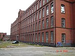
|Villa |
|||
| date_listed = 12 Jan 1967 |
|||
|{{historic-scotland|typ=LB|ID=20342|kurz=ja}} |
|||
| location = Castle Street |
|||
|[[Datei:90 and 92 Hamilton Place, Aberdeen.jpg|150px|90–92 Hamilton Place]] |
|||
| notes = 17th-century [[mercat cross]], since moved and repaired |
|||
|- |
|||
| grid_ref = NJ9449606380 |
|||
|[[94–96 Hamilton Place]] |
|||
| lat = 57.148271 |
|||
|{{Coordinate|text=DMS|NS=57/8/49.8/N|EW=2/7/44.8/W|type=building|region=GB-ABE|name=94–96 Hamilton Place}} |
|||
| lon = -2.092599 |
|||
|Villa |
|||
| image = Mercat_Cross,_the_Castlegate,_Aberdeen.JPG |
|||
|{{historic-scotland|typ=LB|ID=20343|kurz=ja}} |
|||
|commonscat=Mercat Cross, Aberdeen |
|||
|[[Datei:94-96 Hamilton Place, Aberdeen.jpg|150px|94–96 Hamilton Place]] |
|||
}} |
|||
|- |
|||
{{HS listed building row |
|||
|[[81 High Street (Aberdeen)|81 High Street]] |
|||
| hb = 20005 |
|||
|{{Coordinate|text=DMS|NS=57/9/58/N|EW=2/6/10.9/W|type=building|region=GB-ABE|name=81 High Street}} |
|||
| name = Bishop Elphinstone Memorial |
|||
|Villa |
|||
| date_listed = 12 Jan 1967 |
|||
|{{historic-scotland|typ=LB|ID=20360|kurz=ja}} |
|||
| location = [[King's College, Aberdeen|King's College Grounds]], College Bounds, Old Aberdeen |
|||
|[[Datei:81 High Street, Old Aberdeen (geograph 3686318).jpg|150px|81 High Street]] |
|||
| notes = 1926 memorial to [[William Elphinstone]] (1431–1514) |
|||
|- |
|||
| grid_ref = NJ9394308152 |
|||
|[[96 High Street (Aberdeen)|96 High Street]] |
|||
| lat = 57.164181 |
|||
|{{Coordinate|text=DMS|NS=57/10/0/N|EW=2/6/7.3/W|type=building|region=GB-ABE|name=96 High Street}} |
|||
| lon = -2.101782 |
|||
|Wohngebäude |
|||
| image = Bishop_Elphinstone_Memorial,_High_Street,_Old_Aberdeen.JPG |
|||
|{{historic-scotland|typ=LB|ID=20374|kurz=ja}} |
|||
|commonscat=Bishop Elphinstone's Tomb |
|||
|[[Datei:96 High Street, Old Aberdeen (geograph 3463914).jpg|150px|96 High Street]] |
|||
}} |
|||
|- |
|||
{{HS listed building row |
|||
|[[50 Queen’s Road (Aberdeen)|50 Queen’s Road]] |
|||
| hb = 20065 |
|||
|{{Coordinate|text=DMS|NS=57/8/30.2/N|EW=2/8/7/W|type=building|region=GB-ABE|name=50 Queen’s Road}} |
|||
| name = Fountain, [[Victoria Park, Aberdeen|Victoria Park]] |
|||
|Villa |
|||
| date_listed = 19 Mar 1984 |
|||
|{{historic-scotland|typ=LB|ID=20459|kurz=ja}} |
|||
| location = Westburn Road and Argyll Place, [[Rosemount, Aberdeen|Rosemount]] |
|||
|[[Datei:50, 50a and 50b Queen's Road, Aberdeen.jpg|150px|50 Queen’s Road]] |
|||
| notes = Granite fountain with Greek Revival details (1878) by John Bridgeford Pirie of Pirie and Clyne |
|||
|- |
|||
| grid_ref = NJ9270306789 |
|||
|[[1–13 Rosemount Square]] |
|||
| lat = 57.151919 |
|||
|{{Coordinate|text=DMS|NS=57/8/57.3/N|EW=2/6/42/W|type=building|region=GB-ABE|name=1–13 Rosemount Square}} |
|||
| lon = -2.122244 |
|||
|Wohngebäude |
|||
| image = Geograph-2821870-by-Bill-Harrison.jpg |
|||
|{{historic-scotland|typ=LB|ID=20471|kurz=ja}} |
|||
|commonscat=Fountain, Victoria Park, Aberdeen |
|||
|[[Datei:1-13 Rosemount Square, Aberdeen.jpg|150px|1–13 Rosemount Square]] |
|||
}} |
|||
|- |
|||
{{HS listed building row |
|||
|[[Provost Ross’s House|48–50 Shiprow]] |
|||
| hb = 20067 |
|||
|{{Coordinate|text=DMS|NS=57/8/48.1/N|EW=2/5/41/W|type=building|region=GB-ABE|name=48–50 Shiprow}} |
|||
| name = [[Brig o' Balgownie]] (Old Bridge Of Don) |
|||
|Wohngebäude |
|||
| date_listed = 12 Jan 1967 |
|||
|{{historic-scotland|typ=LB|ID=20484|kurz=ja}} |
|||
| location = [[Bridge of Don]] |
|||
|[[Datei:RossHouse-117156-Richard Slessor.jpg|150px|48–50 Shiprow]] |
|||
| notes = 14th-century bridge, attributed to [[Richard Cementarius]] |
|||
|- |
|||
| grid_ref = NJ9412909606 |
|||
|[[1–3 Union Terrace]] |
|||
| lat = 57.177245 |
|||
|{{Coordinate|text=DMS|NS=57/8/44.6/N|EW=2/6/9.8/W|type=building|region=GB-ABE|name=1–3 Union Terrace}} |
|||
| lon = -2.098742 |
|||
|Geschäftsgebäude |
|||
| image = The Old Brig o' Balgownie - geograph.org.uk - 14069.jpg |
|||
|{{historic-scotland|typ=LB|ID=20573|kurz=ja}} |
|||
| commonscat = Brig o' Balgownie |
|||
|[[Datei:The Monkey House (1 Union Terrace), Aberdeen.jpg|150px|1–3 Union Terrace]] |
|||
}} |
|||
|- |
|||
{{HS listed building row |
|||
|[[His Majesty’s Theatre (Aberdeen)|His Majesty’s Theatre]] |
|||
| hb = 20068 |
|||
|{{Coordinate|text=DMS|NS=57/8/52.8/N|EW=2/6/17.8/W|type=building|region=GB-ABE|name=His Majesty’s Theatre}} |
|||
| name = [[Bridge of Dee]] |
|||
|Theatergebäude |
|||
| date_listed = 12 Jan 1967 |
|||
|{{historic-scotland|typ=LB|ID=20605|kurz=ja}} |
|||
| location = Stonehaven Road and Anderson Drive South, Ruthrieston |
|||
|[[Datei:His Majesty's Theatre, Aberdeen.JPG|150px|His Majesty’s Theatre]] |
|||
| notes = Early-16th-century bridge over the River Dee |
|||
|- |
|||
| grid_ref = NJ9290103557 |
|||
|[[79 Hamilton Place]] |
|||
| lat = 57.122889 |
|||
|{{Coordinate|text=DMS|NS=57/8/49.5/N|EW=2/7/40.1/W|type=building|region=GB-ABE|name=79 Hamilton Place}} |
|||
| lon = -2.118878 |
|||
|Villa |
|||
| image = Bridge of Dee Aberdeen.jpg |
|||
|{{historic-scotland|typ=LB|ID=20628|kurz=ja}} |
|||
|commonscat=Bridge of Dee (bridge), Aberdeen |
|||
|[[Datei:79 Hamilton Place, Aberdeen 04.jpg|150px|79 Hamilton Place]] |
|||
}} |
|||
|- |
|||
{{HS listed building row |
|||
|[[98 Hamilton Place]] |
|||
| hb = 20073 |
|||
|{{Coordinate|text=DMS|NS=57/8/49.7/N|EW=2/7/45.7/W|type=building|region=GB-ABE|name=98 Hamilton Place}} |
|||
| name = [[Wellington Suspension Bridge]] |
|||
|Villa |
|||
| date_listed = 12 Jan 1967 |
|||
|{{historic-scotland|typ=LB|ID=20629|kurz=ja}} |
|||
| location = Over River Dee, at Craiglug |
|||
|[[Datei:98 Hamilton Place, Aberdeen.jpg|150px|98 Hamilton Place]] |
|||
| notes = Important example of an early suspension bridge, 1829 by [[Samuel Brown (Royal Navy officer)|Samuel Brown]] and [[John Smith (architect)|John Smith]] |
|||
|- |
|||
| grid_ref = NJ9431604968 |
|||
|[[Bahnhof Aberdeen]] |
|||
| lat = 57.135584 |
|||
|{{Coordinate|text=DMS|NS=57/8/37.3/N|EW=2/5/55.3/W|type=building|region=GB-ABE|name=Bahnhof Aberdeen}} |
|||
| lon = -2.095541 |
|||
|Bahnhof |
|||
| image = On the Chain Briggie - geograph.org.uk - 1446552.jpg |
|||
|{{historic-scotland|typ=LB|ID=20673|kurz=ja}} |
|||
|commonscat=Wellington Bridge, Aberdeen |
|||
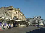
|[[Datei:Aberdeen Railway Station - geograph.org.uk - 249839.jpg|150px|Bahnhof Aberdeen]] |
|||
}} |
|||
|- |
|||
{{HS listed building row |
|||
|[[Ferryhill Turntable]] |
|||
| hb = 20078 |
|||
|{{Coordinate|text=DMS|NS=57/7/52.4/N|EW=2/5/59.4/W|type=building|region=GB-ABE|name=Ferryhill Turntable}} |
|||
| name = Girdleness Lighthouse |
|||
|Verkehrsbauwerk |
|||
| date_listed = 12 Jan 1967 |
|||
|{{historic-scotland|typ=LB|ID=43378|kurz=ja}} |
|||
| location = Greyhope Road |
|||
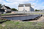
|[[Datei:Turntable, (former) Ferryhill locomotive depot, Aberdeen (geograph 5900395).jpg|150px|Ferryhill Turntable]] |
|||
| notes = 1833 lighthouse by [[Robert Stevenson (civil engineer)|Robert Stevenson]], and late-19th-century fog signal |
|||
|- |
|||
| grid_ref = NJ9715905348 |
|||
|[[Broadford Works]] |
|||
| lat = 57.139025 |
|||
|{{Coordinate|text=DMS|NS=57/9/10.5/N|EW=2/6/28.3/W|type=building|region=GB-ABE|name=Broadford Works}} |
|||
| lon = -2.048576 |
|||
|Industriebauwerk |
|||
| image = Geograph-3260857-by-Bill-Harrison.jpg |
|||
|{{historic-scotland|typ=LB|ID=43908|kurz=ja}} |
|||
|commonscat=Girdleness Lighthouse |
|||
|[[Datei:Broadford Works, Brick Mill - geograph.org.uk - 213775.jpg|150px|Broadford Works]] |
|||
}} |
|||
|- |
|||
{{HS listed building row |
|||
|[[Crombie Halls]] |
|||
| hb = 20082 |
|||
|{{Coordinate|text=DMS|NS=57/9/49.5/N|EW=2/6/14.4/W|type=building|region=GB-ABE|name=Crombie Halls}} |
|||
| name = Former Old Town School |
|||
|Wohngebäude |
|||
| date_listed = 12 Jan 1967 |
|||
|{{historic-scotland|typ=LB|ID=50016|kurz=ja}} |
|||
| location = Little Belmont Street |
|||
|[[Datei:Crombie Halls of Residence, University of Aberdeen I.jpg|150px|Crombie Halls]] |
|||
| notes = Greek revival school of 1841 by [[John Smith (architect)|John Smith]] |
|||
|- |
|||
| grid_ref = NJ9398506250 |
|||
|[[Gilcomstoun Land]] |
|||
| lat = 57.147096 |
|||
|{{Coordinate|text=DMS|NS=57/8/48.4/N|EW=2/6/35.3/W|type=building|region=GB-ABE|name=1–76 Gilcomstoun Land}} |
|||
| lon = -2.101041 |
|||
|Wohngebäude |
|||
|image=Town School, Little Belmont Street - geograph.org.uk - 742861.jpg |
|||
|{{historic-scotland|typ=LB|ID=52522|kurz=ja}} |
|||
|commonscat=Old Town's School, Aberdeen |
|||
|[[Datei:Gilcomstoun Land, Aberdeen - geograph.org.uk - 3066286.jpg|150px|1–76 Gilcomstoun Land]] |
|||
}} |
|||
|- |
|||
{{HS listed building row |
|||
|[[Virginia Court und Marischal Court]] |
|||
| hb = 20088 |
|||
|{{Coordinate|text=DMS|NS=57/8/56/N|EW=2/5/24.8/W|type=building|region=GB-ABE|name=1–48 Virginia Court}} |
|||
| name = [[Robert Gordon's College]] |
|||
|Wohngebäude |
|||
| date_listed = 1 Jun 1966 |
|||
|{{historic-scotland|typ=LB|ID=52523|kurz=ja}} |
|||
| location = Schoolhill |
|||
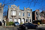
|[[Datei:Castlehill Section 1, Justice Street (SC 1141945).png|150px|1–48 Virginia Court]] |
|||
| notes = 1732 school by [[William Adam (architect)|William Adam]] |
|||
|- |
|||
| grid_ref = NJ9388006496 |
|||
|[[Porthill Court und Seamount Court]] |
|||
| lat = 57.149305 |
|||
|{{Coordinate|text=DMS|NS=57/9/8.9/N|EW=2/5/55.4/W|type=building|region=GB-ABE|name=1–72 Porthill Court}} |
|||
| lon = -2.102782 |
|||
|Wohngebäude |
|||
| image = Robert Gordon's College (The 'Auld Hoose'), Aberdeen.jpg |
|||
|{{historic-scotland|typ=LB|ID=52524|kurz=ja}} |
|||
|commonscat=Robert Gordon's College |
|||
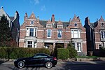
|[[Datei:Porthill Court (foreground) and Seamount Courts.JPG|150px|1–72 Porthill Court]] |
|||
}} |
|||
|- |
|||
{{HS listed building row |
|||
| hb = 20096 |
|||
| name = [[Marischal College]] |
|||
| date_listed = 12 Jan 1967 |
|||
| location = Broad Street |
|||
| notes = Tudor-Gothic granite college by [[Archibald Simpson]], 1844, Aberdeen's largest granite building |
|||
| grid_ref = NJ9424006535 |
|||
| lat = 57.14966 |
|||
| lon = -2.096833 |
|||
| image = Marischal College A.JPG |
|||
| commonscat = Marischal College |
|||
}} |
|||
{{HS listed building row |
|||
| hb = 20098 |
|||
| name = Devanha House |
|||
| date_listed = 12 Jan 1967 |
|||
| location = 12, 14 Devanha Gardens, [[Ferryhill, Aberdeen|Ferryhill]] |
|||
| notes = Early-19th-century Regency house, extended by [[Archibald Simpson]] in 1840 |
|||
| grid_ref = NJ9391005030 |
|||
| lat = 57.136136 |
|||
| lon = -2.10225 |
|||
|image=Devanah House, Ferryhill, Aberdeen.jpg |
|||
| commonscat = |
|||
}} |
|||
{{HS listed building row |
|||
| hb = 20108 |
|||
| name = Westburn House |
|||
| date_listed = 12 Jan 1967 |
|||
| location = [[Westburn Park]], Westburn Road and Cornhill Road |
|||
| notes = Brick house by [[Archibald Simpson]], 1839 |
|||
| grid_ref = NJ9267607055 |
|||
| lat = 57.154308 |
|||
| lon = -2.122698 |
|||
|commonscat=Westburn House, Aberdeen |
|||
|image=Westburn House, Westburn Park, Aberdeen.jpg |
|||
}} |
|||
{{HS listed building row |
|||
| hb = 20156 |
|||
| name = Provost Skene's House |
|||
| date_listed = 12 Jan 1967 |
|||
| location = Broad Street |
|||
| notes = Largely 17th-century house of [[Provost Skene|George Skene]], Provost of Aberdeen |
|||
| grid_ref = NJ9419806385 |
|||
| lat = 57.148312 |
|||
| lon = -2.097524 |
|||
| image = Provost Skene's House, 2013.JPG |
|||
|commonscat=Provost Skene's House |
|||
}} |
|||
{{HS listed building row |
|||
| hb = 20162 |
|||
| name = Former Clydesdale Bank |
|||
| date_listed = 12 Jan 1967 |
|||
| location = 5 Castle Street |
|||
| notes = Built as North of Scotland Bank in 1842, by [[Archibald Simpson]] |
|||
| grid_ref = NJ9442206361 |
|||
| lat = 57.148099 |
|||
| lon = -2.093821 |
|||
| image = Archie's, Aberdeen.jpg |
|||
|commonscat=5 Castle Street (Former Clydesdale Bank), Aberdeen |
|||
}} |
|||
{{HS listed building row |
|||
| hb = 20174 |
|||
| name = Sheriff Court Annex and High Court of Justiciary (formerly Bank of Scotland) |
|||
| date_listed = 12 Jan 1967 |
|||
| location = 53 Castle Street |
|||
| notes = Classical-style former bank, built 1801, the first fully dressed granite ashlar building to be built in Aberdeen |
|||
| grid_ref = NJ9443606307 |
|||
| lat = 57.147614 |
|||
| lon = -2.093589 |
|||
|image=Geograph-4127694-by-Bill-Harrison.jpg |
|||
|commonscat=Aberdeen Sheriff Court Annex and High Court of Justiciary |
|||
}} |
|||
{{HS listed building row |
|||
| hb = 20186 |
|||
| name = Mitchell Hospital |
|||
| date_listed = 12 Jan 1967 |
|||
| location = 9 The Chanonry, [[Old Aberdeen]] |
|||
| notes = Courtyard of alms houses, 1801 |
|||
| grid_ref = NJ9382608671 |
|||
| lat = 57.168842 |
|||
| lon = -2.10373 |
|||
| image = Mitchell Hospital, The Chanonry, Old Aberdeen.JPG |
|||
|commonscat=Mitchell Hospital, The Chanonry, Old Aberdeen |
|||
}} |
|||
{{HS listed building row |
|||
| hb = 20288 |
|||
| name = [[Bede House, Old Aberdeen|Bede House]] |
|||
| date_listed = 12 Jan 1967 |
|||
| location = 20, 22 Don Street, [[Old Aberdeen]] |
|||
| notes = 17th-century town house |
|||
| grid_ref = NJ9395308529 |
|||
| lat = 57.167568 |
|||
| lon = -2.101626 |
|||
| image = Bede House 2010 a.jpg |
|||
|commonscat=Bede House, Aberdeen |
|||
}} |
|||
{{HS listed building row |
|||
| hb = 20299 |
|||
| name = The Chapter House (Cruickshanks Lodgings) |
|||
| date_listed = 12 Jan 1967 |
|||
| location = 245, 247 Don Street, Balgownie |
|||
| notes = 17th-century town house |
|||
| grid_ref = NJ9402109633 |
|||
| lat = 57.177486 |
|||
| lon = -2.100529 |
|||
| image = Geograph-3924525-by-Bill-Harrison.jpg |
|||
|commonscat=The Chapter House, Cruickshanks Lodgings, Aberdeen |
|||
}} |
|||
{{HS listed building row |
|||
| hb = 20331 |
|||
| name = The Northern Hotel |
|||
| date_listed = 23 Apr 1987 |
|||
| location = 1 Great Northern Road |
|||
| notes = Art Deco hotel of 1938, by [[Alexander George Robertson Mackenzie|A.G.R. Mackenzie]] |
|||
| grid_ref = NJ9304207944 |
|||
| lat = 57.1623 |
|||
| lon = -2.116673 |
|||
| image = The Northern Hotel, Great Northern Road, Aberdeen.jpg |
|||
|commonscat=The Northern Hotel, Aberdeen |
|||
}} |
|||
{{HS listed building row |
|||
| hb = 20333 |
|||
| name = [[Tivoli Theatre (Aberdeen)|Tivoli Theatre]] |
|||
| date_listed = 12 Jan 1967 |
|||
| location = 34 - 48 Guild Street |
|||
| notes = Rare example of a nearly intact Victorian theatre, [[Charles J. Phipps]] 1872, alterations by [[Frank Matcham]] 1909 |
|||
| grid_ref = NJ9418906033 |
|||
| lat = 57.14515 |
|||
| lon = -2.097664 |
|||
|image=The Tivoli Theatre on Guild Street, Aberdeen.JPG |
|||
|commonscat=Tivoli Theatre, Aberdeen |
|||
}} |
|||
{{HS listed building row |
|||
| hb = 20334 |
|||
| name = 62, 62a and 62b Hamilton Place |
|||
| date_listed = 19 Mar 1984 |
|||
| location = |
|||
| notes = Villa by Pirie and Clyne, 1885 |
|||
| grid_ref = NJ9244006338 |
|||
| lat = 57.147864 |
|||
| lon = -2.126577 |
|||
| image = 62, 62a and 62b Hamilton Place, Aberdeen.jpg |
|||
|commonscat=62, 62a and 62b Hamilton Place |
|||
}} |
|||
{{HS listed building row |
|||
| hb = 20335 |
|||
| name = 64, 64a, 66, 66a and 66b Hamilton Place |
|||
| date_listed = 19 Mar 1984 |
|||
| location = |
|||
| notes = Villa by Pirie and Clyne, 1885 |
|||
| grid_ref = NJ9242906332 |
|||
| lat = 57.14781 |
|||
| lon = -2.126758 |
|||
| image = Geograph-3907150-by-Bill-Harrison.jpg |
|||
|commonscat=64, 64a, 66, 66a and 66b Hamilton Place |
|||
}} |
|||
{{HS listed building row |
|||
| hb = 20336 |
|||
| name = 68, 68a and 70 Hamilton Place |
|||
| date_listed = 19 Mar 1984 |
|||
| location = |
|||
| notes = Villa by Pirie and Clyne, 1886 |
|||
| grid_ref = NJ9239606318 |
|||
| lat = 57.147683 |
|||
| lon = -2.127303 |
|||
| image = 68, 68A and 70 Hamilton Place, Aberdeen.jpg |
|||
|commonscat=68, 68a and 70 Hamilton Place |
|||
}} |
|||
{{HS listed building row |
|||
| hb = 20337 |
|||
| name = 72 Hamilton Place |
|||
| date_listed = 19 Mar 1984 |
|||
| location = |
|||
| notes = Villa by Pirie and Clyne, 1890, with Provost's lamp |
|||
| grid_ref = NJ9238906311 |
|||
| lat = 57.14762 |
|||
| lon = -2.127419 |
|||
|commonscat=72 Hamilton Place, Aberdeen |
|||
|image=72 Hamilton Place, Aberdeen.JPG |
|||
}} |
|||
{{HS listed building row |
|||
| hb = 20338 |
|||
| name = 74 and 76 Hamilton Place |
|||
| date_listed = 19 Mar 1984 |
|||
| location = |
|||
| notes = Villa by Pirie and Clyne, 1887 |
|||
| grid_ref = NJ9237506307 |
|||
| lat = 57.147584 |
|||
| lon = -2.12765 |
|||
| image = 74 and 76 Hamilton Place, Aberdeen.jpg |
|||
|commonscat=74 and 76 Hamilton Place |
|||
}} |
|||
{{HS listed building row |
|||
| hb = 20339 |
|||
| name = 78 and 80 Hamilton Place |
|||
| date_listed = 19 Mar 1984 |
|||
| location = |
|||
| notes = Villa by Pirie and Clyne, c.1886 |
|||
| grid_ref = NJ9235906299 |
|||
| lat = 57.147512 |
|||
| lon = -2.127914 |
|||
| image = Geograph-3890292-by-Bill-Harrison.jpg |
|||
|commonscat=78 and 80 Hamilton Place |
|||
}} |
|||
{{HS listed building row |
|||
| hb = 20340 |
|||
| name = 82, 82a and 84 Hamilton Place |
|||
| date_listed = 19 Mar 1984 |
|||
| location = |
|||
| notes = Villa by Pirie and Clyne, c.1886 |
|||
| grid_ref = NJ9233006290 |
|||
| lat = 57.147431 |
|||
| lon = -2.128393 |
|||
| image = Geograph-3890205-by-Bill-Harrison.jpg |
|||
|commonscat=82, 82a and 84 Hamilton Place |
|||
}} |
|||
{{HS listed building row |
|||
| hb = 20341 |
|||
| name = 86, 86a, 88 and 88a Hamilton Place |
|||
| date_listed = 19 Mar 1984 |
|||
| location = |
|||
| notes = Villa by Pirie and Clyne, 1885 |
|||
| grid_ref = NJ9231406284 |
|||
| lat = 57.147376 |
|||
| lon = -2.128657 |
|||
| image = 86-88a Hamilton Place, Aberdeen.jpg |
|||
|commonscat=86, 86a, 88 and 88a Hamilton Place |
|||
}} |
|||
{{HS listed building row |
|||
| hb = 20342 |
|||
| name = 90 and 92 Hamilton Place |
|||
| date_listed = 19 Mar 1984 |
|||
| location = |
|||
| notes = Villa by Pirie and Clyne, c.1886 |
|||
| grid_ref = NJ9229406276 |
|||
| lat = 57.147304 |
|||
| lon = -2.128988 |
|||
| image = 90 and 92 Hamilton Place, Aberdeen.jpg |
|||
|commonscat=90 and 92 Hamilton Place |
|||
}} |
|||
{{HS listed building row |
|||
| hb = 20343 |
|||
| name = 94, 94a and 96 Hamilton Place |
|||
| date_listed = 19 Mar 1984 |
|||
| location = |
|||
| notes = Villa by Pirie and Clyne, c.1886 |
|||
| grid_ref = NJ9227506268 |
|||
| lat = 57.147232 |
|||
| lon = -2.129301 |
|||
| image = 94-96 Hamilton Place, Aberdeen.jpg |
|||
|commonscat=94, 94a and 96 Hamilton Place |
|||
}} |
|||
{{HS listed building row |
|||
| hb = 20360 |
|||
| name = 81 High Street |
|||
| date_listed = 12 Jan 1967 |
|||
| location = [[Old Aberdeen]] |
|||
| notes = Late-18th-century town house |
|||
| grid_ref = NJ9386808366 |
|||
| lat = 57.166103 |
|||
| lon = -2.103027 |
|||
| image = Geograph-3686318-by-Bill-Harrison.jpg |
|||
|commonscat=81 High Street, Old Aberdeen |
|||
}} |
|||
{{HS listed building row |
|||
| hb = 20374 |
|||
| name = 96 High Street |
|||
| date_listed = 12 Jan 1967 |
|||
| location = [[Old Aberdeen]] |
|||
| notes = Early-17th-century town house |
|||
| grid_ref = NJ9393108425 |
|||
| lat = 57.166634 |
|||
| lon = -2.101987 |
|||
| image = Geograph-3463914-by-Bill-Harrison.jpg |
|||
|commonscat=96 High Street, Old Aberdeen |
|||
}} |
|||
{{HS listed building row |
|||
| hb = 20459 |
|||
| name = 50, 50a and 50b Queen's Road |
|||
| date_listed = 12 Jan 1967 |
|||
| location = |
|||
| notes = Gothic villa by Pirie and Clyne, 1887 |
|||
| grid_ref = NJ9191305654 |
|||
| lat = 57.14171 |
|||
| lon = -2.135264 |
|||
| image = 50, 50a and 50b Queen's Road, Aberdeen.jpg |
|||
|commonscat=50, 50A And 50B Queen's Road, Aberdeen |
|||
}} |
|||
{{HS listed building row |
|||
| hb = 20471 |
|||
| name = 1-13 Rosemount Square |
|||
| date_listed = 23 Apr 1987 |
|||
| location = [[Rosemount, Aberdeen|Rosemount]] |
|||
| notes = Local authority housing designed in the 1930s and completed 1948, the last granite tenement block to be built in Aberdeen |
|||
| grid_ref = NJ9333106463 |
|||
| lat = 57.149001 |
|||
| lon = -2.111855 |
|||
| image = 1-13 Rosemount Square, Aberdeen.jpg |
|||
|commonscat=1-13 Rosemount Square, Aberdeen |
|||
}} |
|||
{{HS listed building row |
|||
| hb = 20484 |
|||
| name = Provost Ross's House |
|||
| date_listed = 12 Jan 1967 |
|||
| location = 48 and 50 [[Shiprow]] |
|||
| notes = Pair of late-16th-century town houses, once occupied by [[Provost John Ross]], now houses part of the [[Aberdeen Maritime Museum]] |
|||
| grid_ref = NJ9436406204 |
|||
| lat = 57.146688 |
|||
| lon = -2.094776 |
|||
| image = Provost Ross' House, Shiprow, Aberdeen.jpg |
|||
|commonscat=Provost Ross's House |
|||
}} |
|||
{{HS listed building row |
|||
| hb = 20573 |
|||
| name = 1, 2, 3 Union Terrace and 146 [[Union Street, Aberdeen|Union Street]] |
|||
| date_listed = 12 Jan 1967 |
|||
| location = |
|||
| notes = Renaissance-style office building by [[Alexander Marshall Mackenzie]], 1885 |
|||
| grid_ref = NJ9387406102 |
|||
| lat = 57.145765 |
|||
| lon = -2.102872 |
|||
| image = The Monkey House (1 Union Terrace), Aberdeen.jpg |
|||
|commonscat=Union Terrace, 1, 2, 3 And 146 Union Street, Aberdeen |
|||
}} |
|||
{{HS listed building row |
|||
| hb = 20605 |
|||
| name = [[His Majesty's Theatre]] |
|||
| date_listed = 8 Nov 1973 |
|||
| location = Rosemount Viaduct |
|||
| notes = Free Renaissance style theatre by [[Frank Matcham]], 1906 |
|||
| grid_ref = NJ9374806368 |
|||
| lat = 57.148153 |
|||
| lon = -2.104961 |
|||
| image = Playhouseaberdeen.jpg |
|||
| commonscat = His Majesty's Theatre, Aberdeen |
|||
}} |
|||
{{HS listed building row |
|||
| hb = 20628 |
|||
| name = 79 Hamilton Place |
|||
| date_listed = 26 May 1977 |
|||
| location = |
|||
| notes = Villa by Pirie and Clyne, 1894 |
|||
| grid_ref = NJ9236606252 |
|||
| lat = 57.14709 |
|||
| lon = -2.127797 |
|||
| image = 79 Hamilton Place, Aberdeen 04.jpg |
|||
| commonscat = 79 Hamilton Place, Aberdeen |
|||
}} |
|||
{{HS listed building row |
|||
| hb = 20629 |
|||
| name = 98 Hamilton Place |
|||
| date_listed = 26 May 1977 |
|||
| location = |
|||
| notes = Villa by Pirie and Clyne, 1891 |
|||
| grid_ref = NJ9227106266 |
|||
| lat = 57.147214 |
|||
| lon = -2.129367 |
|||
| image = 98 Hamilton Place, Aberdeen.jpg |
|||
|commonscat=98 Hamilton Place |
|||
}} |
|||
{{HS listed building row |
|||
| hb = 20673 |
|||
| name = [[Aberdeen railway station|Aberdeen Station]] |
|||
| date_listed = 2 Mar 1990 |
|||
| location = Guild Street |
|||
| notes = Railway station completed 1920, the last major station to be built in Scotland, and mid-19th-century road bridge |
|||
| grid_ref = NJ9415205889 |
|||
| lat = 57.143856 |
|||
| lon = -2.098272 |
|||
| image = Aberdeen Railway Station - geograph.org.uk - 249839.jpg |
|||
| commonscat = Aberdeen railway station |
|||
}} |
|||
{{HS listed building row |
|||
| hb = 43378 |
|||
| name = Turntable, Ferryhill Motive Power Depot |
|||
| date_listed = 17 May 1996 |
|||
| location = Polmuir Avenue, [[Ferryhill, Aberdeen|Ferryhill]] |
|||
| notes = Early-20th-century [[Turntable (rail)|locomotive turntable]], one of very few surviving in Scotland |
|||
| grid_ref = NJ9405604484 |
|||
| lat = 57.131233 |
|||
| lon = -2.099825 |
|||
| image = |
|||
| commonscat = |
|||
}} |
|||
{{HS listed building row |
|||
| hb = 43908 |
|||
| name = Broadford Works |
|||
| date_listed = 12 Jan 1967 |
|||
| location = Maberly Street |
|||
| notes = Early-19th-century mill, the oldest iron-framed mill in Scotland, and the fourth oldest known to survive in the world, with 19th- and early-20th-century extensions |
|||
| grid_ref = NJ9356006922 |
|||
| lat = 57.153127 |
|||
| lon = -2.108082 |
|||
|image=Geograph-3933186-by-Bill-Harrison.jpg |
|||
|commonscat=Broadford Works |
|||
}} |
|||
{{HS listed building row |
|||
| hb = 50016 |
|||
| name = Crombie Halls of Residence |
|||
| date_listed = 11 Nov 2004 |
|||
| location = Meston Walk |
|||
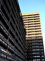
| notes = Modernist student residence by [[Robert Matthew|Sir Robert Matthew]], completed 1960 |
|||
| grid_ref = NJ9380608115 |
|||
| lat = 57.163847 |
|||
| lon = -2.104046 |
|||
| image = Crombie Halls of Residence, University of Aberdeen I.jpg |
|||
|commonscat=Crombie Halls Of Residence, Meston Walk, Aberdeen |
|||
}} |
|||
|} |
|} |
||
== |
== Weblinks == |
||
{{Commonscat|Category A listed buildings in Aberdeen|Kategorie-A-Bauwerke in Aberdeen}} |
|||
{{reflist|group="note"}} |
|||
* [http://portal.historicenvironment.scot Datenbank für Baudenkmäler von Historic Scotland] |
|||
==References== |
|||
{{reflist}} |
|||
==External links== |
|||
{{commonscat-inline|Category A listed buildings in Aberdeen}} |
|||
{{All Coordinates}} |
|||
{{Category A listed buildings}} |
|||
{{Navigationsleiste Listen der Kategorie-A-Bauwerke in Schottland}} |
|||
{{Theatres, galleries, museums and historical buildings in Aberdeen}} |
|||
[[ |
[[Kategorie:Liste (Kategorie-A-Bauwerke in Schottland)|Aberdeen]] |
||
[[ |
[[Kategorie:Kategorie-A-Bauwerk in Aberdeen|!]] |
||
[[Category:Aberdeen-related lists|Category A listed buildings]] |
|||
Aktuelle Version vom 22. Juli 2023, 17:00 Uhr

Die Liste der Kategorie-A-Gebäude in Aberdeen umfasst sämtliche in der Kategorie A eingetragenen Baudenkmäler in der schottischen Council Area Aberdeen. Die Einstufung wird anhand der Kriterien von Historic Scotland vorgenommen, wobei in die höchste Kategorie A Bauwerke von nationaler oder internationaler Bedeutung einsortiert sind. In Highland sind derzeit 69 Bauwerke in der Kategorie A gelistet.
Weblinks
Commons: Kategorie-A-Bauwerke in Aberdeen – Sammlung von Bildern, Videos und Audiodateien


