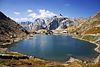
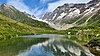
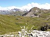
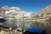
| Bild
|
Name des Sees
|
Gemeinde(n)
|
Zufluss
|
Abfluss
|
Fläche
in km²
|
Höhe über Meer
|
Maximale
Tiefe in Meter
|
Koordinaten
|
|
Goli d'Aget |
Val de Bagnes |
|
|
0,010 |
2760 m ü. M. |
|
!546.0100905507.2460205585079 / 09541246.010097.246022760
|
 |
Anusee |
Blatten |
|
|
0,0006 |
2367 m ü. M. |
|
!546.4558205507.9129905636443 / 14505346.455827.912992367
|
 |
Lacs d'Antème |
Champéry |
|
Torrent de la Frâche |
0,007 |
2052 m ü. M. |
|
!546.1611305506.8985405558279 / 11232846.161136.898542052
|
|
Le Gollié d'Arbey |
Evolène |
|
|
0,002 |
1766 m ü. M. |
|
!546.1140305507.4760305602890 / 10694846.114037.476031766
|
|
Lac de l'Armina |
Anniviers |
Torrent de Prarion |
Torrent de Prarion |
0,010 |
2561 m ü. M. |
|
!546.2246905507.6483205616178 / 11927146.224697.648322561
|
 |
Lac d’Arpitettaz |
Anniviers |
|
|
0,002 |
2229 m ü. M. |
|
!546.1048405507.6444305615912 / 10594746.104847.644432229
|
|
Étang d'Arvige |
Savièse |
|
|
0,005 |
1069 m ü. M. |
|
!546.2636905507.3543105593498 / 12358846.263697.354311069
|
 |
Lac des Audannes |
Ayent |
|
|
0,086 |
2452 m ü. M. |
|
!546.3442905507.3879205596095 / 13254646.344297.387922452
|
 |
Lac des Autannes |
Anniviers |
|
|
0,039 |
2685 m ü. M. |
|
!546.1318505507.5412905607933 / 10893446.131857.541292685
|
 |
Lac de la Bayenna |
Anniviers |
|
|
0,005 |
2546 m ü. M. |
|
!546.1023505507.5728105610375 / 10565846.102357.572812546
|
 |
Bettmersee |
Bettmeralp |
Bettmerbach |
Bettmerbach |
0,072 |
2009 m ü. M. |
|
!546.3939305508.0607005647846 / 13825246.393938.06072009
|
|
Lac de la Bella Tola |
Anniviers |
|
|
0,004 |
2579 m ü. M. |
|
!546.2332905507.6445305615883 / 12022646.233297.644532579
|
|
Bidmerseewji |
Grafschaft |
|
|
0,001 |
2428 m ü. M. |
|
!546.4269405508.2458405662047 / 14205146.426948.245842428
|
|
Étang de Binii |
Savièse |
|
|
0,004 |
1079 m ü. M. |
|
!546.2604805507.3453205592804 / 12323246.260487.345321079
|
|
Bitschjisee |
Naters |
|
|
0,008 |
1044 m ü. M. |
|
!546.3400605507.9892905642395 / 13222346.340067.989291044
|
|
Lac de Blantsin |
Salvan |
|
|
0,007 |
2147 m ü. M. |
|
!546.1041605506.9500505562219 / 10596946.104166.950052147
|
|
Blaus Seewji |
Niederwald |
|
|
0,004 |
2359 m ü. M. |
|
!546.4161605508.2162105659782 / 14083046.416168.216212359
|
|
Blaus Seewji |
Simplon |
|
|
0,001 |
2310 m ü. M. |
|
!546.1808705508.0417905646573 / 11455746.180878.041792310
|
|
Blausee |
Grengiols |
Saflischbach |
Saflischbach |
0,037 |
2462 m ü. M. |
|
!546.3162105508.1211005652566 / 12965146.316218.12112462
|
|
Blausee |
Riederalp |
|
|
0,006 |
2205 m ü. M. |
|
!546.3905405508.0444605646599 / 13786646.390548.044462205
|
|
Blausee |
Visperterminen |
|
|
0,006 |
2573 m ü. M. |
|
!546.2152605507.9504105639492 / 11833046.215267.950412573
|
|
Blausee |
Zermatt |
|
|
0,033 |
2839 m ü. M. |
|
!545.9979905507.8376805630916 / 09412645.997997.837682839
|
|
Blaws Seelin |
Blatten |
|
|
0,002 |
2565 m ü. M. |
|
!546.4560205507.8333705630326 / 14504146.456027.833372565
|
|
Blawseewji |
Obergoms |
|
|
0,001 |
2401 m ü. M. |
|
!546.5381905508.3040905666388 / 15446546.538198.304092401
|
 |
Lac Bleu |
Evolène |
|
|
0,003 |
2091 m ü. M. |
|
!546.0505405507.4800905603208 / 09989146.050547.480092091
|
|
Lac Bleu |
Martigny-Combe |
|
|
0,002 |
2453 m ü. M. |
|
!546.0340805507.0417805569272 / 09813846.034087.041782453
|
|
Bonigersee |
Törbel |
|
|
0,001 |
2090 m ü. M. |
|
!546.2560205507.8441705631270 / 12281346.256027.844172090
|
|
Bortelseewji |
Ried-Brig |
|
Ganterbach |
0,139 |
2463 m ü. M. |
|
!546.2876105508.1078405651572 / 12646346.287618.107842463
|
|
Étang de Botyre |
Ayent |
|
|
0,006 |
1220 m ü. M. |
|
!546.2821105507.3964405596747 / 12563346.282117.396441220
|
|
Lac de Bovine |
Martigny-Combe |
|
|
0,003 |
2427 m ü. M. |
|
!546.0429405507.0327005568574 / 09912746.042947.03272427
|
|
Brändjisee |
Turtmann-Unterems |
|
|
0,001 |
1874 m ü. M. |
|
!546.1969505507.6981205620030 / 11619946.196957.698121874
|
|
Lac de la Brèche |
Sierre |
|
|
0,090 |
499 m ü. M. |
|
!546.2557205507.4469605600641 / 12269946.255727.44696499
|
|
Breitmattensee |
Törbel |
|
|
0,006 |
2047 m ü. M. |
|
!546.2594405507.8441505631267 / 12319346.259447.844152047
|
|
Lac Brunet |
Val de Bagnes |
|
|
0,0004 |
2100 m ü. M. |
|
!546.0300805507.2742605587271 / 09762946.030087.274262100
|
|
Brusee |
Grafschaft |
|
|
0,001 |
2616 m ü. M. |
|
!546.4711505508.1782005656802 / 14691446.471158.17822616
|
|
Lac de Catogne |
Trient |
|
Nant de Catogne |
|
2205 m ü. M. |
|
!546.0332605506.9661905563419 / 09808046.033266.966192205
|
 |
Chaltwassersee |
Ried-Brig |
|
|
0,037 |
2747 m ü. M. |
|
!546.2584505508.0777805649282 / 12320346.258458.077782747
|
 |
Lac de Champex |
Orsières |
|
|
0,121 |
1467 m ü. M. |
|
!546.0282605507.1164805575053 / 09746546.028267.116481467
|
|
Chännilseewji |
Oberems |
|
|
0,001 |
2487 m ü. M. |
|
!546.2430405507.6761505618319 / 12131746.243047.676152487
|
 |
Lac de Chanrion |
Val de Bagnes |
|
|
0,014 |
2388 m ü. M. |
|
!545.9355905507.3783905595326 / 08711345.935597.378392388
|
 |
Lac de Châteaupré |
Anniviers |
|
|
0,036 |
2352 m ü. M. |
|
!546.1049405507.5803105610954 / 10594746.104947.580312352
|
|
Lac de Chermignon |
Lens |
|
|
0,020 |
1574 m ü. M. |
|
!546.3126805507.4671705602197 / 12903146.312687.467171574
|
 |
Lac de Chésery |
Monthey |
Vièze de la Tine |
Vièze de la Tine |
0,015 |
1891 m ü. M. |
|
!546.2022505506.8138205551772 / 11694846.202256.813821891
|
|
Chleis Seewji |
Oberems |
|
|
0,002 |
2519 m ü. M. |
|
!546.2187905507.6821805618792 / 11862246.218797.682182519
|
|
Chumme See |
Grengiols |
|
|
0,053 |
2097 m ü. M. |
|
!546.3231205508.1659005656010 / 13045046.323128.16592097
|
 |
Lac de Cleuson |
Nendaz |
|
Printse |
0,044 |
2186 m ü. M. |
76 |
!546.1077705507.3233905591088 / 10625946.107777.323392186
|
|
Lac de Combavert |
Anniviers |
|
|
0,013 |
2440 m ü. M. |
|
!546.2133205507.6458905615993 / 11800646.213327.645892440
|
 |
Lac de Conche |
Collombey-Muraz |
|
|
0,010 |
1674 m ü. M. |
|
!546.2648605506.8626405555591 / 12387946.264866.862641674
|
|
Lac des Crosayes |
Evolène |
|
|
0,013 |
2817 m ü. M. |
|
!546.0586705507.4530905601118 / 10079446.058677.453092817
|
 |
Daubensee |
Leukerbad |
Lämmerendalu |
|
0,646 |
2207 m ü. M. |
|
!546.4115205507.6189505613864 / 14003446.411527.618952207
|
 |
Lac de Derborence |
Conthey |
Derbonne |
Lizerne |
0,048 |
1451 m ü. M. |
|
!546.2790305507.2169505582912 / 12531446.279037.216951451
|
|
Distelsee |
Obergoms |
|
Ägene |
0,050 |
2588 m ü. M. |
|
!546.4632305508.3230305667935 / 14614946.463238.323032588
|
 |
Lac des Dix |
Hérémence |
|
Dixence |
3,65 |
2364 m ü. M. |
227 |
!546.0579105507.3966505596750 / 10071046.057917.396652364
|
|
Gouille du Dragon |
Bourg-Saint-Pierre |
|
Torrent des Erbets |
0,014 |
2618 m ü. M. |
|
!545.9095405507.1452405577231 / 08425845.909547.145242618
|
|
Lac du Dru |
Martigny-Combe |
|
|
0,003 |
2680 m ü. M. |
|
!546.0266605507.0386805569028 / 09731546.026667.038682680
|
 |
Lac d’Emosson |
Finhaut |
Nant de Drance |
Barberine |
3,27 |
1930 m ü. M. |
161 |
!546.0795105506.9164905559605 / 10324546.079516.916491930
|
|
Engiputz |
Ernen |
|
|
0,0003 |
2348 m ü. M. |
|
!546.4065105508.2002405658564 / 13974546.406518.200242348
|
|
Les Gouilles d'Essertze |
Hérémence |
|
|
0,005 |
2339 m ü. M. |
|
!546.1581405507.3649205594305 / 11185446.158147.364922339
|
|
Feldbachsee
Holzjihorn See |
Binn |
|
|
0,028 |
2868 m ü. M. |
|
!546.4066005508.2530905662628 / 13979646.40668.253092868
|
|
Fellsee |
Saas-Balen |
Fellbach |
Fellbach |
0,027 |
2767 m ü. M. |
|
!546.1678205507.9647305640632 / 11306346.167827.964732767
|
 |
Lacs de Fenêtre |
Orsières |
|
|
0,040 |
2456 m ü. M. |
|
!545.8883905507.1411505576904 / 08190845.888397.141152456
|
 |
Stausee Ferden
Lonzastausee |
Ferden, Kippel |
Lonza |
Lonza |
0,101 |
1310 m ü. M. |
|
!546.3887605507.7575805624534 / 13753846.388767.757581310
|
 |
Findletällisee |
Visperterminen |
|
|
0,001 |
2719 m ü. M. |
|
!546.2072705507.9440905639010 / 11743846.207277.944092719
|
|
Flesch |
Blitzingen |
|
|
0,004 |
2227 m ü. M. |
|
!546.4257605508.2236405660342 / 14190346.425768.223642227
|
|
Fleschensee |
Bellwald |
|
|
0,002 |
2059 m ü. M. |
|
!546.4410205508.1682905656072 / 14355846.441028.168292059
|
|
Fleschsee |
Binn |
|
|
0,007 |
2414 m ü. M. |
|
!546.3342005508.2056305659057 / 13171146.33428.205632414
|
|
Fleschsee |
Fiesch |
|
|
0,0004 |
2523 m ü. M. |
|
!546.4190205508.0914905650191 / 14106046.419028.091492523
|
|
Fleschseeli |
Grengiols |
|
|
0,003 |
2275 m ü. M. |
|
!546.3263905508.1427005654220 / 13079846.326398.14272275
|
|
Lac de Fontanabran |
Salvan |
|
|
0,005 |
2410 m ü. M. |
|
!546.0959005506.9356505561099 / 10505846.09596.935652410
|
|
Lac de la Forcle |
Chamoson |
|
|
0,019 |
2450 m ü. M. |
|
!546.2400505507.1568305578263 / 12099646.240057.156832450
|
|
Lac Inférieur de Fully |
Fully |
|
|
0,032 |
1986 m ü. M. |
|
!546.1674205507.0993105573791 / 11294046.167427.099311986
|
 |
Lac Supérieur de Fully |
Fully |
|
|
0,180 |
2127 m ü. M. |
|
!546.1786405507.0937005573363 / 11418946.178647.09372127
|
|
Geschinersee |
Münster-Geschinen |
Geschinerbach |
|
0,037 |
1340 m ü. M. |
|
!546.4958305508.2877005665182 / 14974346.495838.28771340
|
 |
Geisspfadsee |
Binn |
Mässerbach |
|
0,116 |
2423 m ü. M. |
|
!546.3484305508.2527405662668 / 13333046.348438.252742423
|
 |
Genfersee
Lac Léman |
Port-Valais, Saint-Gingolph |
Aubonne, Dranse,
Rhone, Venoge |
Rhone |
580 |
372 m ü. M. |
310 |
!546.4205705506.8402905554000 / 14120046.420576.84029372
|
 |
Lac de Géronde |
Sierre |
|
|
0,056 |
522 m ü. M. |
|
!546.2889005507.5426705608017 / 12639346.28897.54267522
|
 |
Gibidumsee |
Visperterminen |
|
Riedbach |
0,029 |
2194 m ü. M. |
|
!546.2586405507.9405305638699 / 12314746.258647.940532194
|
 |
Gibidum Stausee |
Bitsch, Naters, Riederalp |
Massa |
Massa |
0,192 |
1436 m ü. M. |
104 |
!546.3757905508.0030005643422 / 13620246.375798.0031436
|
|
Giteilte See |
Oberems |
|
|
0,010 |
2412 m ü. M. |
|
!546.2418805507.6795605618582 / 12118946.241887.679562412
|
|
Gode Tsapelette |
Bourg-Saint-Pierre |
|
|
0,0004 |
2339 m ü. M. |
|
!545.9570205507.1799805579944 / 08952745.957027.179982339
|
|
La Gouille |
Mex |
|
|
0,0003 |
2067 m ü. M. |
|
!546.1775805506.9656905563477 / 11412346.177586.965692067
|
|
La Gouille |
Monthey |
|
|
0,001 |
1959 m ü. M. |
|
!546.2077005506.9500205562288 / 11747946.20776.950021959
|
|
Grampielsee |
Binn |
|
|
0,001 |
2553 m ü. M. |
|
!546.3480605508.2598705663218 / 13329446.348068.259872553
|
 |
Lac du Grand Désert |
Nendaz |
|
|
0,063 |
2642 m ü. M. |
|
!546.0890305507.3354305592016 / 10417446.089037.335432642
|
|
Grand Gouilles |
Savièse |
|
La Nétage |
0,028 |
2471 m ü. M. |
|
!546.3398505507.3425305592600 / 13205646.339857.342532471
|
|
Grand Lé |
Bourg-Saint-Pierre |
|
|
0,041 |
2554 m ü. M. |
|
!545.8929805507.1592505578311 / 08241345.892987.159252554
|
|
Grand Remointse |
Anniviers |
|
|
0,001 |
2374 m ü. M. |
|
!546.2496205507.6161305613688 / 12203646.249627.616132374
|
 |
Lac du Grand St. Bernard |
Bourg-Saint-Pierre |
|
|
0,043 |
2446 m ü. M. |
|
!545.8685505507.1674005578934 / 07969545.868557.16742446
|
|
Grätlisee |
Obergoms |
|
|
0,003 |
2660 m ü. M. |
|
!546.5836605508.3662605671098 / 15957446.583668.366262660
|
 |
Étang Grenon |
Montana |
|
|
0,033 |
1498 m ü. M. |
|
!546.3098605507.4758105602863 / 12871846.309867.475811498
|
 |
Griessee |
Obergoms |
|
Griesbach |
0,664 |
2386 m ü. M. |
50 |
!546.4575705508.3698205671537 / 14556146.457578.369822386
|
|
Grindjisee |
Zermatt |
|
|
0,003 |
2334 m ü. M. |
|
!546.0115005507.7914405627326 / 09561146.01157.791442334
|
|
Grittlesee |
Blitzingen |
|
|
0,011 |
2549 m ü. M. |
|
!546.4176705508.2354405661259 / 14101346.417678.235442549
|
 |
Grosse See |
Unterbäch |
|
Milibach |
0,017 |
2546 m ü. M. |
|
!546.2295605507.7769305626098 / 11984746.229567.776932546
|
|
Grosse Putz |
Riederalp |
|
|
0,0003 |
2193 m ü. M. |
|
!546.3845005508.0272905645284 / 13718446.38458.027292193
|
 |
Grüensee |
Zermatt |
|
|
0,004 |
2299 m ü. M. |
|
!546.0056005507.7856305626879 / 09495346.00567.785632299
|
|
Grundle |
Blitzingen |
Spissbach |
Spissbach |
0,004 |
2424 m ü. M. |
|
!546.4204405508.2302105660853 / 14131646.420448.230212424
|
 |
Grundsee |
Blatten |
|
|
0,004 |
1842 m ü. M. |
|
!546.4370105507.8754705633572 / 14294546.437017.875471842
|
 |
Guggisee |
Blatten |
|
|
0,002 |
2007 m ü. M. |
|
!546.4445405507.8812405634011 / 14378546.444547.881242007
|
|
Halsusee |
Binn |
|
|
0,004 |
2003 m ü. M. |
|
!546.3766805508.2636305663474 / 13647946.376688.263632003
|
|
Holiechtsee |
Simplon |
|
|
0,001 |
2130 m ü. M. |
|
!546.2309605508.0234805645118 / 12011446.230968.023482130
|
 |
Hopschusee |
Simplon |
|
|
0,015 |
2018 m ü. M. |
|
!546.2524405508.0232305645081 / 12250246.252448.023232018
|
|
Lac de Huiton |
Icogne |
L'Ertentse |
|
0,030 |
2573 m ü. M. |
|
!546.3725805507.4761205602884 / 13569046.372587.476122573
|
|
Lac d’Icogne |
Lens |
Partichioux |
Pontec |
0,007 |
1417 m ü. M. |
|
!546.3050305507.4559605601334 / 12818146.305037.455961417
|
 |
Illsee |
Leuk |
|
|
0,210 |
2359 m ü. M. |
|
!546.2573105507.6319405614905 / 12289446.257317.631942359
|
|
Jostsee |
Obergoms |
Jostbach |
Jostbach |
0,010 |
2419 m ü. M. |
|
!546.5444705508.3147805667201 / 15517246.544478.314782419
|
|
Kreuzbodensee |
Saas-Grund |
|
|
0,001 |
2411 m ü. M. |
|
!546.1396805507.9624605640478 / 10993446.139687.962462411
|
|
Le Lachon |
Savièse |
|
|
0,003 |
2296 m ü. M. |
|
!546.3275505507.2693005586959 / 13069846.327557.26932296
|
|
Lämmerensee |
Leukerbad |
|
|
0,070 |
2295 m ü. M. |
|
!546.4015805507.5870305611412 / 13892446.401587.587032295
|
|
Längseewji |
Oberems |
|
|
0,004 |
2568 m ü. M. |
|
!546.2143905507.6698905617845 / 11813146.214397.669892568
|
|
Gouille du Lé |
Bourg-Saint-Pierre |
|
|
0,002 |
2724 m ü. M. |
|
!545.8953105507.1483605577467 / 08267545.895317.148362724
|
 |
Leisee |
Zermatt |
|
|
0,005 |
2232 m ü. M. |
|
!546.0150705507.7724405625853 / 09600246.015077.772442232
|
|
Lengsee |
Bellwald, Blitzingen |
|
|
0,013 |
2707 m ü. M. |
|
!546.4662305508.1638505655705 / 14635746.466238.163852707
|
|
Lengsee |
Blitzingen, Niederwald |
|
|
0,005 |
2408 m ü. M. |
|
!546.4153705508.2207605660132 / 14074646.415378.220762408
|
|
Lengsee |
Obergoms |
|
|
0,022 |
2498 m ü. M. |
|
!546.5392105508.2952505665709 / 15457146.539218.295252498
|
|
Étang de Lombardon |
Ayent |
|
|
0,003 |
1234 m ü. M. |
|
!546.2875805507.4010705597104 / 12624146.287587.401071234
|
 |
Etangs de Lona |
Anniviers |
|
|
0,006 |
2603 m ü. M. |
|
!546.1569105507.5397605607811 / 11172046.156917.539762452
|
 |
Lac de Lona |
Anniviers |
|
|
0,065 |
2640 m ü. M. |
|
!546.1522405507.5290905606988 / 11119946.152247.529092640
|
|
Étang Long |
Arbaz |
|
|
0,007 |
1328 m ü. M. |
|
!546.2816405507.3833505595738 / 12558246.281647.383351328
|
 |
Étang Long |
Chermignon, Lens |
|
|
0,020 |
1456 m ü. M. |
|
!546.3027605507.4677405602242 / 12792846.302767.467741456
|
 |
Lötschbergsee |
Ferden |
|
|
0,017 |
2596 m ü. M. |
|
!546.4108505507.7194105621589 / 13998246.410857.719412596
|
 |
Lac Louché |
Lens |
|
|
0,015 |
1141 m ü. M. |
|
!546.2820705507.4467405600624 / 12562846.282077.446741141
|
|
Le Louché |
Anniviers |
|
|
0,007 |
2401 m ü. M. |
|
!546.1255105507.5604405609414 / 10823146.125517.560442401
|
|
Le Louché |
Mont-Noble |
|
|
0,052 |
2566 m ü. M. |
|
!546.1758205507.5008905604807 / 11381946.175827.500892566
|
 |
Lac de Louvie |
Val de Bagnes |
|
Torrent de Louvie |
0,120 |
2214 m ü. M. |
|
!546.0494505507.3083105589911 / 09977746.049457.308312214
|
 |
Lac de Lovenay |
Saint-Gingolph |
|
|
0,049 |
1632 m ü. M. |
|
!546.3534005506.7902405550091 / 13376446.35346.790241632
|
|
Luché |
Ayent |
|
|
0,002 |
2264 m ü. M. |
|
!546.3149405507.3902105596269 / 12928346.314947.390212264
|
|
Le Luisset
Lac de Recon |
Vionnaz |
|
|
0,001 |
1684 m ü. M. |
|
!546.3023605506.8312805553206 / 12806546.302366.831281684
|
 |
Lüsgersee |
Naters |
|
|
0,004 |
2171 m ü. M. |
|
!546.3798005507.9815805641771 / 13663646.37987.981582171
|
|
Majingsee |
Leukerbad |
|
|
0,001 |
1663 m ü. M. |
|
!546.3882905507.6506505616308 / 13745846.388297.650651663
|
 |
Märjelensee |
Fieschertal |
|
|
0,005 |
2301 m ü. M. |
45 |
!546.4408405508.0920105650210 / 14348646.440848.092012301
|
|
Märjelen Stausee |
Fieschertal |
|
|
0,064 |
2360 m ü. M. |
|
!546.4413805508.1056105651255 / 14355546.441388.105612360
|
|
Mässersee |
Binn |
|
|
0,005 |
2119 m ü. M. |
|
!546.3549105508.2268405660667 / 13403046.354918.226842119
|
|
Mättitalsee |
Grengiols |
|
|
0,004 |
2300 m ü. M. |
|
!546.3172105508.1459605654480 / 12977946.317218.145962300
|
 |
Mattmark Stausee |
Saas-Almagell |
Stafelbach |
Saaser Vispa |
1,76 |
2197 m ü. M. |
93 |
!546.0376405507.9606705640415 / 09859046.037647.960672197
|
|
Mattsand Ausgleichssee |
St. Niklaus |
Vispa |
Vispa |
0,048 |
1230 m ü. M. |
|
!546.1455805507.7906505627198 / 11051646.145587.790651230
|
 |
Lac de Mauvoisin |
Val de Bagnes |
|
Dranse de Bagnes |
2,08 |
1975 m ü. M. |
180 |
!545.9786405507.3532405593380 / 09190145.978647.353241975
|
|
Meidsee |
Oberems |
|
|
0,039 |
2660 m ü. M. |
|
!546.2235705507.6735205618122 / 11915246.223577.673522660
|
|
Lac Miriouges |
Chermignon, Lens |
|
|
0,019 |
1332 m ü. M. |
|
!546.2920605507.4594105601600 / 12673946.292067.459411332
|
|
Mittelsee |
Obergoms |
Niderbach |
Niderbach |
0,013 |
2426 m ü. M. |
|
!546.5246605508.2734005664050 / 15293646.524668.27342426
|
|
Mittelsee |
Bellwald, Blitzingen |
Wilerbach |
Wilerbach |
0,007 |
2551 m ü. M. |
|
!546.4607705508.1652405655817 / 14575146.460778.165242551
|
|
Mittle |
Blitzingen |
Spissbach |
Spissbach |
0,009 |
2368 m ü. M. |
|
!546.4236305508.2316105660957 / 14167246.423638.231612368
|
 |
Lac de Moiry |
Anniviers |
|
Gougra |
1,4 |
2249 m ü. M. |
120 |
!546.1284105507.5707405610210 / 10855546.128417.570742249
|
|
Lac de Mont d'Orge |
Sion |
|
|
0,029 |
644 m ü. M. |
|
!546.2332205507.3369605592156 / 12020346.233227.33696644
|
 |
Lac de Morgins |
Troistorrents |
|
|
0,018 |
1365 m ü. M. |
|
!546.2482705506.8470605554376 / 12204346.248276.847061365
|
 |
Mosjesee |
Zermatt |
|
|
0,005 |
2138 m ü. M. |
|
!546.0103805507.7796205626411 / 09548346.010387.779622138
|
|
Étang de Motone |
Savièse |
|
|
0,004 |
1072 m ü. M. |
|
!546.2594405507.3469305592928 / 12311746.259447.346931072
|
 |
Étang de la Moubra |
Montana |
|
|
0,055 |
1424 m ü. M. |
|
!546.3044505507.4779805603031 / 12811746.304457.477981424
|
|
Lac de Mouchy |
Savièse |
|
|
0,005 |
970 m ü. M. |
|
!546.2530205507.3232405591100 / 12240546.253027.32324970
|
|
Mutterseewji |
Obergoms |
|
|
0,002 |
2141 m ü. M. |
|
!546.5526805508.3451905669523 / 15611246.552688.345192141
|
|
Lac Noir |
Anniviers, Leuk |
|
|
0,015 |
2499 m ü. M. |
|
!546.2499505507.6317305614891 / 12207646.249957.631732499
|
|
Oberer Meretschisee |
Agarn, Leuk |
Meretschibach |
Meretschibach |
0,037 |
2360 m ü. M. |
|
!546.2553905507.6505105616337 / 12268446.255397.650512360
|
|
Oberer Rossusee |
Brig-Glis |
|
|
0,005 |
2573 m ü. M. |
|
!546.2618305507.9876005642326 / 12352646.261837.98762573
|
|
Oberer Trützisee |
Münster-Geschinen |
|
|
0,009 |
2725 m ü. M. |
|
!546.5271205508.2499705662250 / 15319046.527128.249972725
|
|
Oberstafelsee |
Zwischbergen |
|
|
0,007 |
2036 m ü. M. |
|
!546.1509805508.0763005649265 / 11125546.150988.07632036
|
|
Obersts Seewji |
Obergoms |
|
Niderbach |
0,010 |
2674 m ü. M. |
|
!546.5305605508.2670705663558 / 15358646.530568.267072674
|
 |
Lac d'Orny |
Orsières |
|
|
0,005 |
2684 m ü. M. |
|
!546.0032705507.0689705571361 / 09470346.003277.068972684
|
|
Goli des Otanes |
Val de Bagnes |
|
|
0,014 |
2551 m ü. M. |
|
!546.0187105507.2518405585532 / 09636946.018717.251842551
|
|
Lac des Ottans |
Evionnaz |
|
|
0,003 |
2072 m ü. M. |
|
!546.1296105506.9572905562796 / 10879446.129616.957292072
|
|
Petit Lé |
Bourg-Saint-Pierre |
|
|
0,007 |
2581 m ü. M. |
|
!545.8902705507.1526805577800 / 08211445.890277.152682581
|
|
Lac du Petit Mont Fort |
Val de Bagnes |
|
Torrent de Louvie |
0,017 |
2764 m ü. M. |
|
!546.0728805507.3215605590941 / 10238046.072887.321562764
|
|
Pfafforetsee |
Leuk |
|
|
0,004 |
553 m ü. M. |
|
!546.2995205507.5868505611419 / 12757946.299527.58685553
|
|
Plan des Roses |
Ayent |
|
|
0,003 |
2363 m ü. M. |
|
!546.3707205507.4250005598950 / 13548346.370727.4252363
|
|
Pontimiaseen |
Zwischbergen |
|
|
0,016 |
2246 m ü. M. |
|
!546.1239405508.1079505651736 / 10827046.123948.107952246
|
|
Gouille de Potoc |
Mont-Noble |
|
|
0,004 |
2468 m ü. M. |
|
!546.1875005507.4987805604643 / 11511746.18757.498782468
|
|
Les Reunes |
Val de Bagnes |
|
|
0,002 |
2483 m ü. M. |
|
!546.0214905507.2548105585763 / 09667746.021497.254812483
|
|
Étang de Revouire |
Grimisuat |
|
|
0,008 |
903 m ü. M. |
|
!546.2638405507.3886405596145 / 12360346.263847.38864903
|
 |
Riffelsee |
Zermatt |
|
|
0,005 |
2757 m ü. M. |
|
!545.9833405507.7621005625067 / 09247145.983347.76212757
|
|
Étang de Rocher |
Savièse |
|
|
0,004 |
1059 m ü. M. |
|
!546.2625105507.3545705593518 / 12345746.262517.354571059
|
|
Goli du Rogneux |
Val de Bagnes |
|
|
0,010 |
2592 m ü. M. |
|
!546.0197705507.2442105584941 / 09648846.019777.244212592
|
|
Rosensee |
Leuk |
|
|
0,005 |
553 m ü. M. |
|
!546.2983305507.5828905611114 / 12744646.298337.58289553
|
 |
Rotelsee |
Simplon |
|
Chrummbach |
0,014 |
2030 m ü. M. |
|
!546.2445005508.0314005645717 / 12162446.24458.03142030
|
|
Roti Seewe |
Grafschaft |
|
|
0,009 |
2681 m ü. M. |
|
!546.4734505508.1726205656371 / 14716646.473458.172622681
|
|
Rundsee |
Obergoms |
|
|
0,029 |
2475 m ü. M. |
|
!546.5353705508.2943505665645 / 15414446.535378.294352475
|
 |
Lac de Salanfe |
Evionnaz |
|
Salanfe |
1,26 |
1909 m ü. M. |
48 |
!546.1407705506.9584905562896 / 11003446.140776.958491909
|
 |
Sanetschsee |
Savièse |
Saane |
Saane |
0,288 |
2034 m ü. M. |
|
!546.3560305507.2941105588875 / 13386046.356037.294112034
|
|
Étang de Saxonna |
Ayent |
|
|
0,002 |
1223 m ü. M. |
|
!546.2830005507.3980305596870 / 12573246.2837.398031223
|
|
Schaplersee |
Binn |
|
|
0,003 |
2229 m ü. M. |
|
!546.3507605508.2019105658753 / 13354946.350768.201912229
|
|
Schwarze See |
Guttet-Feschel |
|
|
0,006 |
2599 m ü. M. |
|
!546.3793205507.6944205619679 / 13647146.379327.694422599
|
 |
Schwarzsee |
Blatten |
|
|
0,003 |
1861 m ü. M. |
|
!546.4311705507.8354005630496 / 14228046.431177.83541861
|
|
Schwarzsee |
Oberems |
|
|
0,014 |
2612 m ü. M. |
|
!546.2428205507.6663505617563 / 12129046.242827.666352612
|
 |
Schwarzsee |
Zermatt |
|
|
0,006 |
2550 m ü. M. |
|
!545.9908005507.7068405620781 / 09328445.99087.706842550
|
|
Seewe |
Reckingen-Gluringen |
Hobachji |
Hobachji |
0,010 |
2455 m ü. M. |
|
!546.4508905508.2859805665104 / 14474646.450898.285982455
|
|
Seewjini |
Zwischbergen |
|
|
0,002 |
2379 m ü. M. |
|
!546.1435005508.0532305647489 / 11040946.14358.053232379
|
|
Sirwolte Weiher |
Simplon |
|
|
0,033 |
2438 m ü. M. |
|
!546.2119805507.9935805642826 / 11798846.211987.993582438
|
|
Sirwoltesee |
Simplon |
|
|
0,010 |
2411 m ü. M. |
|
!546.2107905507.9973605643119 / 11785746.210797.997362411
|
|
Lac de Soi |
Val-d'Illiez |
|
|
0,004 |
2246 m ü. M. |
|
!546.1737405506.9235605560221 / 11371746.173746.923562246
|
|
Spilsee |
Bellwald, Blitzingen |
Wilerbach |
Wilerbach |
0,013 |
2400 m ü. M. |
|
!546.4573505508.1685705656077 / 14537346.457358.168572400
|
 |
Stellisee |
Zermatt |
|
|
0,015 |
2537 m ü. M. |
|
!546.0134405507.8002605628009 / 09583046.013447.800262537
|
|
Straffelsee |
Visperterminen |
|
|
0,003 |
2423 m ü. M. |
|
!546.2441005507.9800705641759 / 12155146.24417.980072423
|
|
Tällisee |
Fieschertal |
|
|
0,001 |
2623 m ü. M. |
|
!546.4331805508.1022905651008 / 14264146.433188.102292623
|
 |
Lac de Tanay |
Vouvry |
|
Fossau |
0,181 |
1404 m ü. M. |
|
!546.3454705506.8405105553953 / 13285246.345476.840511404
|
|
Teifschlüechtsee |
Münster-Geschinen, Reckingen-Gluringen |
|
|
0,012 |
2412 m ü. M. |
|
!546.4508405508.2931105665652 / 14474646.450848.293112412
|
|
Lac de Tenehet |
Ayent |
|
|
0,014 |
2440 m ü. M. |
|
!546.3631005507.3989605596946 / 13463746.36317.398962440
|
 |
Totesee |
Obergoms |
Sidelbach |
Meiebach |
0,202 |
2160 m ü. M. |
|
!546.5605505508.3397405669095 / 15698246.560558.339742160
|
 |
Lac des Toules |
Bourg-Saint-Pierre |
La Dranse d'Entremont |
La Dranse d'Entremont |
0,601 |
1810 m ü. M. |
75 |
!545.9189905507.1985405581370 / 08529545.918997.198541810
|
|
Lac du Toûno |
Anniviers |
|
|
0,013 |
2659 m ü. M. |
|
!546.1995905507.6526105616516 / 11648146.199597.652612659
|
|
Lac de Tracouet |
Nendaz |
|
|
0,021 |
2171 m ü. M. |
|
!546.1598505507.2837205588032 / 11205346.159857.283722171
|
|
Étang de Trente Pas |
Conthey |
Tsene de Terty |
Tsene de Terty |
0,016 |
2194 m ü. M. |
|
!546.2883005507.2799905587773 / 12633346.28837.279992194
|
|
Trützisee |
Münster-Geschinen |
Geschinerbach |
Geschinerbach |
0,045 |
2579 m ü. M. |
|
!546.5218205508.2509705662333 / 15260246.521828.250972579
|
|
Lac du Tsaté |
Evolène |
|
|
0,002 |
2687 m ü. M. |
|
!546.1012805507.5488805608524 / 10553646.101287.548882687
|
|
Tschalmetenseeli |
Leukerbad |
|
|
0,004 |
2332 m ü. M. |
|
!546.4361305507.6132005613416 / 14276946.436137.61322332
|
 |
Tschawinersee |
Zwischbergen |
|
|
0,066 |
2174 m ü. M. |
|
!546.1467605508.1375605654002 / 11082646.146768.137562174
|
 |
Lac de Tseuzier |
Ayent, Icogne |
|
La Liène |
0,836 |
1777 m ü. M. |
140 |
!546.3507405507.4302205599352 / 13326246.350747.430221777
|
|
Lac de Tsofeiret |
Val de Bagnes |
|
|
0,018 |
2572 m ü. M. |
|
!545.9541305507.3802105595469 / 08917445.954137.380212572
|
|
Turbsee |
Binn |
|
|
0,004 |
2796 m ü. M. |
|
!546.4036105508.2732505664182 / 13948046.403618.273252796
|
 |
Turtmannsee |
Oberems, Turtmann-Unterems |
Bruneggbach |
Turtmänna |
0,102 |
2177 m ü. M. |
|
!546.1685105507.6928405619633 / 11303646.168517.692842177
|
|
Üelisee |
Obergoms |
|
Oberbach |
0,012 |
2566 m ü. M. |
|
!546.5329405508.2861005665015 / 15386746.532948.28612566
|
|
Unterer Meretschisee |
Agarn, Leuk |
Meretschibach |
Meretschibach |
0,032 |
2305 m ü. M. |
|
!546.2579605507.6545105616645 / 12297146.257967.654512305
|
|
Unterer Rossusee |
Simplon |
|
|
0,002 |
2474 m ü. M. |
|
!546.2553105507.9909205642587 / 12280346.255317.990922474
|
 |
Lac des Vaux |
Riddes |
|
La Fare |
0,114 |
2546 m ü. M. |
|
!546.1074105507.2725405587156 / 10622646.107417.272542546
|
|
Lac de Vernamiège |
Mont-Noble |
|
|
0,004 |
1741 m ü. M. |
|
!546.2123205507.4488605600788 / 11787446.212327.448861741
|
|
Lac Vert |
Finhaut |
|
|
0,013 |
2610 m ü. M. |
|
!546.0450105506.8885005557413 / 09942546.045016.88852610
|
 |
Lac Vert |
Val-d'Illiez |
|
|
0,022 |
1973 m ü. M. |
|
!546.1962705506.8157605551916 / 11628246.196276.815761973
|
|
Le Gouillé Vert |
Hérémence |
|
|
0,002 |
2496 m ü. M. |
|
!546.1458405507.3589905593845 / 11048746.145847.358992496
|
|
Gouille Verte |
Martigny-Combe |
|
|
0,0002 |
1907 m ü. M. |
|
!546.0719005506.9957405565731 / 10236246.07196.995741907
|
 |
Lac du Vieux Emosson |
Finhaut |
|
Nant de Drance |
0,760 |
2205 m ü. M. |
42 |
!546.0619005506.8904405557576 / 10130246.06196.890442205
|
 |
Wairasee |
Zwischbergen |
|
|
0,003 |
2042 m ü. M. |
|
!546.1523305508.1353005653822 / 11144446.152338.13532042
|
|
Waschsee |
Leuk |
|
|
0,005 |
2418 m ü. M. |
|
!546.2581005507.6224105614170 / 12298046.25817.622412418
|
|
Weingartensee |
Täsch |
Rotbach |
Rotbach |
0,014 |
3055 m ü. M. |
|
!546.0635205507.8391605630993 / 10141246.063527.839163055
|
|
Wirbulsee |
Bellwald |
Wilerbach |
Wilerbach |
0,009 |
2658 m ü. M. |
|
!546.4632505508.1609005655481 / 14602446.463258.16092658
|
|
Witentirsee |
Grengiols |
|
|
0,001 |
2236 m ü. M. |
|
!546.3232905508.1494105654740 / 13045846.323298.149412236
|
 |
Wysse See |
Guttet-Feschel |
|
|
0,015 |
2336 m ü. M. |
|
!546.3688505507.6821405618737 / 13530446.368857.682142336
|
|
Zantmärjelebielsee |
Binn |
|
|
0,016 |
2366 m ü. M. |
|
!546.3450505508.2359905661383 / 13294146.345058.235992366
|
|
Z'Seew |
Grächen |
|
|
0,006 |
1720 m ü. M. |
|
!546.1957805507.8450305631371 / 11611746.195787.845031720
|
|
Ze Seewe |
Zwischbergen |
|
|
0,035 |
2609 m ü. M. |
|
!546.2306805508.1155905652224 / 12014046.230688.115592609
|
|
Züesee |
Binn |
|
|
0,030 |
2421 m ü. M. |
|
!546.3467405508.2453105662098 / 13313646.346748.245312421
|
 Interaktive Karte Interaktive Karte
|


